Brought to you by Calvert Title Company
Early this morning, we saw a cluster of thunderstorms push through Southern MD with locally heavy rain. We have since cleared out, but this sets the stage for what could be an active day. An incoming cold front will look to set off scattered storms across the Mid-Atlantic this afternoon and evening.
Hi-Resolution Futurecast shows a band of showers and storms moving into Western MD this morning. This band of precip will gradually work eastward as temperatures warm into the 80s. Futurecast shows this line of showers and storms moving through Southern MD during the mid-to-late afternoon hours.

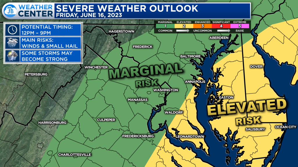
The Storm Prediction Center has placed much of the Mid-Atlantic at risk of seeing some strong to severe thunderstorms. Areas east of I-95 have a heightened, Level 2 “Elevated Risk” of severe weather between 12-9pm. The more sunshine any location sees today, the higher the chance of strong storms. The higher threat is currently placed east of I-95 because that area could see the most sunshine, and thus the atmosphere could be the most conducive for severe weather.

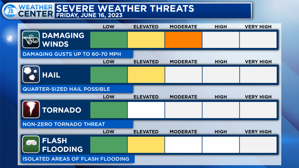
The primary threat from these showers and storms would be damaging winds in excess of 60mph. These storms could also spring 1″ hail and locally heavy rain. The tornado threat is what I call “non-zero.” That’s to say that while the tornado threat is not high today, it is something I am watching. Under the right conditions, an isolated brief spin-up is marginally possible.
Remember that severe weather forecasting is far from a guarantee of anything. The goal of these forecasts are to alert you to the potential of storms, not a promise of storms.
You will want to stay weather aware this afternoon and evening. While I would not necessarily cancel any outdoor plans, I would have an indoor backup plan for any activities after lunchtime. While not everyone will see storms and rain today, those that do could see some meaningful impacts.
Stay with JB Weather for the latest information on Southern Maryland weather. You can always access my forecasts and updates here on the website, on Facebook, on Twitter, on Instagram, and on YouTube.
-JB

Calvert Title Company is guiding you HOME one closing at a time! Check out https://calverttitle.com/ today!

