Brought to you by Calvert Title Company
Yesterday was a hot day with temps getting back up into the 90s, which led to a couple of afternoon and evening thunderstorms! Today will look to be a repeat performance with warm and humid conditions likely, especially south of Washington. Another round of thunderstorms looks likely, as well.
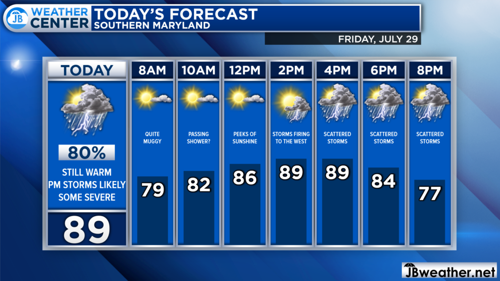
We are already off to a muggy start with dewpoints above 70*. A passing shower cannot be ruled out during the mid-morning hours. Peeks of sunshine are possible by lunchtime, which will help temperatures warm into the upper 80s. Then, thunderstorms will look to develop as a cold front pushes through this evening.
Futurecast seems to have a pretty good handle on today’s potential storm threat. Thunderstorms are likely to fire to our west after lunchtime, and gradually move through the region during the late afternoon and evening hours before clearing after sunset. The more sunshine we see during the midday hours, the more thunderstorm fuel would be present in the atmosphere. More thunderstorm fuel would allow any storms to become strong to severe.
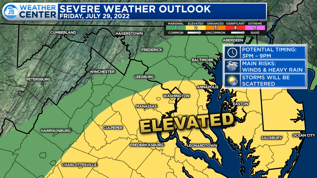
The greatest risk of thunderstorms will be south of DC, because this is where the highest thunderstorm fuel (thanks to the warmer temps) will be. The Storm Prediction Center has placed much of our region under a Level 2 “Elevated Risk” of severe weather. This highlights the higher than normal chance to see a few severe thunderstorms.
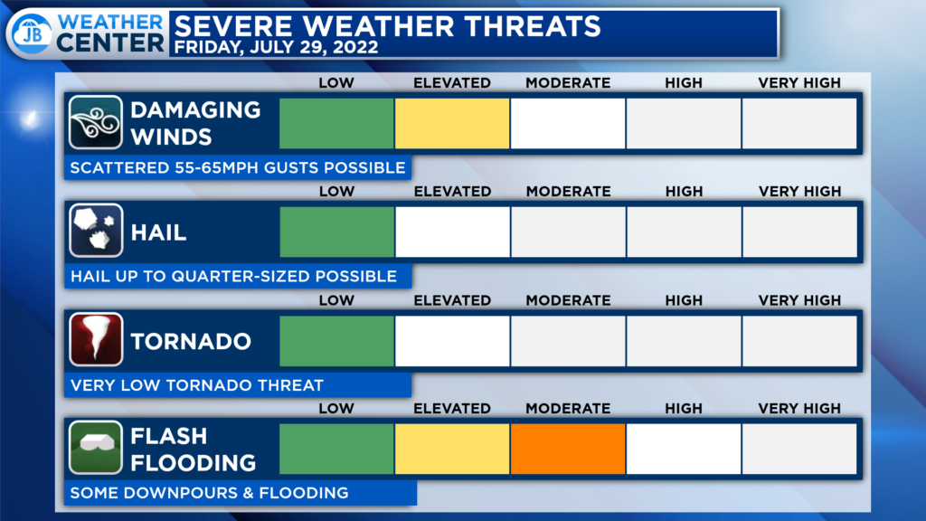
The primary risk from any thunderstorms this afternoon and evening would be damaging winds and localized flash flooding. Some thunderstorms could contain winds upwards of 55-65mph, which could cause damage. Given the recent heavy rain, any additional amounts could lead to the rapid development of flash flooding. The primary time to watch is 3-9pm.
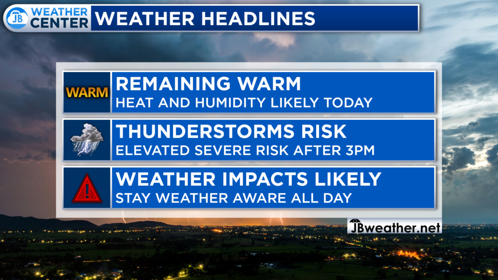
All-in-all, today is likely to be another impactful weather day. We are likely to see another round of heat and humidity settle over the area. Heat indices are likely to get near 100* this afternoon, so you will want to take it easy. The heat and humidity will also prime the region for potential storms. This means that you will want to stay weather aware throughout the day.
If you have outdoor plans this afternoon and evening, I would plan on scattered showers moving through and bringing some impacts. While it may not rain everywhere all day, I would plan on moving outdoor activities inside to avoid any impacts. I would also keep the umbrella handy!
Stay with JB Weather for the latest information on Southern Maryland weather. You can always access my forecasts and updates here on the website, on Facebook, on Twitter, on Instagram, and on YouTube.
-JB

Calvert Title Company is guiding you HOME one closing at a time! Check out https://calverttitle.com/ today!
