Brought to you by Calvert Title Company
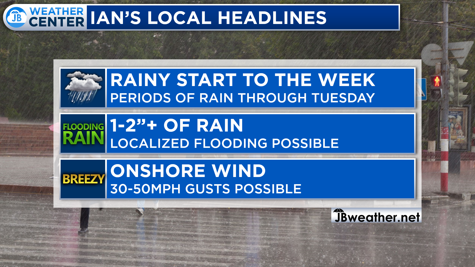
Hurricane Ian made landfall in South Carolina on Friday. The storm has since weakened into a remnant low, but it has brought our region a decent amount of rain and wind this weekend. Some spots have seen upwards of 1-3″+ of rain already with our coastal areas seeing tidal rise. However, the impacts are not over.
The remnant low of Ian will regenerate into a coastal low that will look a lot like an early season Nor’Easter. Weak atmospheric steering currents will mean that this new coastal low will be slow to slide out to sea. This will lead to a prolonged period of rain and onshore winds.
Our Futurecast currently only goes out to Tuesday morning. However, it shows that off and on periods of rain will remain likely through the rest of today, all of Monday, and into Tuesday. Once the coastal low start to get going Monday evening, you see how the rain bands intensify. This will lead to a soggy start to the work week.
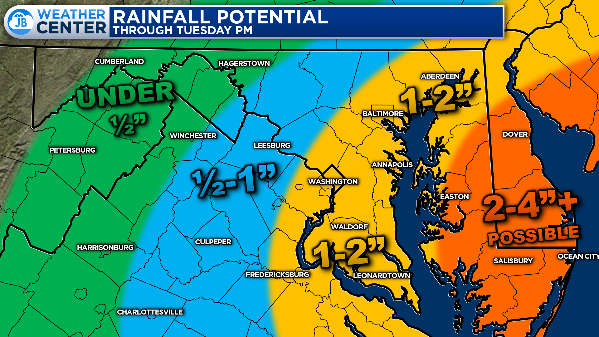
Parts of the Delmarva could see upwards of 2-4″+ of additional rain over the next couple of days. Some of the immediate Atlantic beaches could see 5″+! The further inland you head, the lower the impacts, as is typical with a coastal low.
Areas along the Bay could see an additional 1-2″+ of rainfall from Sunday afternoon through Tuesday evening. This could lead to some localized flash flooding in some spots. Areas west of I-95 should see the rain tapper off earlier on Monday, which will lead to lower rain totals.

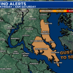
As the coastal low strengthens, we will see the winds pick up. The Atlantic beaches could see 50mph+ gusts! Winds will diminish the further inland you head, but Bayside locations could still see elevated wind gusts. While much of Southern MD will only see 25-40mph gusts, some of the immediate Bayside communities could see gusts up to 40-50mph.

As a result of the elevated wind gusts along the Bay, our Bayside counties have been placed under a Wind Advisory from 5pm Sunday until 2pm Monday. Most areas in Southern MD will only see gusts up to 35mph. However, those immediate coastal communities will see higher winds coming right off the water.
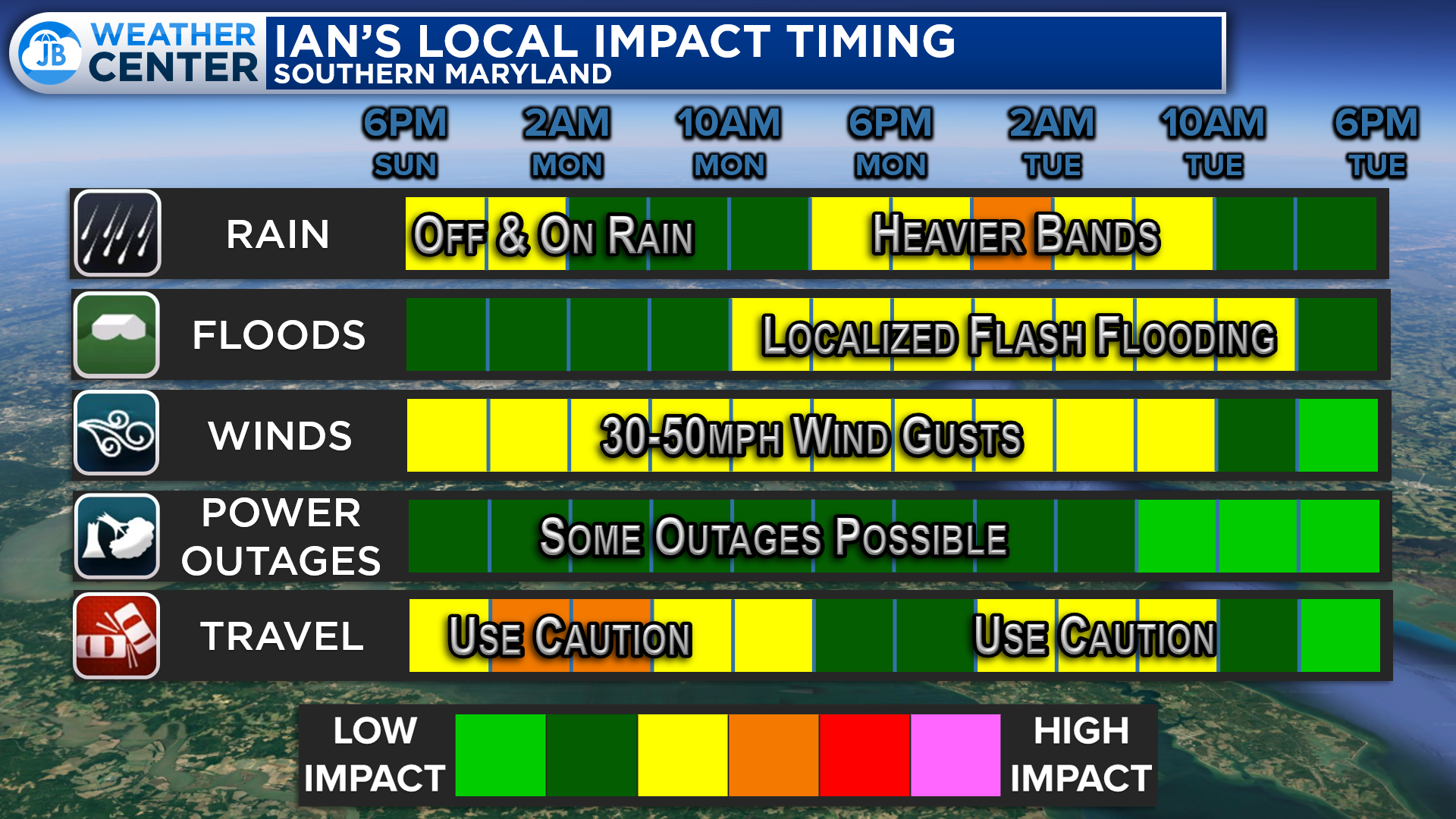
We are likely going to see two more main time frames of more moderate impacts in Southern MD. The first will come tonight as we see steady rain return with those high wind gusts. This could make for a soggy and slow morning start. We may see a brief break in the action midday Monday before the rain and wind peak back up by the evening hours. We could see some localized flash flooding late Monday into early Tuesday. We should see everything draw to a close by late Tuesday.
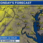
All in all, the next few days look rather wet and windy as the remnants of Ian regenerate as a Nor’Easter-like coastal low this week. This will lead to an extended period of rain and onshore winds. We could see another 1-2″+ of rainfall and periodic gusts up to 50mph for our Bayside communities. Not to mention, it will remain chilly over the next few days. It will definitely feel like late Fall!
Stay with JB Weather for the latest information on Southern Maryland weather. You can always access my forecasts and updates here on the website, on Facebook, on Twitter, on Instagram, and on YouTube.
-JB
Calvert Title Company is guiding you HOME one closing at a time! Check out https://calverttitle.com/ today!
John Bordash
View More PostsJB Weather forecaster John Bordash is working around the clock to provide Southern Maryland, and neighboring communities, with accurate and reliable weather information.