A weak, fast-moving system will brush the Mid-Atlantic between Tuesday afternoon and Wednesday midday, bringing a couple rounds of light, steady rain to the region. This isn’t a major weather maker, but it will offer some beneficial moisture after a stretch of quieter days. Impacts remain low overall, and the highest totals will be focused well north of DC. Still, it’s a good idea to keep the umbrella nearby for periodic showers.
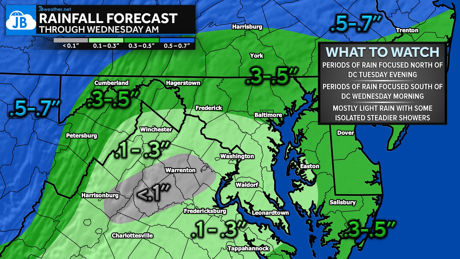
Rain begins after 12 PM Tuesday, first favoring areas north of Washington, DC, including central Maryland, southern Pennsylvania, and the I-70 corridor. These locations sit closer to the track of the surface low, so they’ll see the most consistent rainfall, with 0.3″–0.5″ possible in the higher elevations. For most other locations, especially between Frederick and Fredericksburg, a familiar “dry slot” may limit totals to just 0.1″–0.3″, and a few spots could even come in under a tenth of an inch.
Overnight into Wednesday morning, the focus of the rain shifts southeast as the system pivots. Areas along the coastal plain, including Southern Maryland, the Northern Neck, and the Delmarva, may see their steadiest rain between 4 AM and 10 AM Wednesday, with totals up to a third of an inch. Rain gradually tapers from west to east, clearing the region around midday as cooler, drier air filters in behind the departing system.
While amounts are modest, it’s always fun to imagine these totals as snow — and using the classic 10:1 ratio, this would equate to 1–3 inches for many and a hefty 5–7 inches in the northern tier. Just like in winter setups, though, someone between Frederick and Fredericksburg would almost certainly lose out thanks to that pesky dry slot! Overall, this is a low-impact, in-and-out system that simply brings us a healthy drink of late-November rain.
John Bordash
View More PostsJB Weather forecaster John Bordash is working around the clock to provide Southern Maryland, and neighboring communities, with accurate and reliable weather information.