Brought to you by Calvert Title Company
Much of this week has featured a typical summertime pattern of heat and humidity with hit-and-miss afternoon thunderstorms. While some areas have seen over an inch of rain this past week, many others haven’t. Well, after a quiet Saturday, things will take an active turn for Sunday.
Futurecast shows that a line of widespread downpours with embedded storms is likely to develop around lunchtime tomorrow as a cold front works eastward. This front will be slow-moving. As a result, this line of storms will slowly work its way through the afternoon and evening hours.
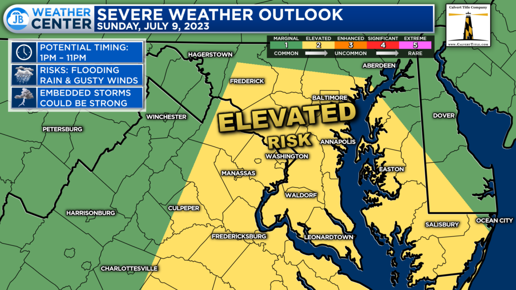
The Storm Prediction Center has placed areas along and east of I-95 under a Level 2 “Elevated Risk” of severe weather for tomorrow afternoon and evening. Any of those embedded thunderstorms could turn severe, especially if we see any bit of sun tomorrow morning.
I would not be surprised to see the Level 2 region expanded further north and west in subsequent updates. This is because there looks to be sufficient amounts of storm energy (also known as CAPE) across the Mid-Atlantic tomorrow. All areas in our region will need to stay weather aware.
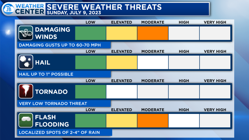
The primary severe weather threat tomorrow will come from damaging winds. 60mph+ gusts will be possible in the most intense storms. The hail, and especially tornado, threat does not look as high. However, what I find just as concerning if not more so, is the risk of flash flooding!
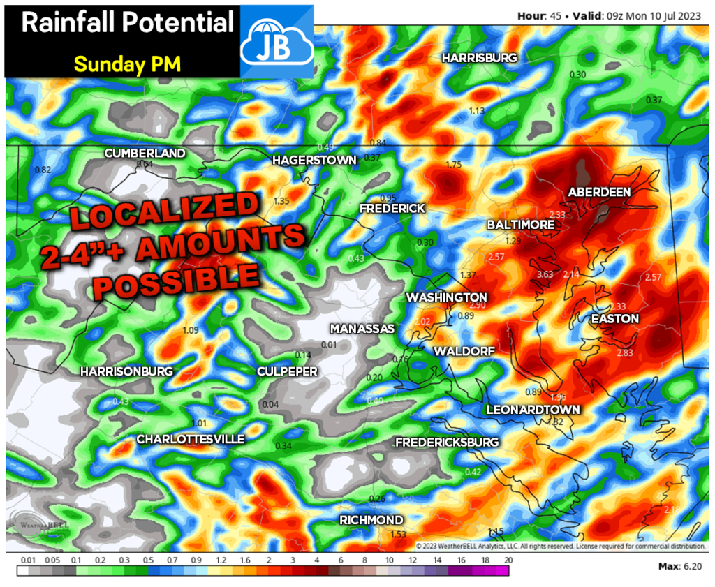
The atmosphere will be juiced with moisture tomorrow, which means that there will be more than enough water for thunderstorms to tap into. Adding in the slow-moving nature of tomorrow’s storms, flash flooding threats will be high.
A widespread 1″+ of rain looks likely for most (not all) with localized amounts of 2-4″+ in some neighborhoods. Our model above does a great job of showing that potential! The heaviest rains will look to be focused east of I-95.
Stay with JB Weather for the latest information on Southern Maryland weather. You can always access my forecasts and updates here on the website, on Facebook, on Twitter, on Instagram, and on YouTube.
-JB

Calvert Title Company is guiding you HOME one closing at a time! Check out https://calverttitle.com/ today!
