Brought to you by Calvert Title Company
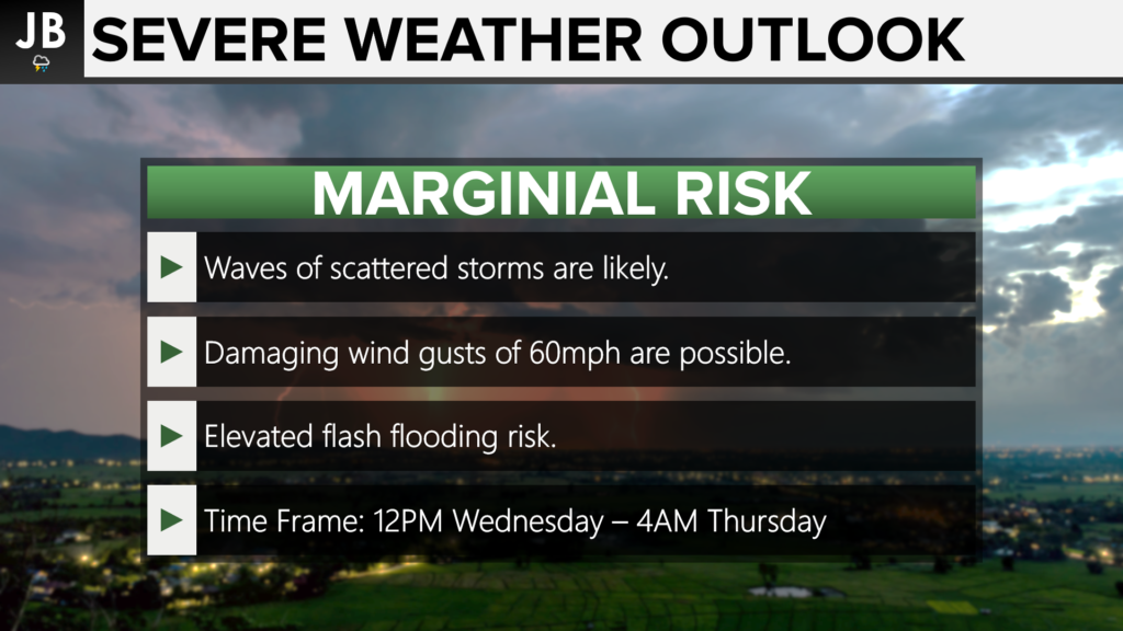
After a decent Labor Day weekend, we have seen warmer temperatures arrive as we get this work week started. Thankfully, these warmer temperatures should not be around for long as an incoming cold front will look to usher in cooler air to end the week. With that cold front will come the chance of scattered thunderstorms on Wednesday. With that in mind, the Storm Prediction Center has placed our region under a Marginal Risk for severe weather on Wednesday.
This Level 1 Risk comes as multiple rounds of scattered storms look likely to develop throughout tomorrow. The timing right now appears to be from lunchtime on Wednesday until daybreak on Thursday. The increased heat and humidity will allow for a few stronger thunderstorms. These stronger thunderstorms could produce damaging wind gusts of 60mph. The tornado risk is low tomorrow, but it is not zero. While this is not my primary concern (it’s far from it) we will need to watch every storm that fires up. Tomorrow does feature an elevated flash flooding risk, too.

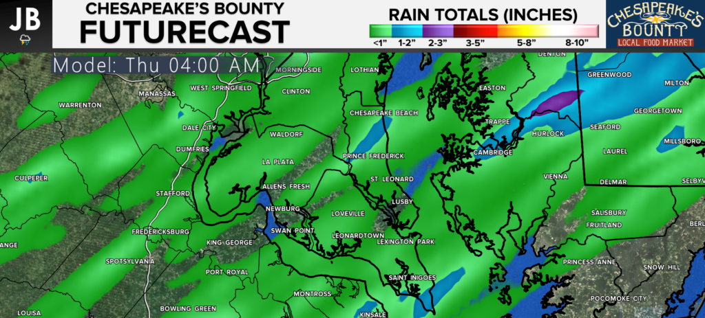
Our Chesapeake’s Bounty Futurecast does a great job of outlining this potential threat. Southerly winds tomorrow will help to bring up warm and humid air. This flow from the south could allow for an initial area of storms to develop across the region after lunchtime. A couple of these storms could be strong to severe thanks to the daytime heating. Later on in the evening, the actual cold front will move eastward towards our region. This cold front will bring with it another threat of storms. If we do in fact see severe storms around lunchtime, I would suspect that our severe threat would be lower in the evening. If we do not see those midday storms, then the atmosphere could remain primed to produce stronger storms with the passage of the cold front.
Our Chesapeake’s Bounty also does a great job of depicting the spotty nature of the rain. Our model shows that while some areas may not see much rain tomorrow evening, some communities could see 1-2″+ of rain. It is hard to peg down where the exact locations of higher totals will be, so do not take this verbatim. Those that do see

Stay weather aware on Wednesday as multiple rounds of severe storms seem possible throughout the afternoon and evening hours. Damaging winds and flash flooding will be the primary threats tomorrow. While the tornado threat is not high at all, it is not zero. You can stay with JB Weather for the latest information on Southern Maryland weather. You can always access my forecasts and updates here on the website, on Facebook, on Twitter, and on YouTube.
-JB

Calvert Title Company is guiding you HOME one closing at a time!
