Brought to you by Professional Communication Training
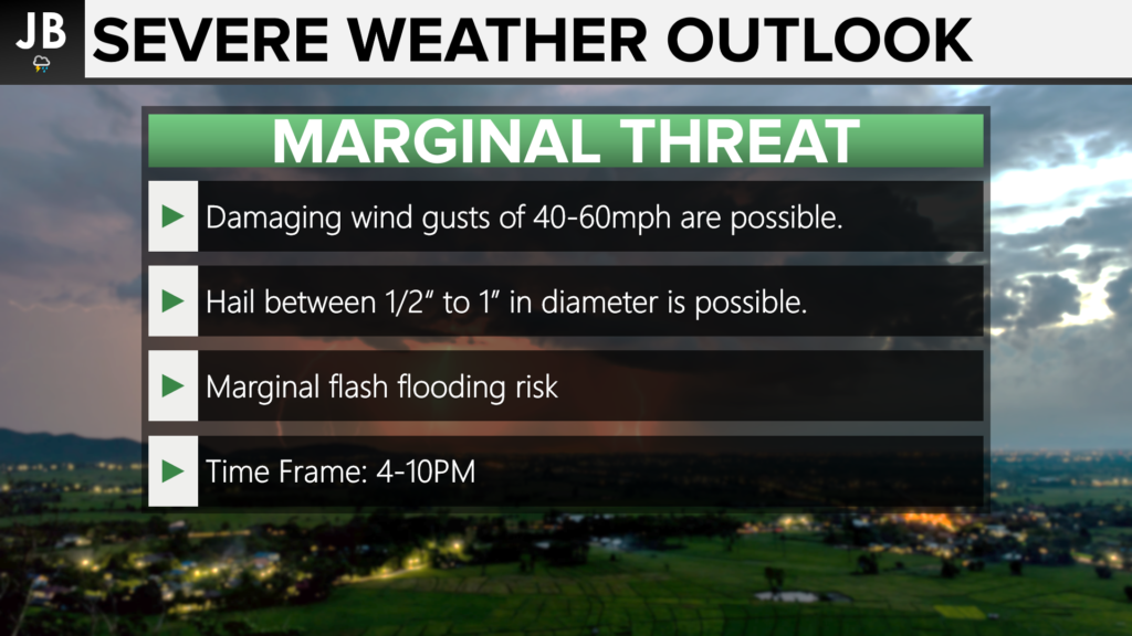
The Storm Prediction Center has placed much of our region under a Marginal Risk (Level 1 of 5) of seeing severe storms this afternoon. The timing of these potential storms looks to be between 4-10PM. The primary threat this evening will come from storms potentially producing damaging winds near 60mph.

An incoming front will help to kick off some scattered storms in our region this evening. The heat and humidity should make the atmosphere at least somewhat supportive of storm development. We have to look back to our west early this afternoon as a potential line of broken storms tries to form. If this does indeed happen, it would likely cross I-95 around 3-5PM, and then move into Southern MD. Our Chesapeake’s Bounty Futurecast shows this potential threat well. With that said, it is far from a guarantee that we will indeed see storms. We will have to wait and see if these storms are able to fire up and then if they’re able to hold their own as they move eastward.
Stay with JB Weather for the latest information on Southern Maryland weather. You can always access my forecasts and updates here on the website, on Facebook, on Twitter, and on YouTube.
-JB

The mission at Professional Communication Training (PCT) is to help people work together to work better. Business communication is a complicated, multi-layered system. PCT works with companies to create customized, soft-skill training sessions to be held, in-person or virtually. Each interactive session provides a blend of discussion and practical application of tools. People work best when they feel connected to each other and the project. I can help establish and maintain that connectedness. We also offer professional writing and editing services and classes.

