Brought to you by Calvert Title Company
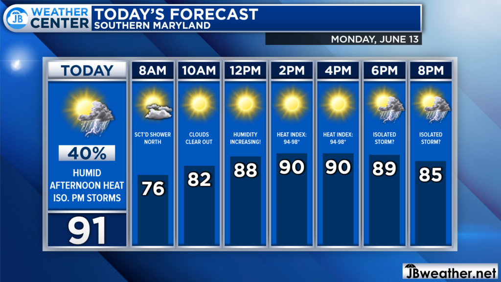
We have a hot and humid day on tap to get this week started! Many spots will look to max out in the lower 90s this afternoon. Dewpoints will get into the lower 70s, which will make it feel several degrees warmer! Late-day showers and storms will also be possible.

We are already off to a mild start this morning with temperatures in the 70s. There are some showers moving through Northern MD this morning, which should fizzle as they approach Annapolis later this morning. We should see mostly sunny skies take hold by mid-morning, leading to our warm-up!
The heat and humidity this afternoon will allow for thunderstorm energy to form across the region. This could set the stage for a couple of showers or storms to bubble up this afternoon and evening. Futurecast shows that this potential is not likely to be widespread, and the severe risk is rather low today, only 5%.
Nevertheless, anytime between 5-11pm could be fair game for one of those random summertime showers to move overhead.
Stay with JB Weather for the latest information on Southern Maryland weather. You can always access my forecasts and updates here on the website, on Facebook, on Twitter, on Instagram, and on YouTube.
-JB

Calvert Title Company is guiding you HOME one closing at a time! Check out https://calverttitle.com/ today!

