Brought to you by OakPoint Insurance
Today will look to be another active one in the weather department. After some lingering showers this morning, many spots should see clearing by the middle of the day. This will allow temperatures to get into the middle 80s, and potentially set us up to see scattered storms this afternoon and evening.
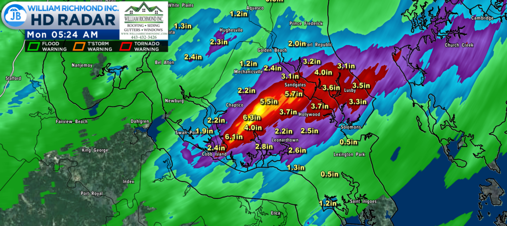
Yet again, we saw another heavy rain last night. Storms moved through yesterday evening, bringing flooding and a lot of rain to central St. Mary’s, southern Charles, and southern Calvert County. Widespread amounts of 2-4″ were common with locallzied amounts near 6″ north of Leonardtown near Loveville and Clements!
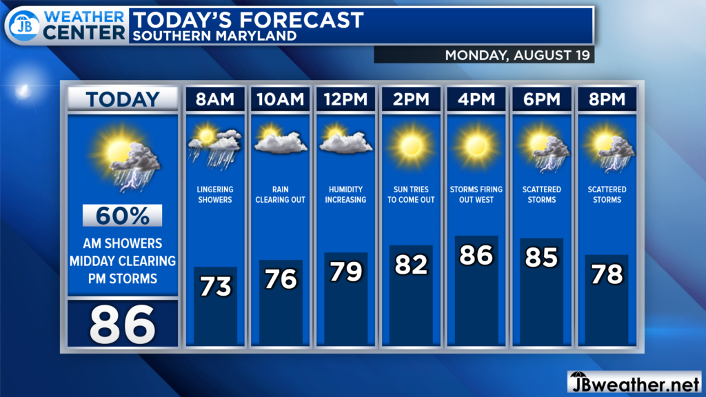
Some lingering showers from last night may look to move through this morning. We should see the rain clear up a bit by mid-morning with peeks of sunshine returning by this afternoon. As temperatures warm, though, the chance of afternoon and evening thunderstorms will increase, too.
Futuercast shows that we should get a break in the activity later on this morning. However, just after lunchtime, you can see activity beginning to fire up to our west. Those storms will look to move eastward this afternoon, likely making it across I-95 by 4/5pm, and moving through our region this evening.
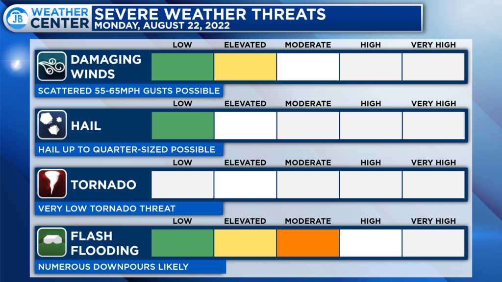
Like yesterday, the severe weather threat will not be all that high. Some storms may contain gusty winds up to 55-60mph. However, the bigger threat will likely come from a continued heavy rain risk. We could see numerous downpours again this evening. Those downpours could put down another quick 1-2″+ of rain, which could lead to more flooding.
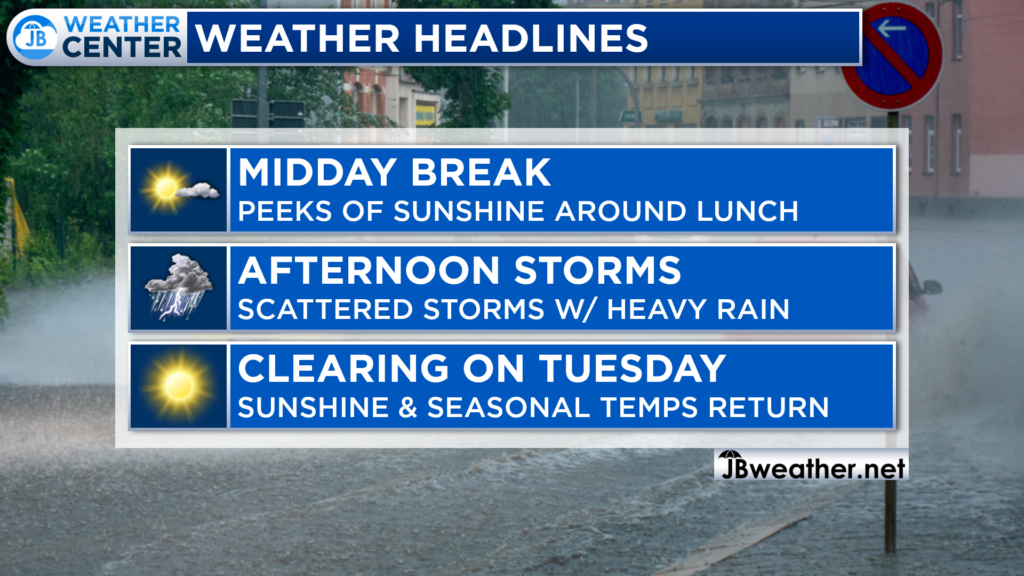
All in all, I would expect another impactful weather day. After a midday break in the activity, more showers and storms are likely this evening., Anytime after 4pm will be fair game, and we could see some flooding. Have the umbrella ready! Thankfully, clearing skies take hold for tomorrow.
Stay with JB Weather for the latest information on Southern Maryland weather. You can always access my forecasts and updates here on the website, on Facebook, on Twitter, on Instagram, and on YouTube.
-JB

The premier insurance agency in Southern Maryland with three locations. We provide insurance for Home, Auto, Business, Farm, and Life. In partnership with many top insurers, we provide solutions to fit our client’s needs. Get in touch with us at 301-863-8100 to experience the difference, mention JB Weather to claim your free gift!
