Brought to you by Cedar Point Federal Credit Union
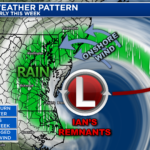
Over the last 3 days, much of our region has picked up between 1-3″ of rain thanks to the remnants of Ian. Thanks to weak atmosphere steering currents, we are likely going to get the remnants of Ian around through late Tuesday, leading to prolonged rain, wind, and cold temps!

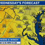
The most noticeable aspect of today’s forecast is just how cold it will be! Highs today will only max out in the middle 50s. 54° is our average high for the 3rd week in November, not the third day of October! These cool temps will be met with periods of rain and onshore winds.
Futurecast shows that off and on periods of rain will be the most prominent across the eastern half of the Mid-Atlantic as Ian’s remnants regenerate into a late fall-like Nor’easter. We will likely see the rain pick up in intensity and coverage after sunset as the costal low strengthens.
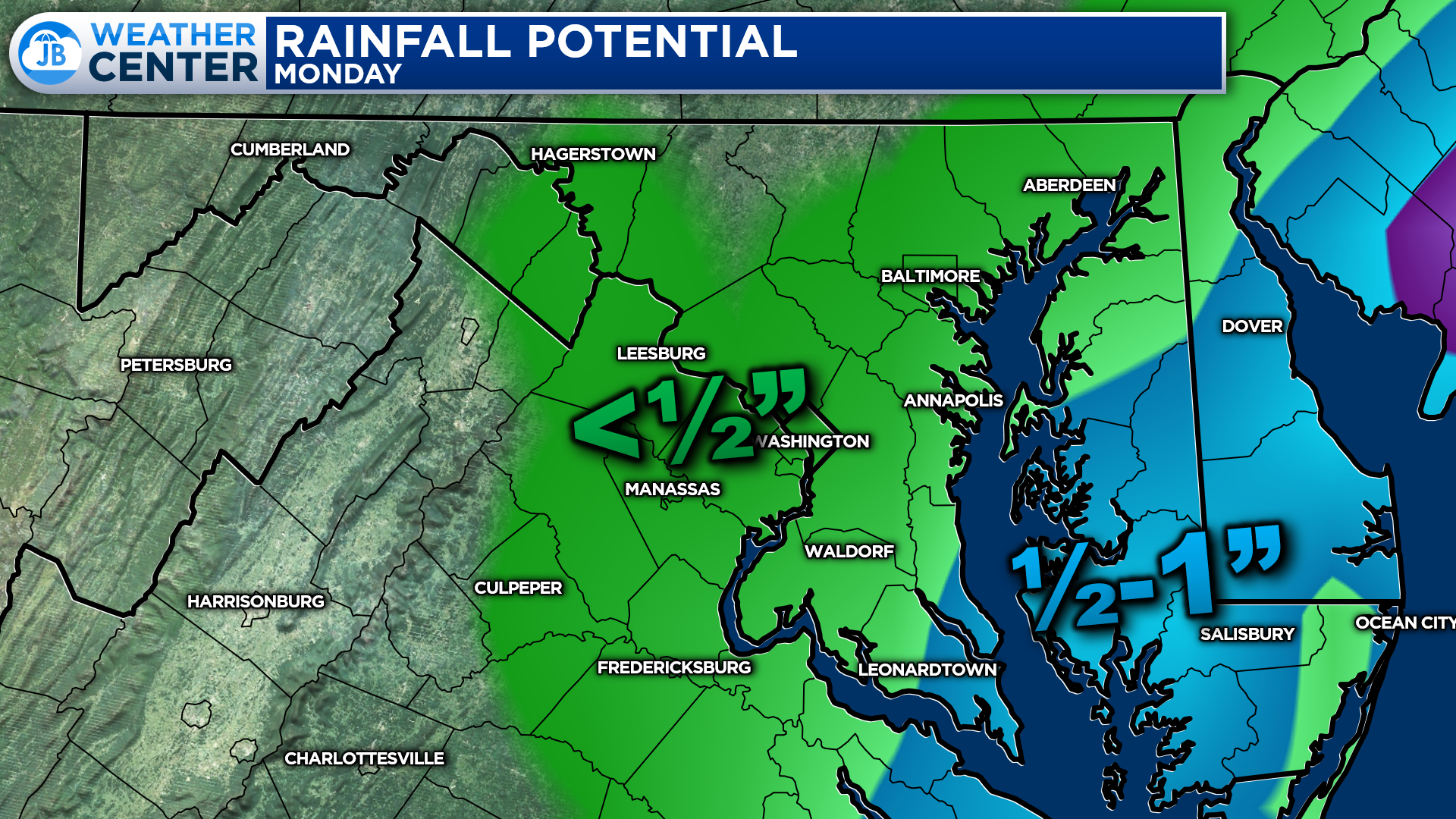
It is likely that areas along the Bay and on the Eastern Shore pick up another half-inch to an inch of rain today alone! The heaviest will be found closer to the coast. Given the prolonged nature of the rain, flash flooding concerns are relatively low. However, this could cause ponding and travel impacts on area roadways.
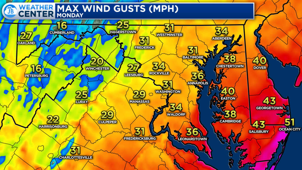
We will also be battling an annoying onshore wind all day. This wind could gust up to 40-50mph along the immediate shoreline of the Bay and Atlantic, and up to 30-40mph just inland. This is why we have a Wind Advisory in effect for our Bayside counties through the afternoon.
This consistent onshore wind will also help to pile up water along our waterways. Minor coastal flooding will be possible at times of high tide. Additional 1-2 foot water rise will be possible.
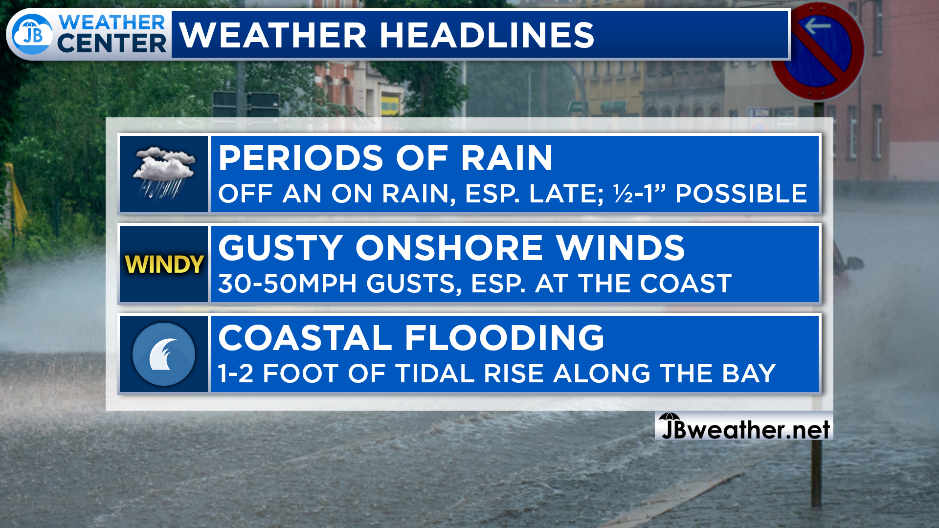
All in all, today has the makings of a dreary, late-fall day. Cool temps in the 50s will be accompanied by periods of rain, gusty winds, and coastal flooding. This is thanks to Ian’s remnants regenerating into what looks like a late-fall Nor’easter! The gustiest winds are likely before sunset tonight with the steadiest rains likely coming after sunset.
Stay with JB Weather for the latest information on Southern Maryland weather. You can always access my forecasts and updates here on the website, on Facebook, on Twitter, on Instagram, and on YouTube.
-JB
Cedar Point has been providing trusted banking, lending and personal finance solutions to the Southern Maryland Community since 1945. Visit the credit union at any of its 6 locations in St. Mary’s, Charles and Calvert counties or online at www.cpfcu.com.
John Bordash
View More PostsJB Weather forecaster John Bordash is working around the clock to provide Southern Maryland, and neighboring communities, with accurate and reliable weather information.