Brought to you by All in One Tag & Title
We have a rather active weather day on tap across the Mid-Atlantic to kick off the work week! An incoming cold front will look to bring our region our first legitimate chance of severe weather this year. All modes of severe are possible as this front moves through.
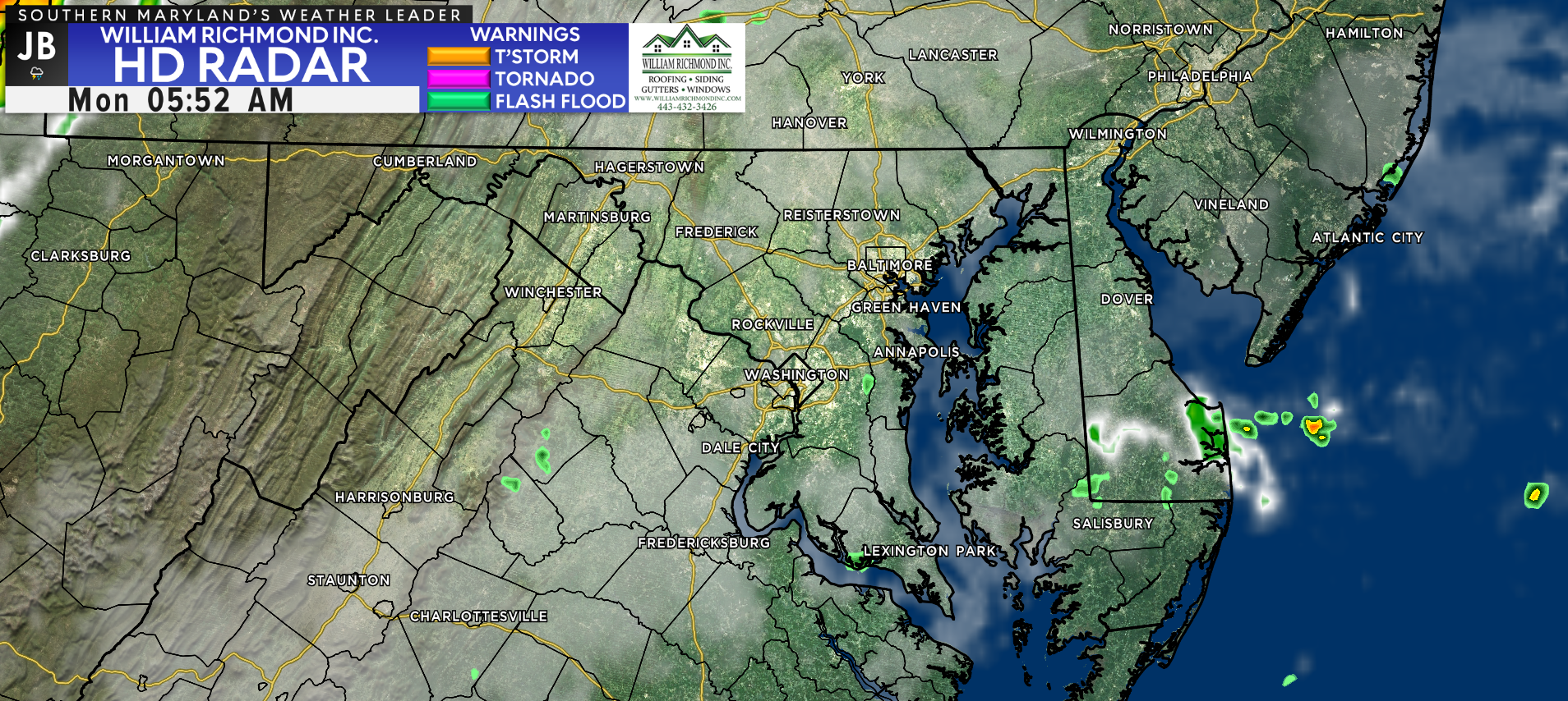
We saw some strong storms push through last night, which limited our ability to see the lunar eclipse that happened around midnight. We still have some leftover showers and clouds out there this morning, along with some areas of patchy fog. This should all burn off by mid-morning.
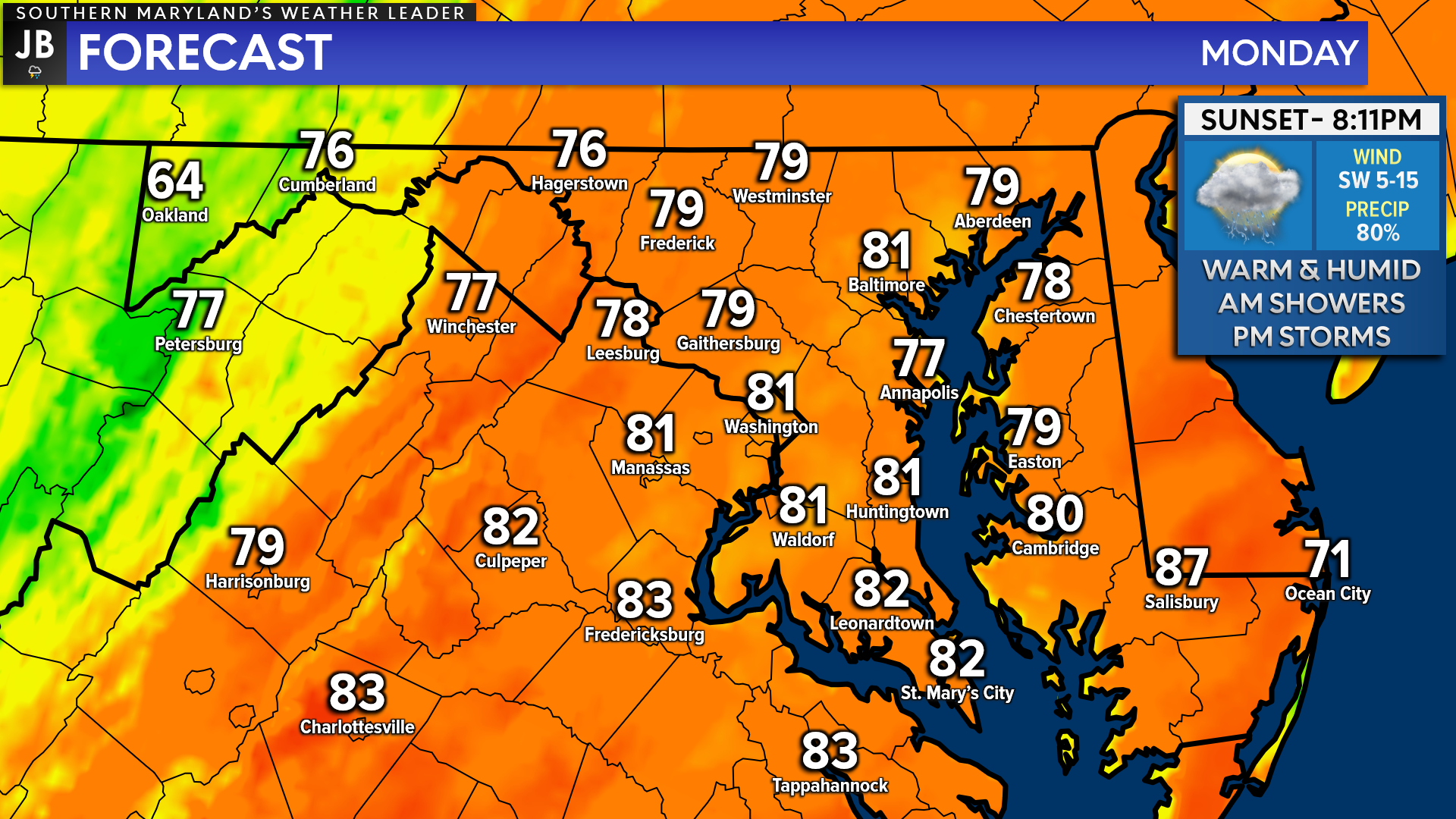
Out ahead of the cold front, we will see temperatures and humidity levels surge across our region! Many spots are likely to max out in the upper 70s to lower 80s just after lunchtime. Dewpoints will be in the middle to upper 60s, meaning that you will be able to feel the humidity out there! Then, our attention will turn to our storm chances.
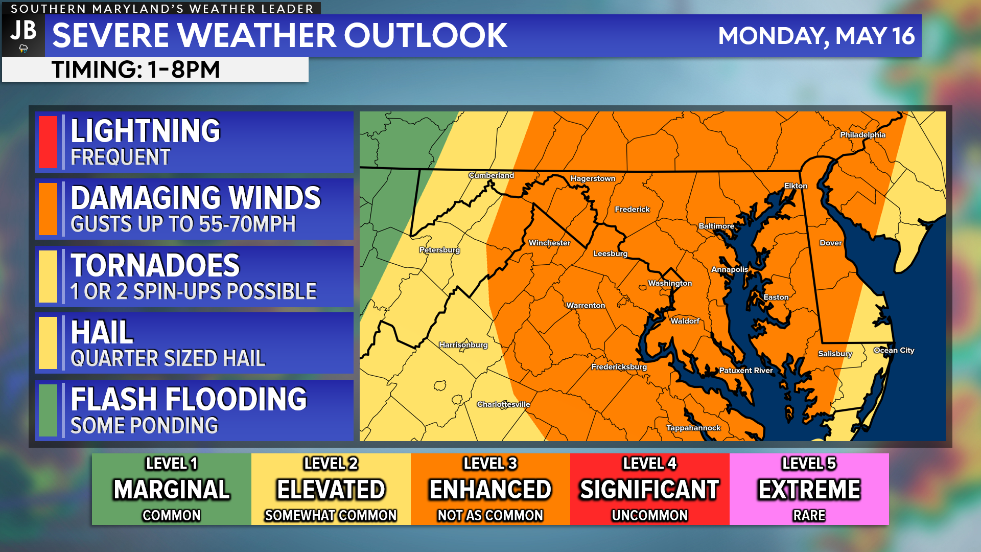
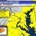
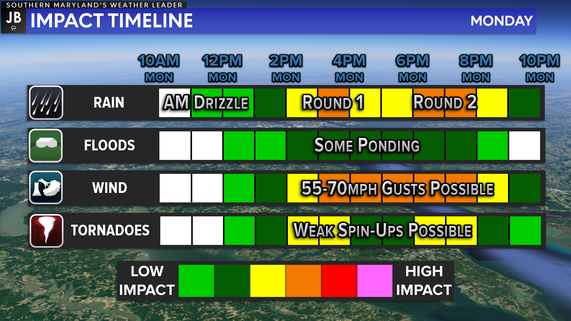
The Storm Prediction Center has maintained a Level 3 “Enhanced Risk” of severe weather across our region for this afternoon and evening. We are likely to see a couple of rounds of showers and storms push through. As they do so, lightning is likely along with some instances of damaging wind gusts. Quarter-sized hail and a brief spin-up tornado cannot be ruled out either! Some flooding/ponding could be possible as well.
We typically only see a threat level this high a handful of times a year. So this is something to take note of and should prompt all of us to stay aware to quickly changing weather conditions.
Keep in mind that severe weather forecasting is far from a guarantee of anything. The goal of these forecasts is to alert you to the potential of storms, not a promise of storms.
Our Chesapeake’s Bounty Futurecast seems to have a good handle on today’s threat. We are likely to see a couple of showers out there throughout the morning, thanks to our moist, southerly flow. The extent of these showers will be critical to this afternoon’s forecast.
The more numerous and widespread these showers are, the lower the afternoon severe threat will be. This is because it would limit the ability for the atmosphere to become unstable, limiting the atmospheric fuel for thunderstorms. This is something we will need to watch throughout the morning and afternoon.
We are likely to see our threat of thunderstorms come in two separate rounds, which I detail below.
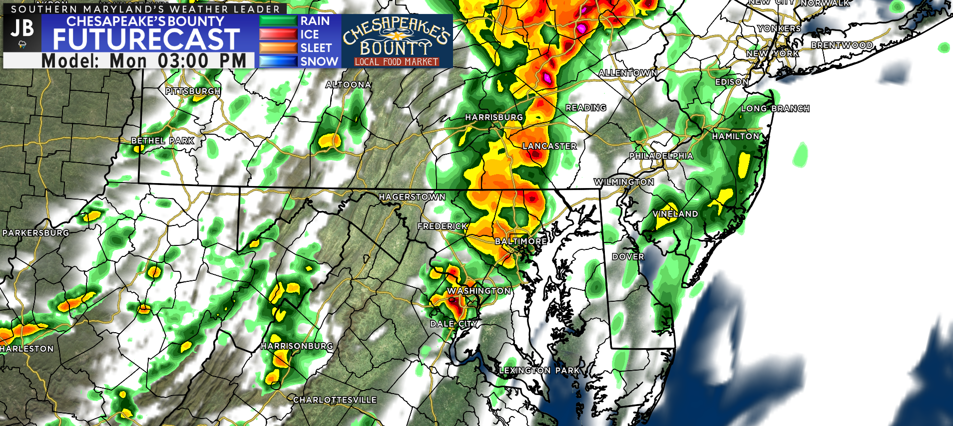
The first round of storms is likely to develop during the early afternoon hours, out ahead of the main cold front. These pre-frontal storms will have a greater chance of developing if the morning showers are kept at a minimum and we see decent daytime heating by lunchtime. The timing for this first round would likely be between 1-4PM.
Right now, it looks like this initial round may favor areas along, and north, of US-50 (the DC-to-Annapolis corridor). With that said, though, we could see these develop anywhere with enough heating. The main threat with these storms would be damaging wind gusts up to 70mph and some potential rotation that could lead to a spin-up tornado.
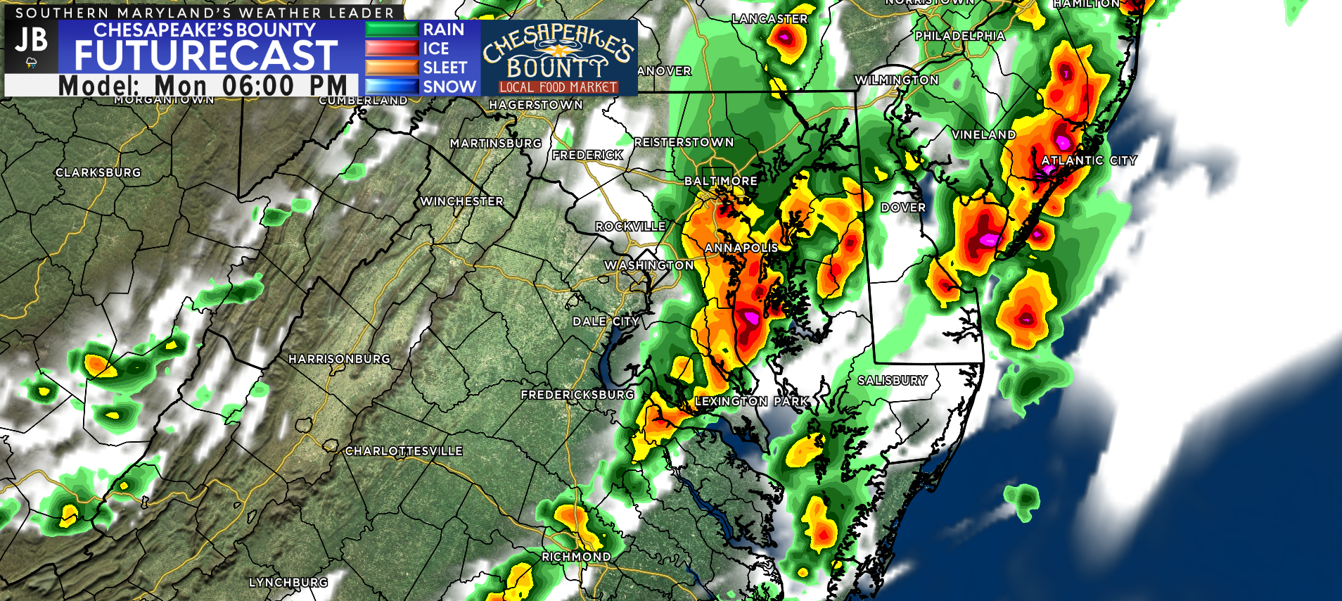
Our second round of storms likely comes with the cold front itself this evening and would bring a threat of strong to severe thunderstorms to much of our region. The severity of these storms will be highly dependent on how long the morning showers stick around, and if we see storms from the first round. If the answer is yes to either, then this round may be kept down in its severity. However, if we do not see either of these, especially the first round, then this round could be severe.
Heavy rain, damaging wind gust up to 70mph, and hail up to the size of quarters would be possible with this. We could also see an embedded, brief spin-up tornado with this line. The timing of this line of storms is likely to be between 5-8PM. If the rain is heavy enough, this line could bring the threat of flooding as well.
Summary
All-in-all, today definitely has the potential to become an active, severe weather day across the Mid-Atlantic. We will see a couple of rounds of storms try to bring the region a couple of chances of severe weather. While severe weather is far from a guarantee today, the potential ceiling with this event is high. Therefore, it will be important to stay weather aware anytime after 12PM.
This forecast will be updated later on this morning, around 8/9AM, and again around lunchtime. You will want to stay tuned for those subsequent updates. This forecast is prone to change as we learn more details about today’s threats. I will be in the weather office all day looking over this new information, and providing updates.
Stay with JB Weather for the latest information on impacts here in Southern Maryland. You can always access my forecasts and updates here on the website, on Facebook, on Twitter, on Instagram, and on YouTube. JB Weather is Southern Maryland’s Weather Leader, and I am working around the clock to keep you ahead of the storm!
-JB

At All In One Tag & Title, we make quick work of MVA Tag & Title Services! We are located in Owings, MD on the corner of Chaneyville Rd. Give us a call at 301-327-5081 or stop by, no appointment needed! Mention you saw us on JB Weather and get $5.00 off tag & title services. Check out www.allinonellc.net today!
John Bordash
View More PostsJB Weather forecaster John Bordash is working around the clock to provide Southern Maryland, and neighboring communities, with accurate and reliable weather information.