Brought to you by OakPoint Insurance
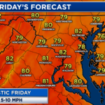
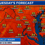
The nice weather we saw at the end of last week has slowly eroded away this weekend as warmth and humidity return to the region. Today will be the start of our warmest stretch with this September warm up! Many communities will make a run for the upper 80s by this afternoon.

We are off to a cool yet humid start this morning. We will see the clouds gradually increase through the morning and into the afternoon. Southerly winds, though, will help to warm up our temperatures. The southerly winds will also increase humidity levels. Spotty showers become possible by this evening.
A weak wave of atmospheric energy will move through PA and northern MD later on today. As it does so, showers and storms will become possible across those locations. Most of this activity should stay to our north. However, Futurecast does show the potential of a stray shower or two making the trip down to Southern MD this afternoon. We’re not expecting a washout, but anytime after 3pm is fair game for a shower.
Stay with JB Weather for the latest information on Southern Maryland weather. You can always access my forecasts and updates here on the website, on Facebook, on Twitter, on Instagram, and on YouTube.
-JB

The premier insurance agency in Southern Maryland with three locations. We provide insurance for Home, Auto, Business, Farm, and Life. In partnership with many top insurers, we provide solutions to fit our client’s needs. Get in touch with us at 301-863-8100 to experience the difference, mention JB Weather to claim your free gift!

