Brought to you by All in One Tag & Title
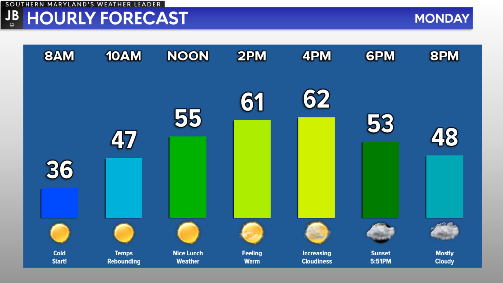
After a weekend full of weather whiplash, we will continue to see the weather pendulum swing again today. Many spots will look to max out in the lower to middle 60s this afternoon! Many spots will see temperatures that are 20° warmer than yesterday!

Temperatures will be off to a cold start this morning. Many of us are waking up to chilly temps in the 30s, thanks to clear skies overnight. The southerly flow with our winds today will be what allows temperatures to warm so quickly later on today.

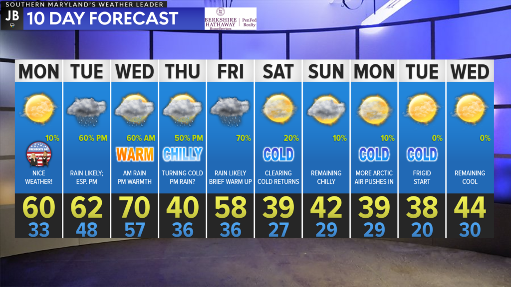
After maxing out in the 60s today, we will see cloud cover increase this evening ahead of our next weather system on Tuesday. This system will kick off an unsettled couple of days in our region with wild temperature swings.
Our first system will look to spread rain into the region tomorrow afternoon, and stick around through Wednesday afternoon. Behind that system, temperatures should be allowed to warm nicely before cooler air moves in for Thursday. An additional system will then move through late Thursday into Friday with more rain before another cool-down sets in this coming weekend.
This week will definitely have a lot to offer in the weather department this week as begin to work into late February. So, I would definitely take advantage of the nice weather we have out there today.
Stay with JB Weather for the latest information on Southern Maryland weather. You can always access my forecasts and updates here on the website, on Facebook, on Twitter, and on YouTube.
-JB

At All In One Tag & Title, we make quick work of MVA Tag & Title Services! We are located in Owings, MD on the corner of Chaneyville Rd. Give us a call at 301-327-5081 or stop by, no appointment needed! Mention you saw us on JB Weather and get $5.00 off tag & title services. Check out www.allinonellc.net today!

