Brought to you by Row House
After pretty nice weather this past weekend, we should be able to squeeze out one more late Spring-like day before cooler air returns this evening. Many spots, locally, should make it into the upper 70s and lower 80s by early afternoon. Our record high for today is 76°, set back in 1994, which looks to be in real jeopardy today!
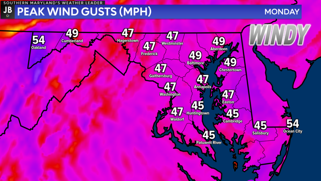
The warmth this afternoon will come on the heels of gusty southwest winds! Winds look to be sustained between 15-25mph by late morning. Wind gusts up to 45-50mph look likely by this afternoon.
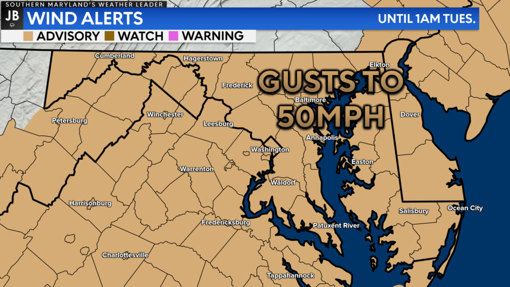
Due to the threat of high winds, the National Weather Service has issued a Wind Advisory for our entire region from 11am this morning until 1am Tuesday. Gusty winds could blow around unsecured objects. Tree limbs could be blown down, and a few power outages may occur. Use extra caution when driving, especially if operating a high-profile vehicle. Secure outdoor objects.
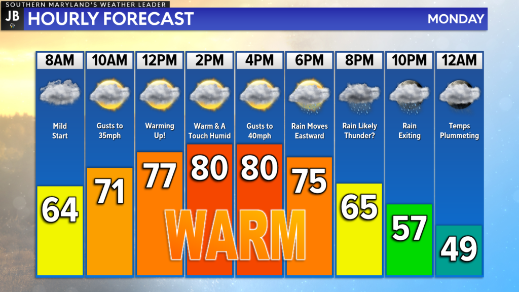
We are off to a mild start this morning, with many waking up to temperatures in the 60s. We should be able to manage a few peeks of sunshine by lunchtime, helping temperatures really warm up! Our cold front will begin working eastward by this evening, allowing for a chance of showers/storms. Much cooler air rushes in behind the front!
Our Chesapeake’s Bounty Futurecast is doing an excellent job of depicting the evening rain threat. We should begin to see rain, with an embedded line of storms, move through the Mountains and cross I-81 late this afternoon. That line should then cross I-95 by rush hour and move through Southern MD between 5-11pm, with clearing conditions behind it.
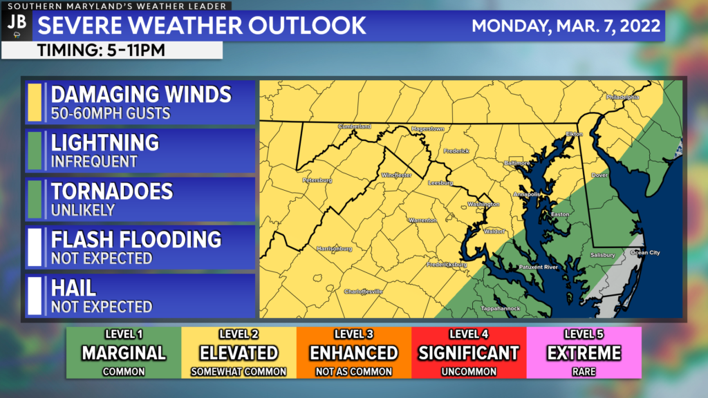
With this in mind, the Storm Prediction Center has placed our region under its first threat of severe weather of the year! Granted, this is not a big threat, as much of our region only sits under a Level 1 “Marginal Risk.” Western zones have been placed under a Level 2 “Elevated Risk.”
While temperatures will be plenty warm this afternoon, and there will be plenty of wind energy, there will not likely to be much storm energy for this evening’s line to tap into. As a result, this is likely to resemble just Spring-time thunderstorms, with a limited severe weather risk.
With that said, if one or two embedded thunderstorms within the line do become strong enough, we could see it produce 50-60mph wind gusts! The threat of hail, flash flooding, and tornadoes are all rather low for today. The primary time frame to watch for this would be this evening, mainly after sunset. Again, the highest storm threat, particularly from damaging winds, looks to be to our west. However, this will be something to watch throughout the day.
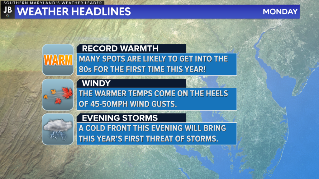
All-in-all we have a pretty impactful weather day! Record warmth looks likely today, so I would not worry about having the coat on today! This warmth is thanks to the gusty winds we will have around today. You may want the jacket or umbrella by this evening though, as a cold front brings this year’s first chance of thunderstorms to Southern MD and the Northern Neck. Locally damaging winds and heavy rain are the main threats today.
Keep in mind that severe weather forecasting is far from a guarantee of anything. The goal of these forecasts is to alert you to the potential of storms, not a promise of storms. Stay with JB Weather for the latest information on impacts here in Southern Maryland.
Stay with JB Weather for the latest information on Southern Maryland weather. You can always access my forecasts and updates here on the website, on Facebook, on Twitter, and on YouTube.
-JB

Row House SOMD is more than just a workout; it’s about people, connection, strength and community. Our classes offer varied programming, helping you progress your workout and avoid plateaus. In our boat there’s a seat for everyone, so contact us TODAY at 301.686.7788 and mention JB Weather to schedule a FREE introductory class. Also receive a FREE GIFT when you sign up for a membership.
2 thoughts on “Monday’s Forecast: Warm & Windy With PM Storm Chance”
Comments are closed.


I like this format. Very complete
Thank you for the feedback, Susan! I appreciate it!