Brought to you by Berkshire Hathaway HomeServices PenFed Realty
We have seen quite a great start to the work week! After a blast of winter weather this weekend, temperatures yesterday and today have peaked in the 70s regionwide. This switch to prolonged warmth is helping to finally usher in that Spring-like feel. While warmer temperatures will continue, we will have a bump in the road for tomorrow.

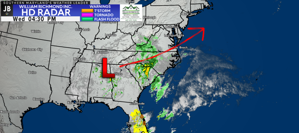
An area of low pressure is currently making its way across the South this afternoon, bringing rain and some severe storms to the Southeast. This system is what will eventually work its way northward and towards our region for tomorrow.
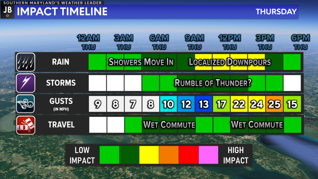
Our Chesapeake’s Bounty Futurecast seems to be doing a good job at depicting our rain threat. We will likely see some showers begin to break out overnight tonight. However, the majority of the rain looks to move through between sunrise and early afternoon. Futurecast shows the rain gradually tapering off by tomorrow evening.
None of this rain is expected to be overly heavy, and we should avoid flooding issues tomorrow. With that said, the heaviest rains will likely be southeast of I-95, along the Bay. There may even be some localized downpours that move across far southeastern zones.

While rain does look likely tomorrow, the amount of rain will be nothing to write home about. As mentioned earlier, the heaviest rains will be southeast of DC, which is where we will find the highest rain totals. Between a quarter-to-half inch of rain seems possible for many spots. Some areas to the south may see localized higher totals, with spots to our northwest seeing less.
Again, this does not look to be any significant. Rather, this will likely be off-and-on showers that move through, some of which could bring steady rains with 1 or 2 localized downpours.

While this does not look like a significant event for our area, it will definitely bring some impacts to our region. I would have the umbrella handy throughout the day as this area of low pressure slides off the coast. I would expect the rain to bring some minor impacts on the commutes tomorrow, especially the morning commute. Winds will not be a huge factor tomorrow, with the highest wind gusts getting between 20-25mph.
1 or 2 rumbles of thunder are possible late tomorrow morning and during the early afternoon hours. The severe weather risk is rather low tomorrow, with the Storm Prediction Center not even placing our region under a Level 1 Risk. With that said, localized downpours, some thunder, and quick wind gusts of 30-40mph could be possible with any embedded storms that do develop. The great threat for these embedded storms would be for our southernmost communities, along the middle of the Bay.

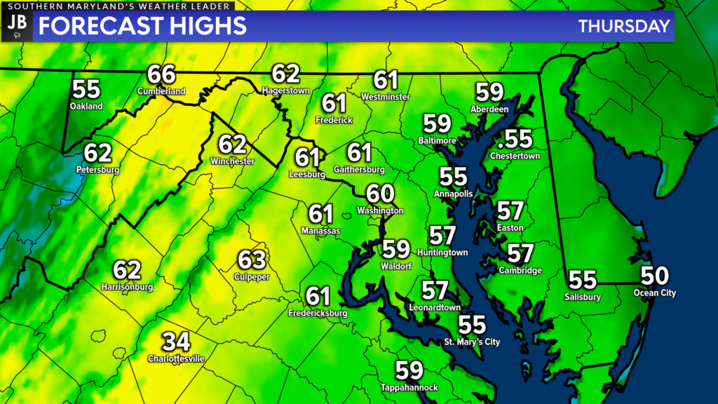
With the storm system sliding off the coast we will also see easterly winds throughout the day. This is a cooling onshore wind direction, which will mean slightly cooler temperatures for areas east of I-95. While temperatures will still likely be above our average high of 55, many of us will likely only stay in the upper 50s, to maybe lower 60s.
We will see clearing by tomorrow evening with mainly clear skies setting in by tomorrow night. Evening plans for St. Patrick’s Day should be alright! This will set the stage for another amazing weather day for Friday!
Stay with JB Weather for the latest information on Southern Maryland weather. You can always access my forecasts and updates here on the website, on Facebook, on Twitter, on Instagram, and on YouTube.
-JB

Real Estate now! Not sure where to start? View our Southern Maryland inventory of homes, land, farms and commercial properties on penfedrealty.com. Engage with our planning tools to determine your next real estate lifestyle decision, choose your realtor as a trusted advisor. Experience the difference with service and support from real estate’s forever brand!

