Brought to you by G&H Jewelers, Inc.
The remnants of Tropical Storm Fred are set to move up along the Appalachian Mountains today, and in turn, spread impacts across Maryland. Heavy rain and gusty winds are possible across the region today, along with an isolated tornado threat. The highest risks for both rain and isolated tornadoes will be centered out west, but we have a non-zero threat of both of those here in Southern MD.
Scattered rain showers will likely increase in coverage as we head throughout the morning. Beginning after lunchtime, we may see a couple of lines of rain move through the state. Embedded areas of heavier rain and some weak rotating cells cannot be ruled out with these lines. We should begin to see some clearing as we approach sunset. Shown below is our Chesapeake’s Bounty Futurecast, which does a good job of showing these threats.
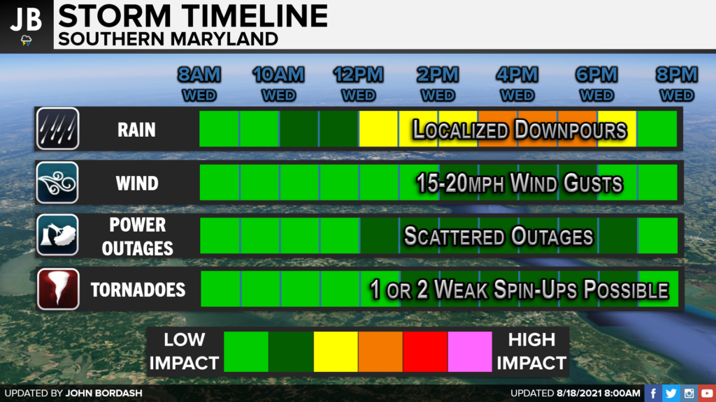
I think the primary timeframe to watch locally will be 12pm to 7pm today. This is when we could see those localized downpours and a rotating storm or two. The tornado threat is NOT as high as it was with Isiais last year, or Elsa this year. We may see winds gusts as high as 15-20mph this afternoon, with scattered outages being possible (but not likely).
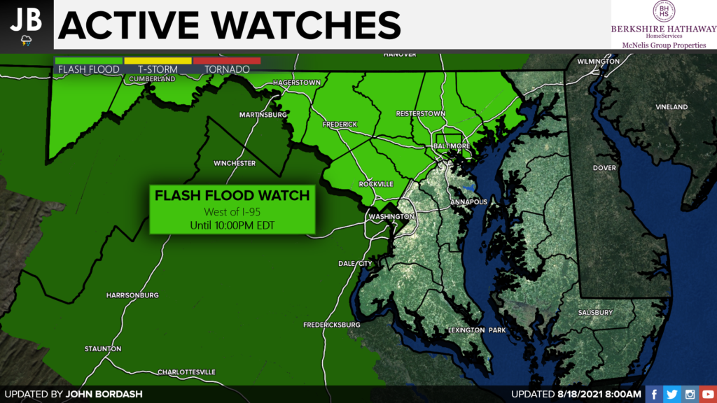
The highest rain totals are likely to fall out west of I-95. 1-3″ of rain is possible west of I-95, and there could be some isolated higher totals as you head out to far western Maryland. Locally in Southern MD I think we may see up to an inch of rain, with some locally higher totals being possible. Some locations may receive very little rain while others see a lot. Since we are not talking about a widespread rain event, and just lines of rain moving through, this tends to be the case. On the second slide below, you can see where that the Flash Flood Watch is mainly confined west of I-95. Again, that is where the highest rain totals are likely to be. With that said, localized flooding is still possible here in Southern MD; the chances are just not as widespread.

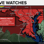
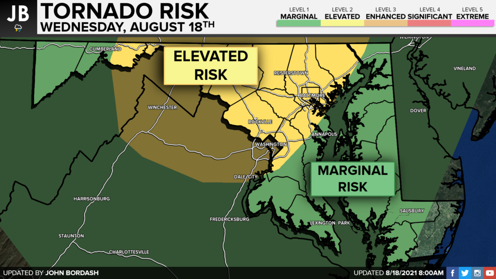
The tornado threat has been getting plenty of buzz on social media. As things stand right now, this does not appear to be a widespread tornado outbreak. I do not expect us to see anything on the level of what saw with Isiais last August. With that said, 1 or 2 rotating storms, which may try to put down weak tornadoes, certainly look possible The highest threat will be west of I-95, closer to the track of Fred. Given that we also will see those lines of showers/storms move through, Southern MD does have a marginal tornado risk. While the highest tornado risk should be confined to the yellow shaded zone, the green zone has a non-zero threat. This will be something to monitor as we head into the afternoon and evening.
It will be important to stay with JB Weather for the latest information on Fred and the impacts here in Southern Maryland this afternoon. You can always access my forecasts and updates here on the website, on Facebook, on Twitter, and on YouTube. JB Weather is Southern Maryland’s Weather Leader, and I am working around the clock to keep you ahead of the storm!
-JB
Shop G&H Jewelers Today for Loose Diamonds, Fine Diamond & Colored Gemstone Jewelry, On-site Custom Jewelry Design (CAD) & Manufacturing, Jewelry Repair and GIA Graduate Gemologist Appraisal Services. Third Generation Family Owned & Operated Since 1965.
John Bordash
View More PostsJB Weather forecaster John Bordash is working around the clock to provide Southern Maryland, and neighboring communities, with accurate and reliable weather information.