Brought to you by Berkshire Hathaway HomeServices PenFed Realty
We have a pretty active day on tap in the weather department! We are likely to go from Spring-like warmth, to heavy rain, to snow, with wind and dropping temperatures all within a matter of hours today. This dynamic weather is brought to us thanks to a powerful cold front and a developing system moving northward as Winter tries its best to hang on!
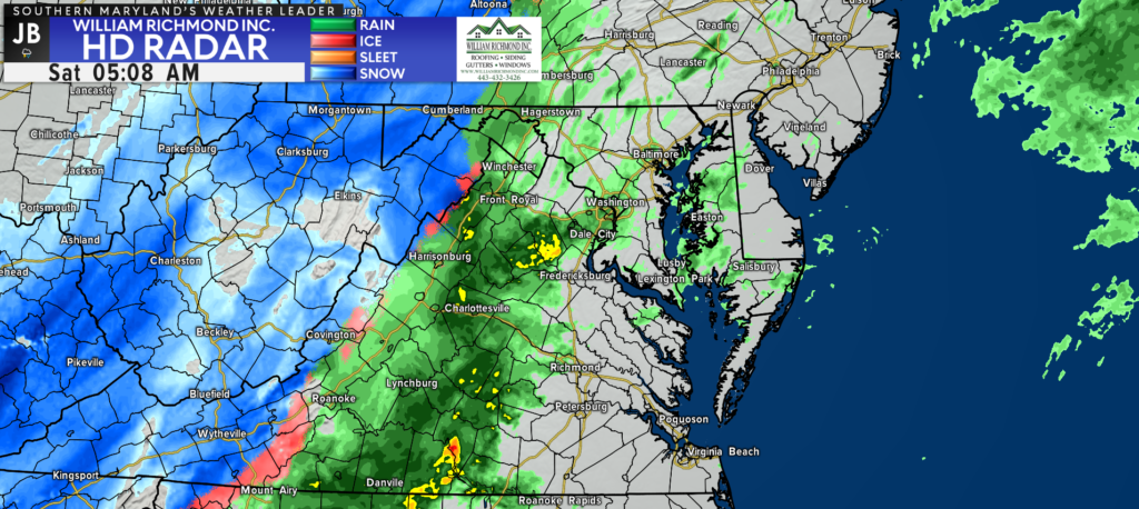
We held on to yesterday’s warmth overnight, and we’ve seen only a few rain showers work through the region. The bulk of the moisture with our system is still down to south, which should stream northward this morning. The cold front is already entering western Maryland, where the rain has gone over to snow.
Our Chesapeake’s Bounty Futurecast shows that we will see rain increase in coverage throughout the morning, with bouts of heavy rain looking to move through after sunrise. As the cold front races eastward, we will see temperatures drop. This temperature drop will allow areas to gradually transition from rain to snow, from west to east, throughout the day.
The biggest question with today’s forecast remains, how quickly does the cold air race in here? Additionally, how long does the precipitation stick around before moving out? Our Futurecast suggests that we could see the precip stick around for a few hours, leading to a few hours of snowfall across our region.
Road conditions are likely to deteriorate very quickly throughout the day. While snow accumulation on roadways may not be widespread, the rapid drop in temperatures will freeze any moisture left on roadways from today’s events. This will likely lead to widespread slick spots and black ice by tonight.
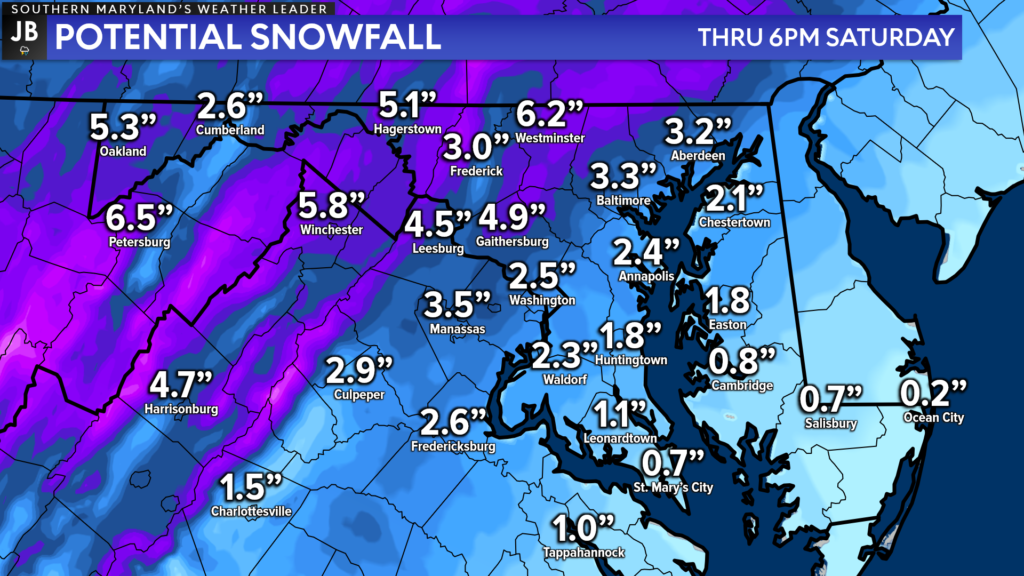
Our modeling suggests that areas northwest of DC, that should switch over to snow rather quickly, are likely to see a few inches of snow accumulation. Locally, our model shows an inch or two slushy accumulation on grassy surfaces is possible.
I’m wary that this model may be a touch too aggressive with the snow accumulation, given the warm pavement temperatures and the Mid-March sun angle. I think the best chances to see an inch or two will likely be along Route 301.
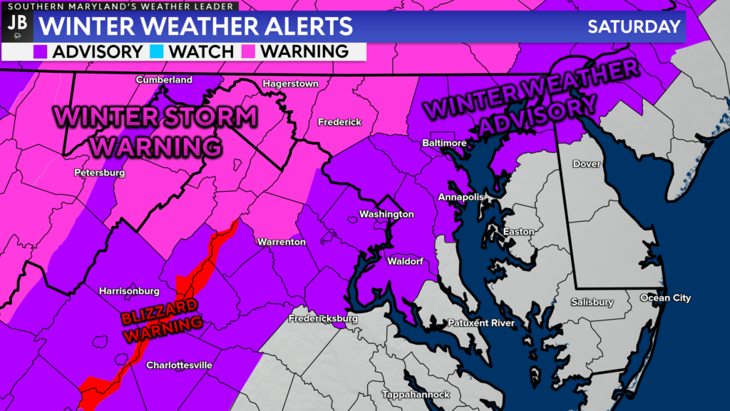
With this in mind, the National Weather Service has expanded the Winter Weather Advisory to now include Anne Arundel, Charles, King George, and Prince George’s Counties from 7am-3pm. Again, locally, this is where the best chance to see a couple of inches of snow exists.
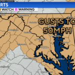
Areas to the northwest of DC are under a Winter Storm Warning, where several inches of snow are likely. We even have Blizzard Warnings in effect along the Blue Ridge Mountains where both heavy snow and high winds are the most likely.
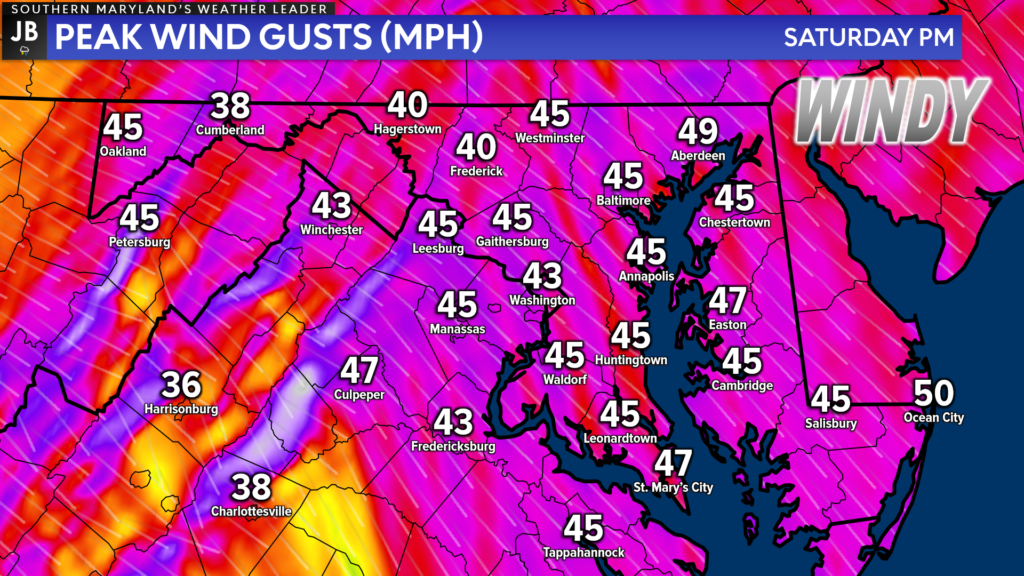
Winds will become an increasing problem throughout the day. Once the cold front moves through the region during the mid-morning hours, we will see winds markedly increase from the northwest. We could see wind gusts up to 40-55mph at times across the region as the cold air filters in.
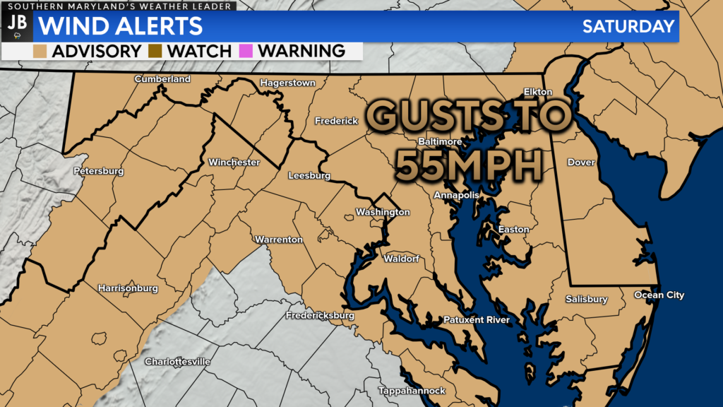
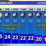
As a result of this elevated wind threat, much of the region remains under a Wind Advisory for today. These gusty northwest winds could lead to a few downed tree branches, some scattered power outages, and reduced visibilities. The worst of the wind is likely from 11am-10pm, with winds gradually tapering off to only gusting around 15-20mph by sunrise on Sunday.
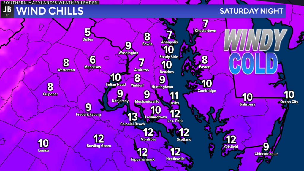
Lastly, we will see bitterly cold air drive-in by tonight, thanks to our northwest winds. Air temperatures are likely to drop into the 20s by sunset tonight and stay there overnight. The northwest winds will bring an added chill, making it feel like we’re in the single digits and teens tonight! Extra blankets will be a necessity tonight! The winter coats will be needed throughout the day tomorrow, as well.
Stay with JB Weather for the latest information on Southern Maryland weather. I will be with you all throughout the day to cover this impactful system. You can always access my forecasts and updates here on the website, on Facebook, on Twitter, on Instagram, and on YouTube.
-JB

Real Estate now! Not sure where to start? View our Southern Maryland inventory of homes, land, farms and commercial properties on penfedrealty.com. Engage with our planning tools to determine your next real estate lifestyle decision, choose your realtor as a trusted advisor. Experience the difference with service and support from real estate’s forever brand!
