Brought to you by Cedar Point Federal Credit Union
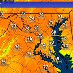
After the thick fog that rolled through this morning, we have seen a pretty nice day shape up! This afternoon, many spots have seen temperatures max out in the lower to middle 70s. This has been thanks to southerly winds and clearing skies. While the mild conditions will stick around tonight, we will see clouds increase this evening. Both of these will set the stage for tomorrow’s weather.
Our Chesapeake’s Bounty Futurecast shows that the increase in cloud cover this evening will eventually give way to scattered showers. This overnight rain chance comes as a warm front lifts northward through our region. This model has backed off on depicting widespread downpours moving through tonight. It has come in line with my thinking of scattered showers with only one or two downpours. Thunderstorms are not expected, and we should avoid seeing the amount of rain we saw on Thursday. We could begin to see these showers move through between midnight and mid-morning.
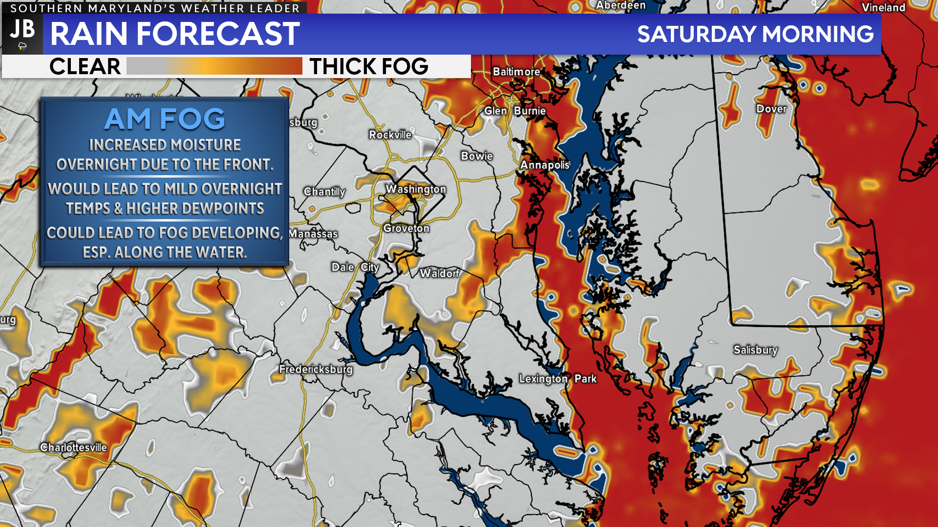
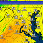
Thanks to the warm front crossing through the region, we should remain rather mild overnight, with lows only in the 50s. The threat of showers overnight will also mean an increased moisture content in the air. This combination could once again lead to patchy fog in the morning, especially along the Bay. Now, the fog should not be as thick or widespread as this morning, but there is the potential for reduced visibilities tomorrow morning.
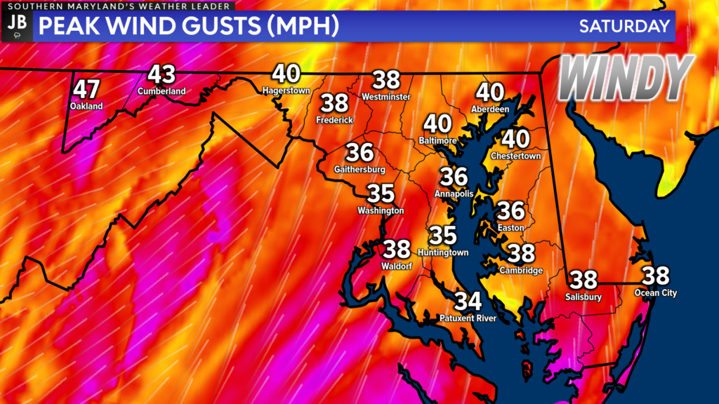
We should see any rain showers die out by mid-to-late morning, but we will keep the clouds around. Once the warm front passes northward, we will see southerly winds pick up. These winds could gust upwards of 25-35mph at times. These winds will increase some as we then have a cold front push eastward, which should arrive by tomorrow evening.
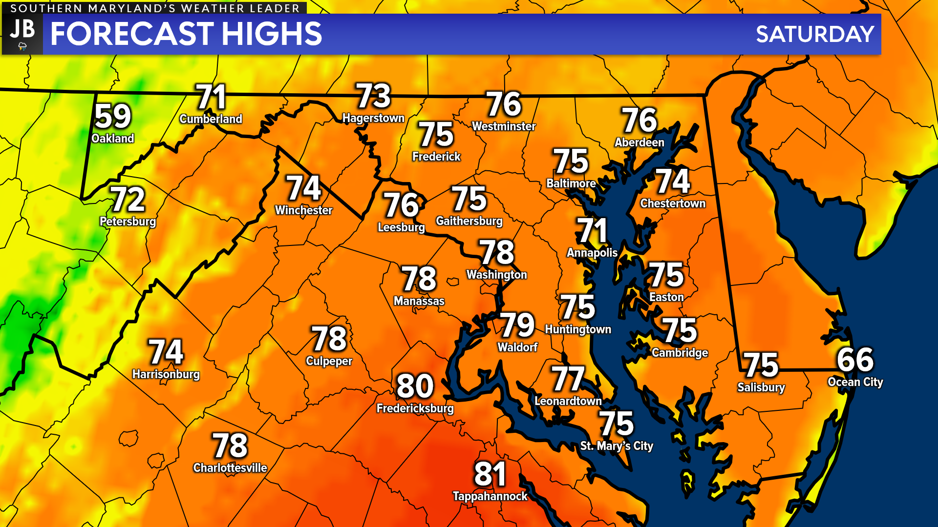
Despite the morning fog & showers, and residual cloud cover, we will see temperatures soar tomorrow! Thanks to the warm southerly winds, we are likely to see highs in the 70s again tomorrow. If we see some breaks in the cloud over by lunchtime, then we could see a few communities, especially to our south, get into the lower 80s!
As the cold front moves towards our region tomorrow evening, we could see a couple of additional showers and storms develop across the region. Our Futurecast suggests that these storms are not likely to be widespread, and could be more isolated in nature. Additionally, it looks like the highest threat for storms will likely be to our north, across PA, and to our south, across southern VA. Any showers or storms are likely to clear the area by midnight tomorrow night.
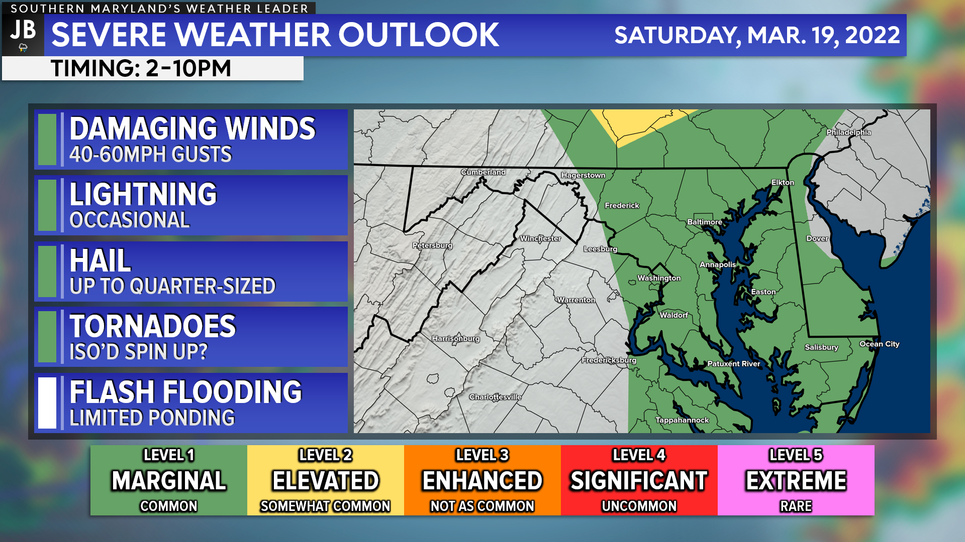
The Storm Prediction Center has highlighted our region under a Level 1 “Marginal Risk”. The two highest threat zones are to our north and south, and we will be caught in between those two areas. This is because the highest instability to support storm development will likely be kept to our south, and the highest amounts of atmospheric wind energy will be kept to our north.
With all of that said, I would not rule out afternoon showers or storms between lunchtime and midnight. If we see storms develop Saturday afternoon, they could contain damaging wind gusts of 40-60mph, small hail, and could even try to rotate. Again, these storms are likely to be limited in coverage, and we will lack key severe storm ingredients. But it will be important to watch this threat. We all know that things can change on a dime.
Stay with JB Weather for the latest information on Southern Maryland weather. You can always access my forecasts and updates here on the website, on Facebook, on Twitter, on Instagram, and on YouTube.
-JB
Cedar Point has been providing trusted banking, lending and personal finance solutions to the Southern Maryland Community since 1945. Visit the credit union at any of its 6 locations in St. Mary’s, Charles and Calvert counties or online at www.cpfcu.com.
John Bordash
View More PostsJB Weather forecaster John Bordash is working around the clock to provide Southern Maryland, and neighboring communities, with accurate and reliable weather information.