Brought to you by William Richmond, Inc.
Good Saturday morning! We are now within 24 hours of a significant winter storm, and this morning’s data continues to support the Second Call forecast issued overnight. While details are still sharpening, the overall evolution and impact level of this storm remain firmly on track.
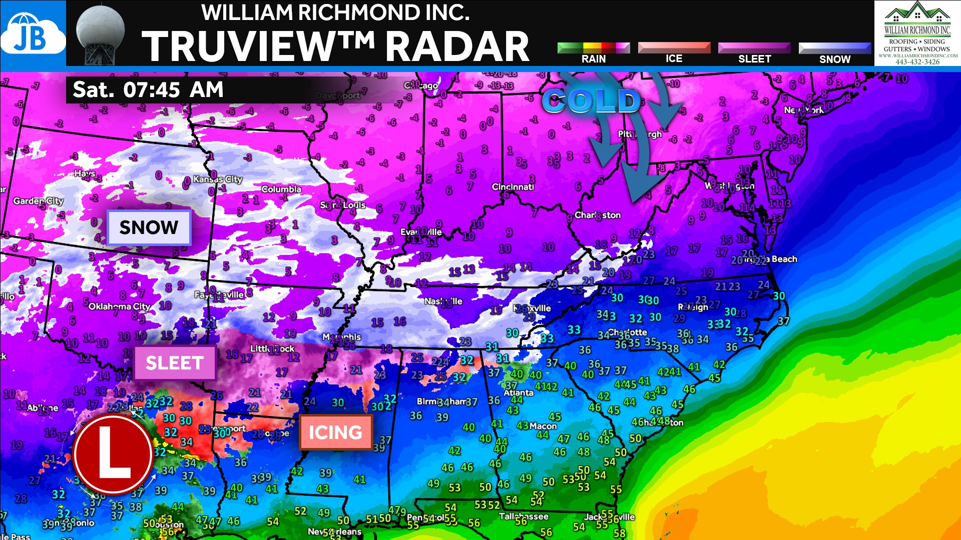
Current radar imagery shows a large, well-organized storm system stretching across the central United States, with widespread snow on its cold side and a broad zone of sleet and icing developing to the south. Strong high pressure to our north is supplying cold air, ensuring that precipitation will begin as snow everywhere once it arrives late tonight into early Sunday. This cold air is locked in initially, setting the stage for a heavy thump of snow before any changeover occurs.
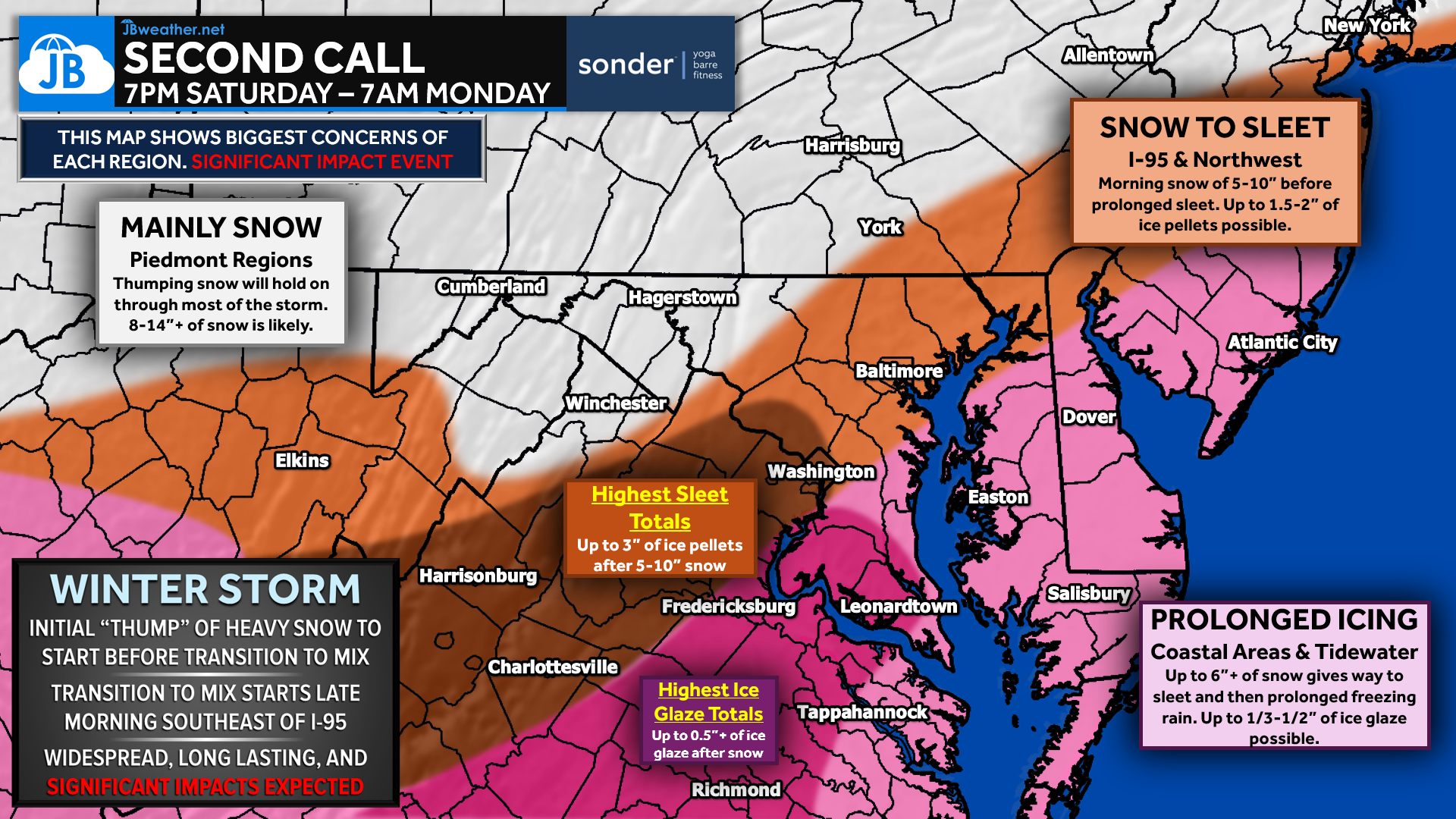
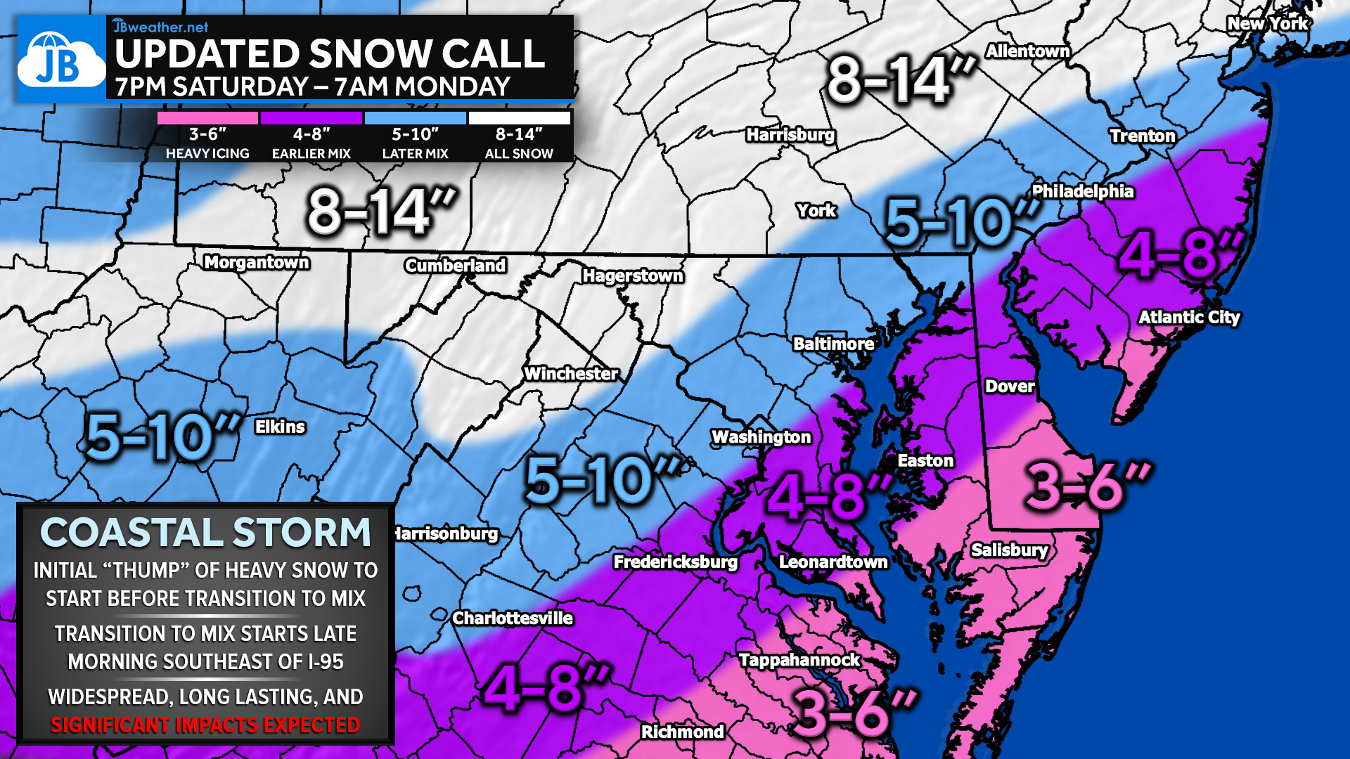

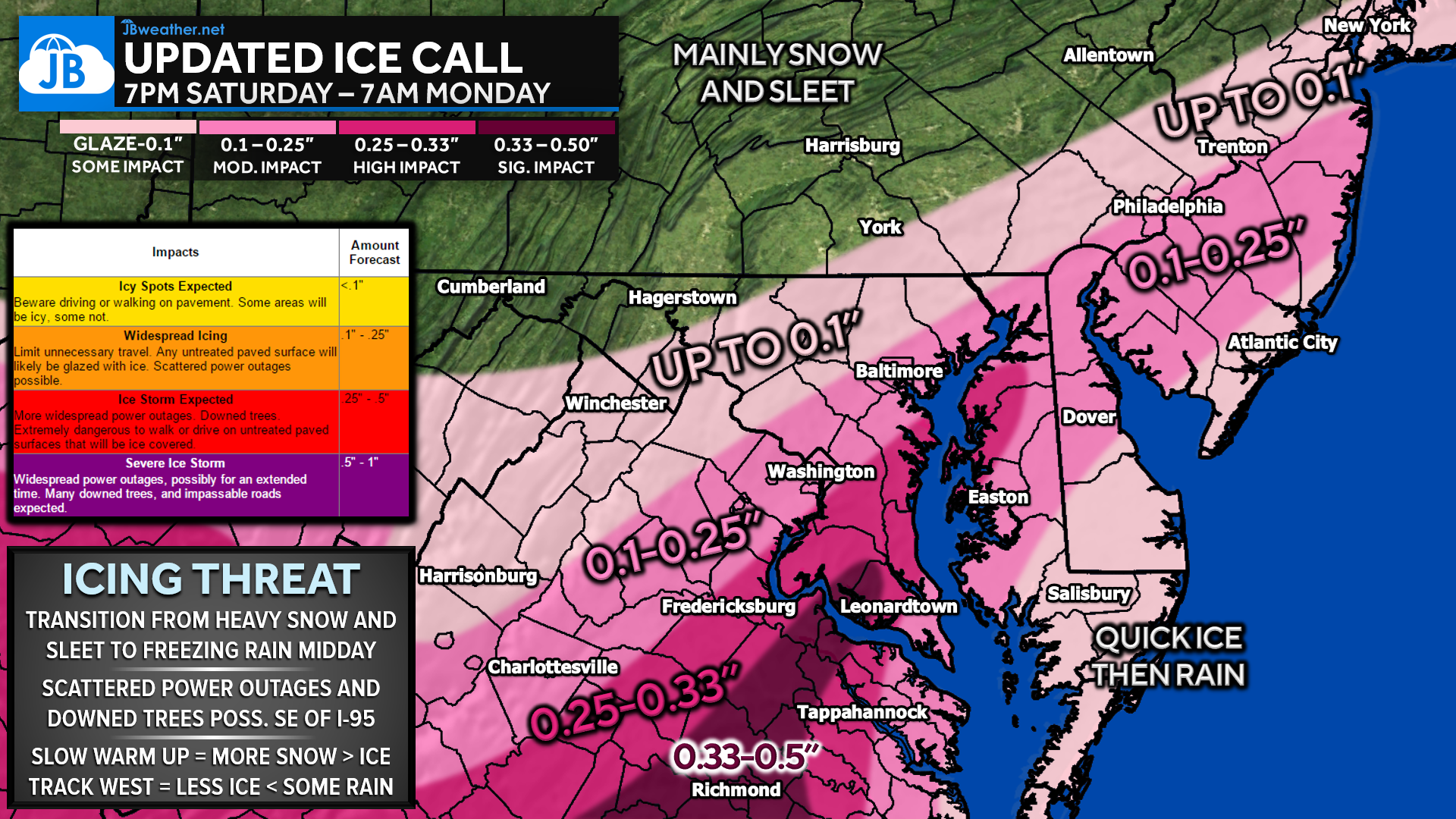
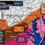
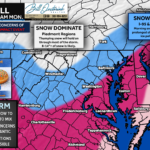
At this time, not much has changed from the Second Call forecast — and that’s a good thing for confidence. Snowfall totals remain solid across much of the region, especially northwest of I-95, while ice continues to trend as the bigger concern southeast of I-95. The timing of transitions still looks most likely late Sunday morning into Sunday afternoon, when sleet and freezing rain begin to build on top of the existing snowpack.
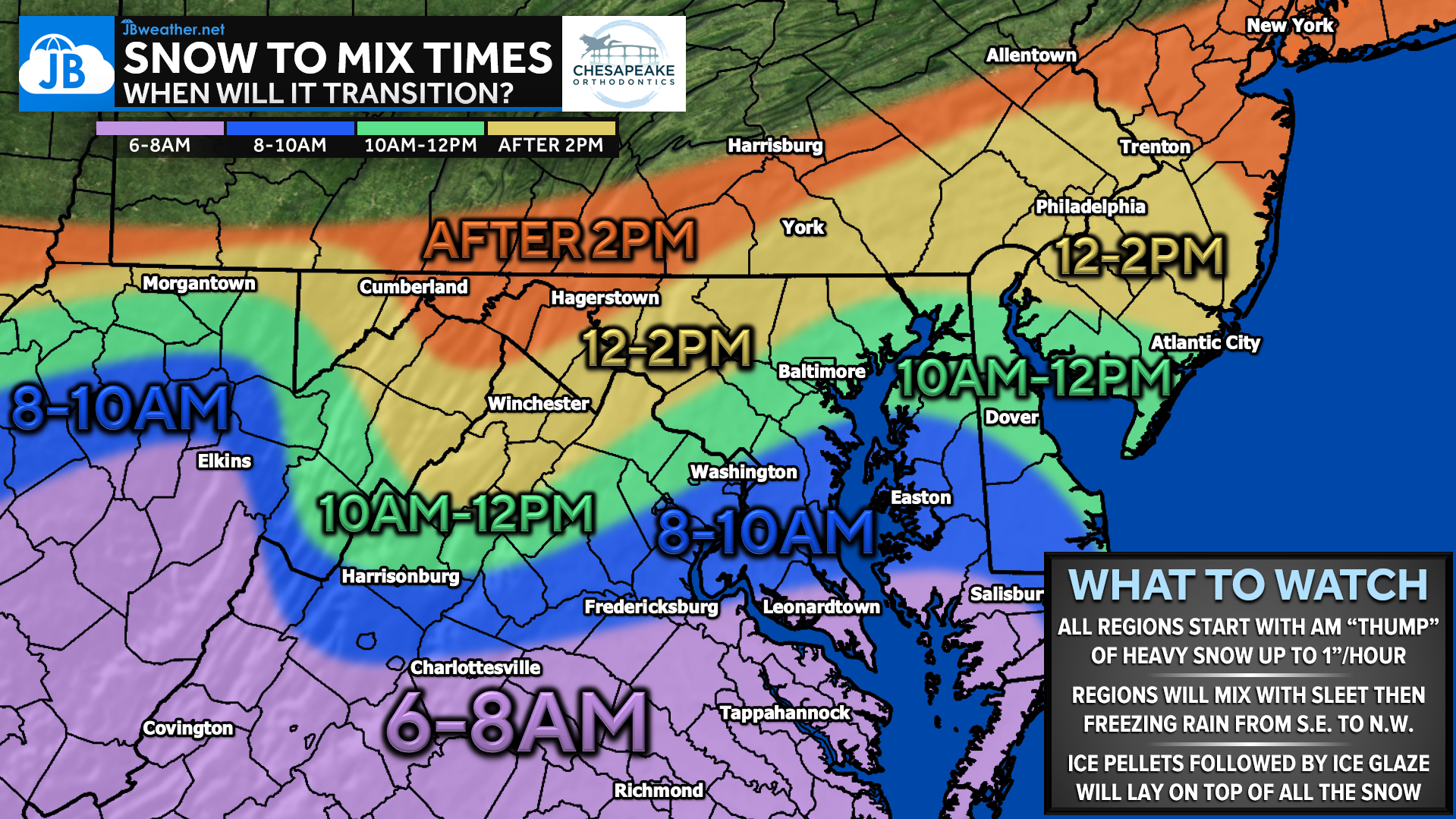
This graphic highlights when snow is expected to transition to sleet and freezing rain on Sunday, with everyone starting the day with a heavy thump of snow. The changeover begins earliest southeast of I-95 during the 6–8 AM window, then gradually pushes north and west through the late morning and early afternoon. Farther northwest, snow holds on the longest, but once mixing begins, ice will fall on top of the existing snowpack, quickly worsening travel conditions.
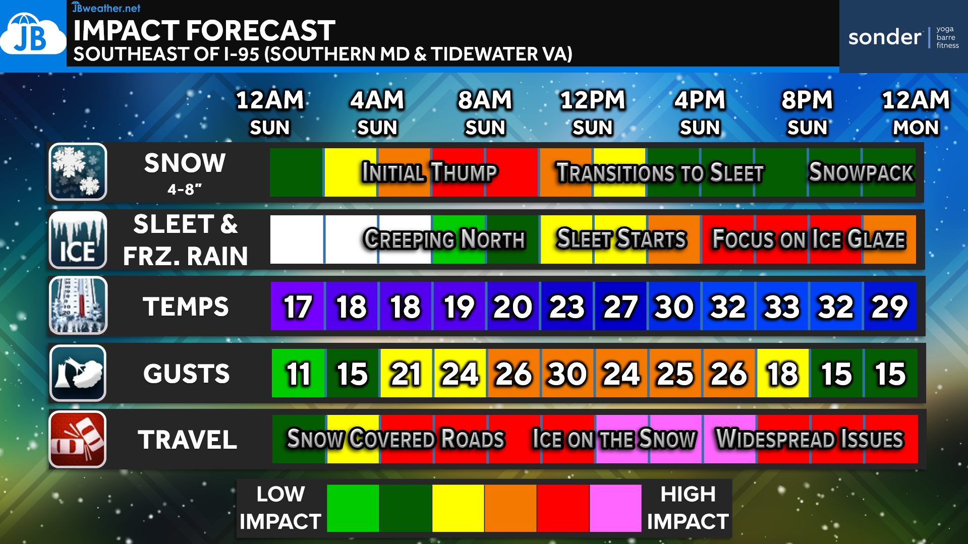
The highest-impact period continues to look like roughly 5 AM through 5 PM Sunday. During this window, heavy snow gives way to sleet and freezing rain in many areas, creating ice on top of snow, which is one of the most dangerous winter weather setups for travel. Even areas that stay colder longer will see worsening conditions once sleet begins to mix in.
Bottom Line: Today is the final full day to prepare. Everyone starts with snow, but ice is becoming the dominant concern, particularly southeast of I-95 where prolonged freezing rain is possible. Travel conditions are expected to deteriorate quickly on Sunday, especially during the late morning and afternoon hours. This is a high-impact winter storm, and plans should be adjusted accordingly.
Stay with JB Weather for the latest information on impacts here in Southern Maryland and across the Mid-Atlantic. You can always access my forecasts and updates here on the website, on Facebook, on Twitter, on Instagram, and on YouTube. JB Weather is the Mid-Atlantic’s Weather Leader, and I am working around the clock to keep you ahead of any storm!

William Richmond Inc. is your trusted roofing and siding contractor in Southern Maryland. Our services include roof installation and repair, siding replacement, gutter installation and repair, and window replacement. Contact us today for quality workmanship and exceptional customer service.
John Bordash
View More PostsJB Weather forecaster John Bordash is working around the clock to provide Southern Maryland, and neighboring communities, with accurate and reliable weather information.