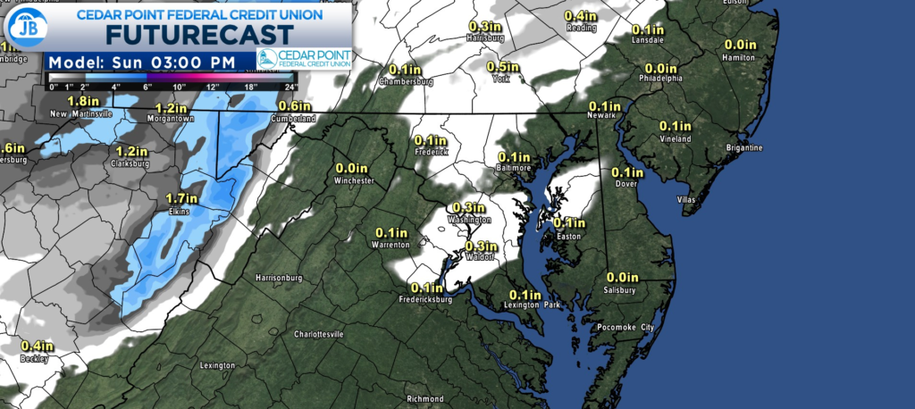
Tomorrow, an arctic cold front will work through the region, arriving at the I81 corridor around 9/10am & 1pm along the Bay. This will usher in 20s/30s to the area, which may allow any rain to briefly turn to a quick burst of snow. The snow could be briefly heavy w/ low visibility.
This should not put down much snow at all. Our Cedar Point Federal Credit Union Futurecast model is the most aggressive that I’ve seen with this & even this is just a quick coating on grassy areas.

Driving might be temporarily hazardous w/ low visibility, but no road accumulations. This lasts for about 30mins.

