After a busy stretch of wintry weather last week, we’re wasting no time jumping into another system. A weak disturbance will pass just to our south early Monday, bringing light snow close to the region. While this won’t be a major event, the northern edge of the snow shield is close enough that Southern Maryland could still see some impacts.
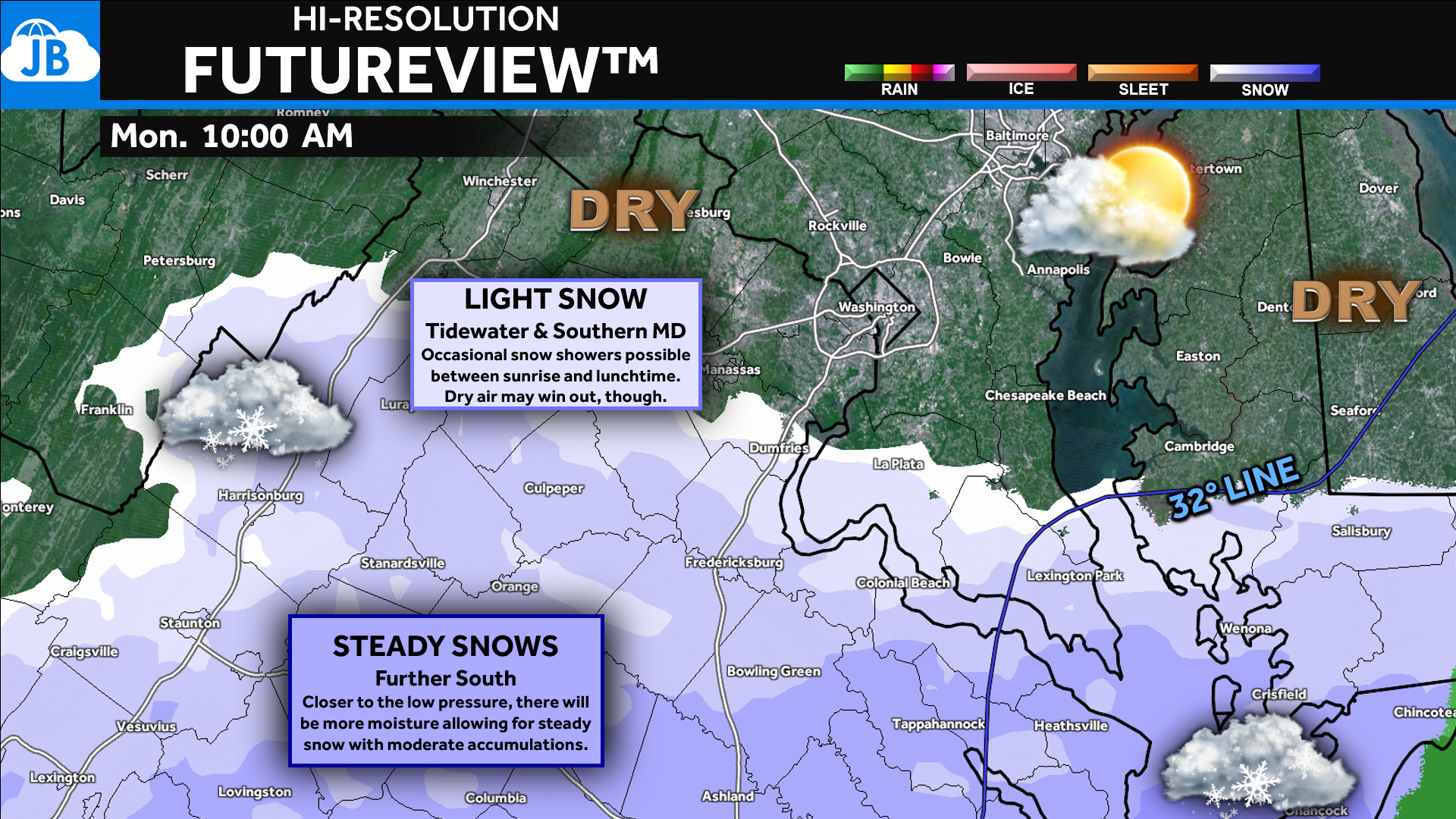
This evening’s data continues to paint a similar picture: a weak, fast-moving system will slide by to our south Monday morning, bringing light snow close to the region. While uncertainty remains in the exact northern cutoff, we’re now close enough to confidently issue a snowfall and impact forecast for Southern Maryland. This still appears to be a low-impact event, but it will pass close enough to bring flakes into the area.
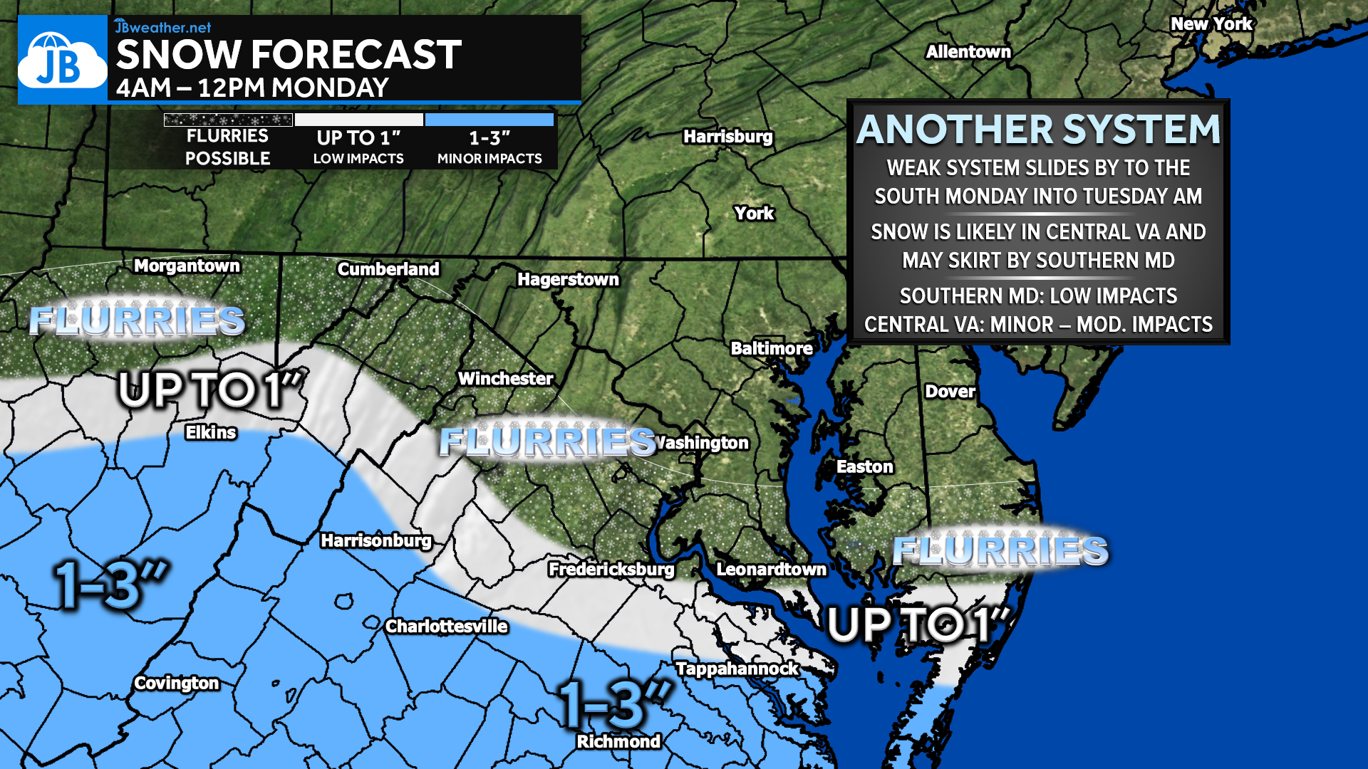
Southern St. Mary’s County has the best shot at up to 1″ of snow, particularly from Lexington Park to Scotland. North of there—Mechanicsville, Waldorf, Prince Frederick, La Plata—expect flurries or a brief dusting at most, with many locations seeing no accumulation at all. Snow looks most likely between 4 AM and noon, though scattered flurries could linger into the afternoon or early evening. This tight gradient is why confidence in exact totals remains lower than usual.
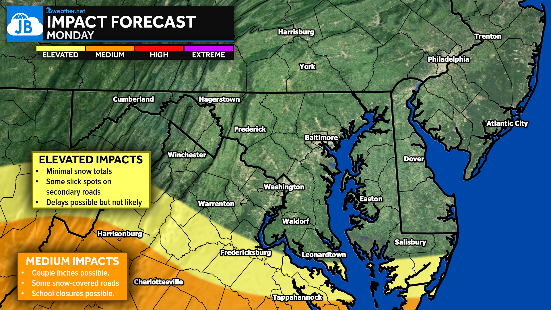
The Impacts Forecast highlights this clearly: much of Central Virginia and southern portions of our region fall in the Elevated Impacts zone, meaning minimal snow totals, isolated slick spots on secondary roads, and delays that are possible but not likely. Just southwest of our area, near Tappahannock, impacts increase to Medium, where a couple of inches could lead to snow-covered roads and the potential for school closures.
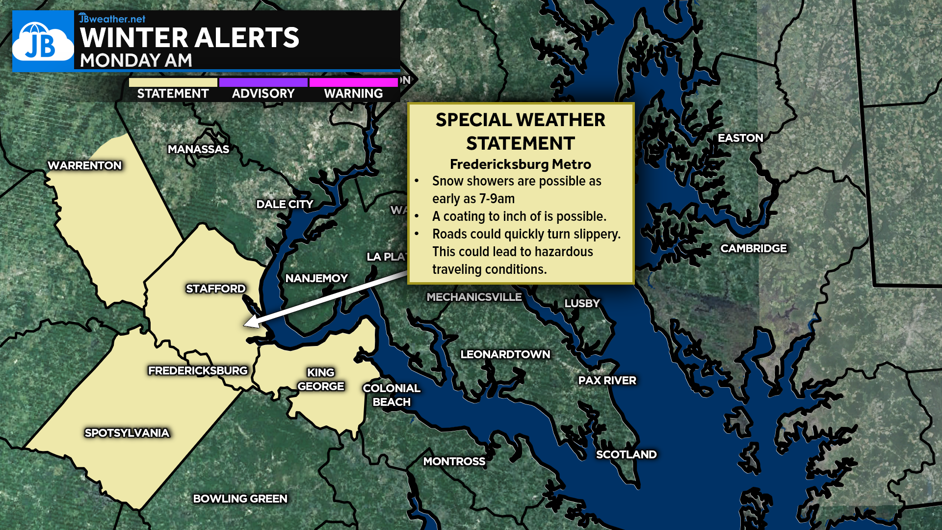
The National Weather Service has issued a Special Weather Statement for the Fredericksburg area, warning that snow beginning during the 7–9 AM commute could quickly create hazardous conditions. These counties sit closer to the core of the snow shield and serve as a reminder of how narrow the gradient is between steadier snow and flurries.
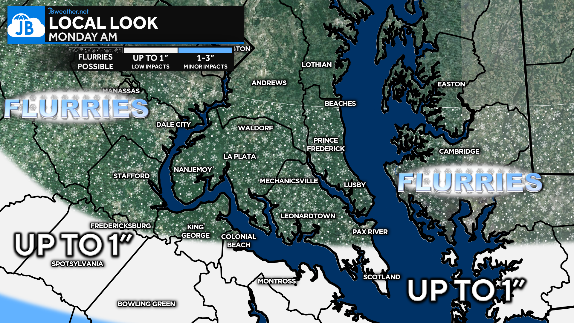
Bottom line: Southern Maryland remains on the northern edge, with most seeing flurries and southern St. Mary’s possibly seeing a coating to 1″. Impacts are low, but roads could become slick early if snow reaches your area. As always with close-call systems, I’ll monitor trends through the evening and update if the track shifts north.
Stay with JB Weather for the latest information on impacts here in Southern Maryland and across the Mid-Atlantic. You can always access my forecasts and updates here on the website, on Facebook, on Twitter, on Instagram, and on YouTube. JB Weather is the Mid-Atlantic’s Weather Leader, and I am working around the clock to keep you ahead of any storm!
John Bordash
View More PostsJB Weather forecaster John Bordash is working around the clock to provide Southern Maryland, and neighboring communities, with accurate and reliable weather information.

1 thought on “Snow Potential Monday Morning: Minor Impacts, Tight Gradient”
Comments are closed.
jb, thank you for your dedication and accuracy for southern maryland! much appreciated!