Brought to you by Berkshire Hathaway HomeServices PenFed Realty
Our latest stretch of summer heat has brought some extreme conditions to the region. Many locations this weekend have seen temperatures max out in the middle to upper 90s with heat indices over 100. The heat will look to continue tomorrow, but relief is in sight. A coming cold front will move through Monday evening and bring a brief relief from the hot temperatures.
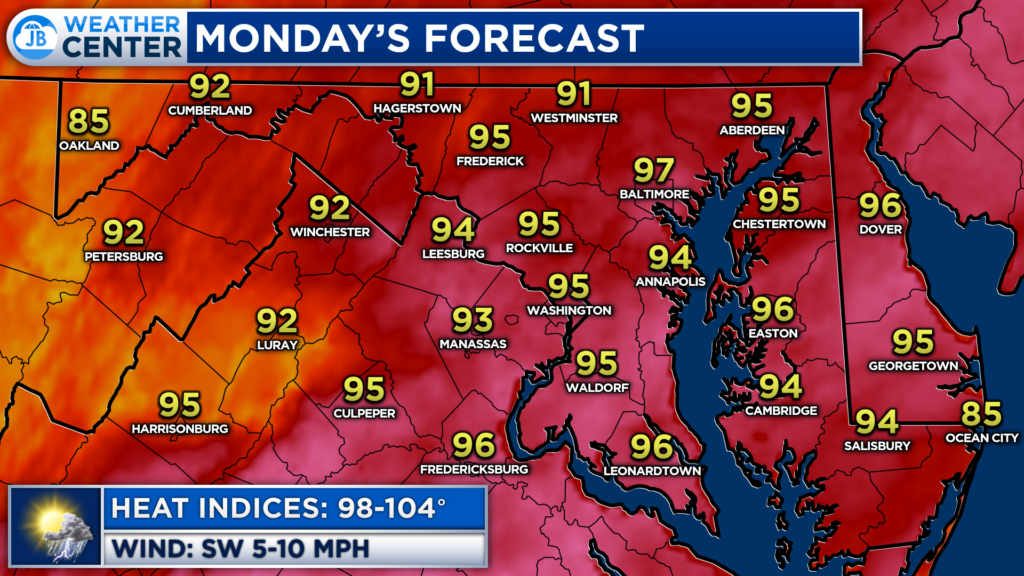
Before the cold front arrives late tomorrow, we will see temperatures, yet again, get back up into the 90s. Many spots, especially south and east of DC are likely to see highs in the lower to middle 90s Monday afternoon. Heat indices Monday afternoon are likely to get back above 100, as well.
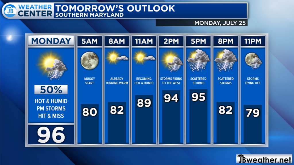
Overnight temperatures are not likely to drop far, meaning that Monday will get off to a warm and humid start. That is what will allow for temperatures to soar into the 90s by lunchtime. We will begin to notice an increase in cloud cover later on in the afternoon before rain chances increase.
Futurecast shows activity beginning to fire to our northwest around lunchtime as the cold front inches closer and we warm up out ahead of it. As the front moves eastward, we will see this hit-and-miss activity increase, and look to push through during the evening hours.
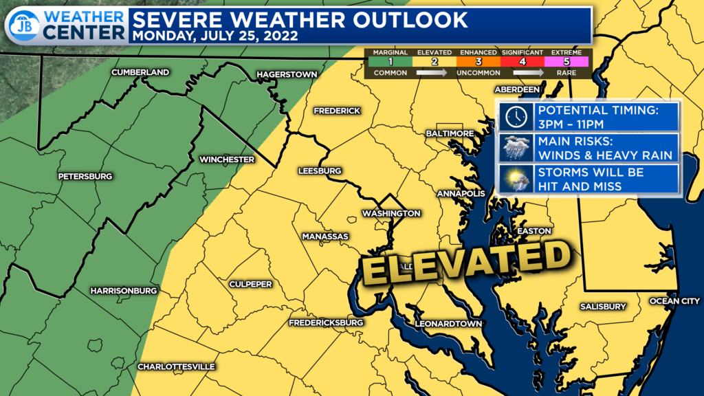
The Storm Prediction Center has placed much of our region under a Level 2 “Elevated Risk” of severe weather for tomorrow. This denotes an increased chance of seeing several strong to severe thunderstorms. However, storm development is likely to be scattered, and not everyone will see them. Anytime between 3-11pm looks to be fair game.
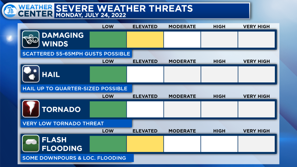
Given the heat and humidity that will be present tomorrow, we will have a decent amount of storm energy present. So, if any storms are able to form, they could tap into and become strong. The primary severe weather risks will be the threat of storms producing damaging wind gusts up to 65mph and localized flash flooding. Some storms may also produce hail, but the tornado threat is quite low tomorrow.
If you have outdoor plans tomorrow afternoon and evening, I would not cancel them. However, I would have water with you. And, I would recommend stay weather aware as hot and miss storms try to fire during the afternoon and evening hours. Have a Plan B ready to go, and be ready to act if quickly-changing weather conditions move overhead.
Stay with JB Weather for the latest information on Southern Maryland weather. You can always access my forecasts and updates here on the website, on Facebook, on Twitter, on Instagram, and on YouTube.
-JB

Real Estate now! Not sure where to start? View our Southern Maryland inventory of homes, land, farms and commercial properties on penfedrealty.com. Engage with our planning tools to determine your next real estate lifestyle decision, choose your realtor as a trusted advisor. Experience the difference with service and support from real estate’s forever brand!

