Brought to you by Gentle Pressure Roof & Exterior Cleaning
With a hot afternoon on tap, today looks to finally be the conclusion to our week-long heat wave. With that said, it will take a strong cold front to break up this heat. A strong cold front will arrive this evening, but it will bring with it the threat of some strong storms.
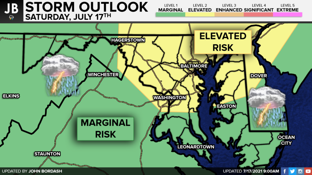
Our region has been placed under a Level 1 Marginal Risk of severe storms for this evening with a Level 2 Elevated Risk hoisted for areas to the north. The best atmospheric forcing today will exist to our north as our frontal boundary works through. The main question is whether we will see the developing line of storms extend far enough south to impact our region. That is something we just won’t know until we see these storms form.

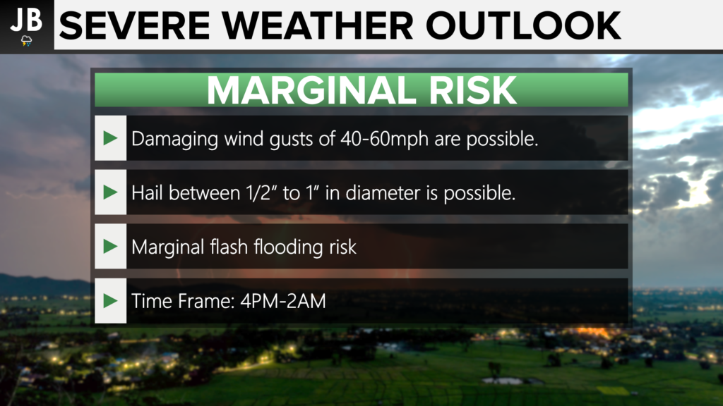
Our main threats from any storms that fire will come from damaging wind gusts and heavy rain. The hot and humid conditions that will exist this afternoon will act as fuel to potentially support any storm development. The time frame I am looking at for Southern MD would be 4PM-2AM.

Our Chesapeake’s Bounty Futurecast is a tad aggressive with the potential for storm development. These storms will try to fire out towards our west between 1-4PM. Any storms that fire will look to congeal into a line by mid-afternoon. This line would look to cross I-95 and move into our region around 4-5PM.
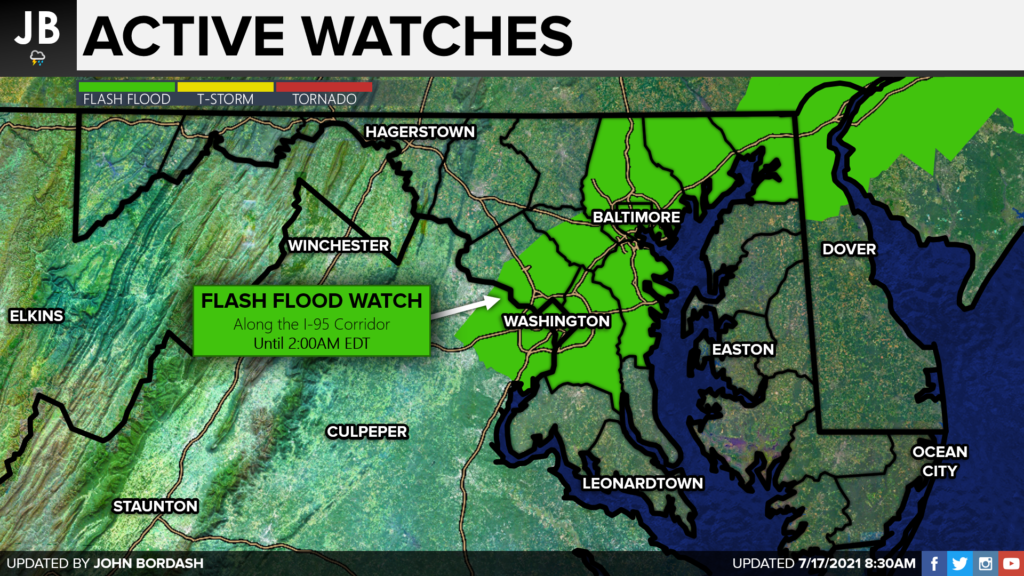
It is possible that we see a few waves of storms move through this evening. If this does happen, we could see localized flooding take place. The National Weather Service has gone ahead and issued a Flash Flood Watch along the I-95 corridor, including PG and AA Counties. These areas are the most prone to flooding this evening, but everyone will have a flooding risk.

It will be important to stay weather aware this afternoon and evening. The heat and humidity could lead to strong to severe storms as a cold front moves towards the region. Damaging winds and heavy rain will be the main threats as storms look to move through between 4PM-2AM. Southern MD may be on the southern edge of storm development, so we will need to closely watch atmospheric trends throughout the day.
Stay with JB Weather for the latest information on Southern Maryland weather. You can always access my forecasts and updates here on the website, on Facebook, on Twitter, and on YouTube.
-JB

At Gentle Pressure Roof & Exterior Cleaning there is no Pressure when you call and No pressure when we clean. Check out https://gentlepressureroof.com/ today!

