Brought to you by Berkshire Hathaway HomeServices PenFed Realty
Yesterday was a seasonally warm day with plenty of humidity that featured scattered thunderstorms. Those thunderstorms brought some places 60mph+ winds and put down as much as 4″+ of rain in parts of Anne Arundel County. Yet again, it looks like a “rise, wash, and repeat” cycle for today.

Temperatures again today will look to get back into the upper 80s. Dewpoints will also be quite high, near 70°, making it feel humid. Much like yesterday, this warm and humid combination will try to set the stage for additional scattered storms this afternoon and evening.
Futurecast shows that we may have some isolated showers and cloud cover push through this morning. We should see this give way to some midday sunshine, which will help us warm well into the 80s. Then, a weak frontal boundary will approach the region this afternoon and evening.
This front boundary will look to kick off scattered showers and storms as it crosses through the region. While these storms are not likely to be widespread and overly strong, there will definitely be a scattering of these storms, which will develop across the region quite randomly. I tend to think that Futurecast seems to be handling today’s setup quite well.

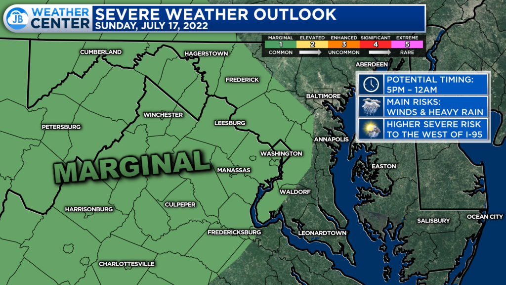
The Storm Prediction Center has placed areas along and west of Route-301 under a Level 1 “Marginal Risk” of severe weather. This threat level indicates the chance for a couple of storms to develop, and 1 or 2 may turn severe. We had this same threat level yesterday, and we still saw some impactful storms. That is to say, take this threat just as seriously as you would any other.
The primary risk time for the Mid-Atlantic as a whole is anytime after lunchtime. However, storm chances appear to be the highest in Southern Maryland between 5pm-midnight. I think most of the region as a whole has a similar storm chance this afternoon, regardless of if you’re west or east of 301. However, the greatest risk of these storms turning severe does lay out to the west. However, if we see enough daytime heating, then we could see that threat expand eastward, into our region.

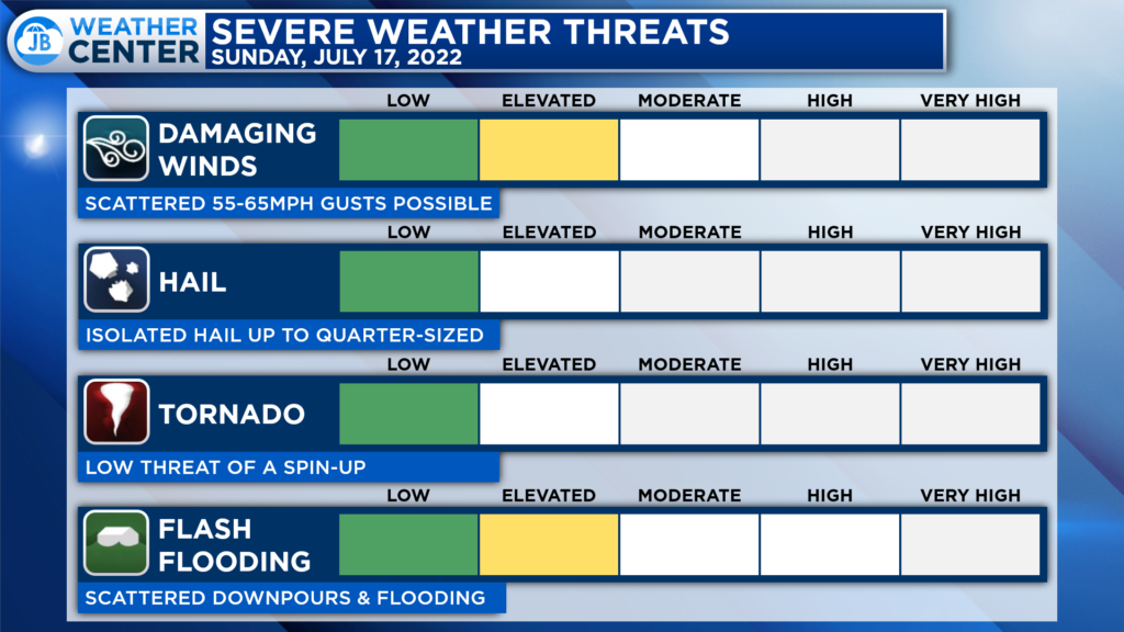
The primary threats this afternoon and evening appear to be the threat of damaging winds up to 60-65mph and the threat of heavy rain that could lead to localized flooding. Thankfully, the threat of hail and tornadoes looks quite low.
If you have outdoor plans this afternoon and evening, I would not cancel them. It is very possible that we see fewer storms than expected if we lack adequate storm energy. However, I would stay aware and think of a Plan B if things do start to fire this afternoon. Conditions could change quickly, so be ready to act.
Stay with JB Weather for the latest information on Southern Maryland weather. You can always access my forecasts and updates here on the website, on Facebook, on Twitter, on Instagram, and on YouTube.
-JB

Real Estate now! Not sure where to start? View our Southern Maryland inventory of homes, land, farms and commercial properties on penfedrealty.com. Engage with our planning tools to determine your next real estate lifestyle decision, choose your realtor as a trusted advisor. Experience the difference with service and support from real estate’s forever brand!

