Brought to you by Berkshire Hathaway HomeServices PenFed Realty
The last couple of days have offered up some of the nicest weather that we have seen since last Spring! Friday featured highs in the 60s and yesterday featured highs in the 70s! Today will be a different story, though. We will see warmer temps which will give way to PM storms.
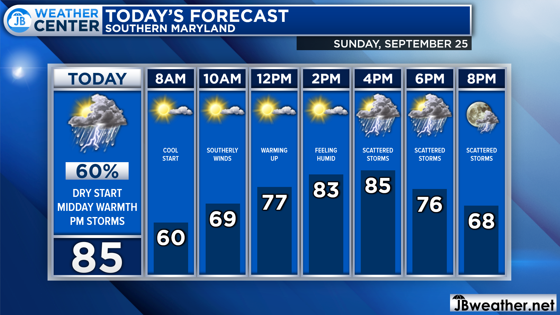
We are off to a cool and dry start this morning with temps in the 50s. We will see southerly winds kick into effect later on this morning, which will help temps soar into the 70s by lunchtime and into the 80s this afternoon. An incoming cold front will then set off storms this evening.
Futurecast shows that we will begin to see storms develop out west just after lunchtime. As the cold front crosses the mountains, we will see those storms move eastward. We are likely to see storms cross I-95 and move into Southern Maryland after 4pm, and they may last through the evening.
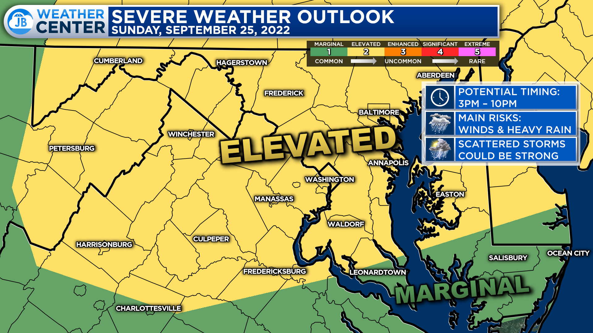
The Storm Prediction Center has placed much of the region under a Level 2 “Elevated Risk” of severe weather for this afternoon. Yes, it has been quite a while since we talked about severe weather! This Level 2 threat means that we should expect to see a couple of strong to severe storms develop. Granted, not everyone will the strongest storms; they are likely to be scattered.

The primary risks with the storms this afternoon and evening will come from damaging winds and hail. We could see gusts up to 65mph with hail up to the size of quarters. There is also a non-zero tornado threat at play. While I do not expect a tornado outbreak, we will have to monitor all storms for some weak rotation. There will be heavy rain with these storms, but given our recent dry streak, flash flooding does not appear to be a concern.
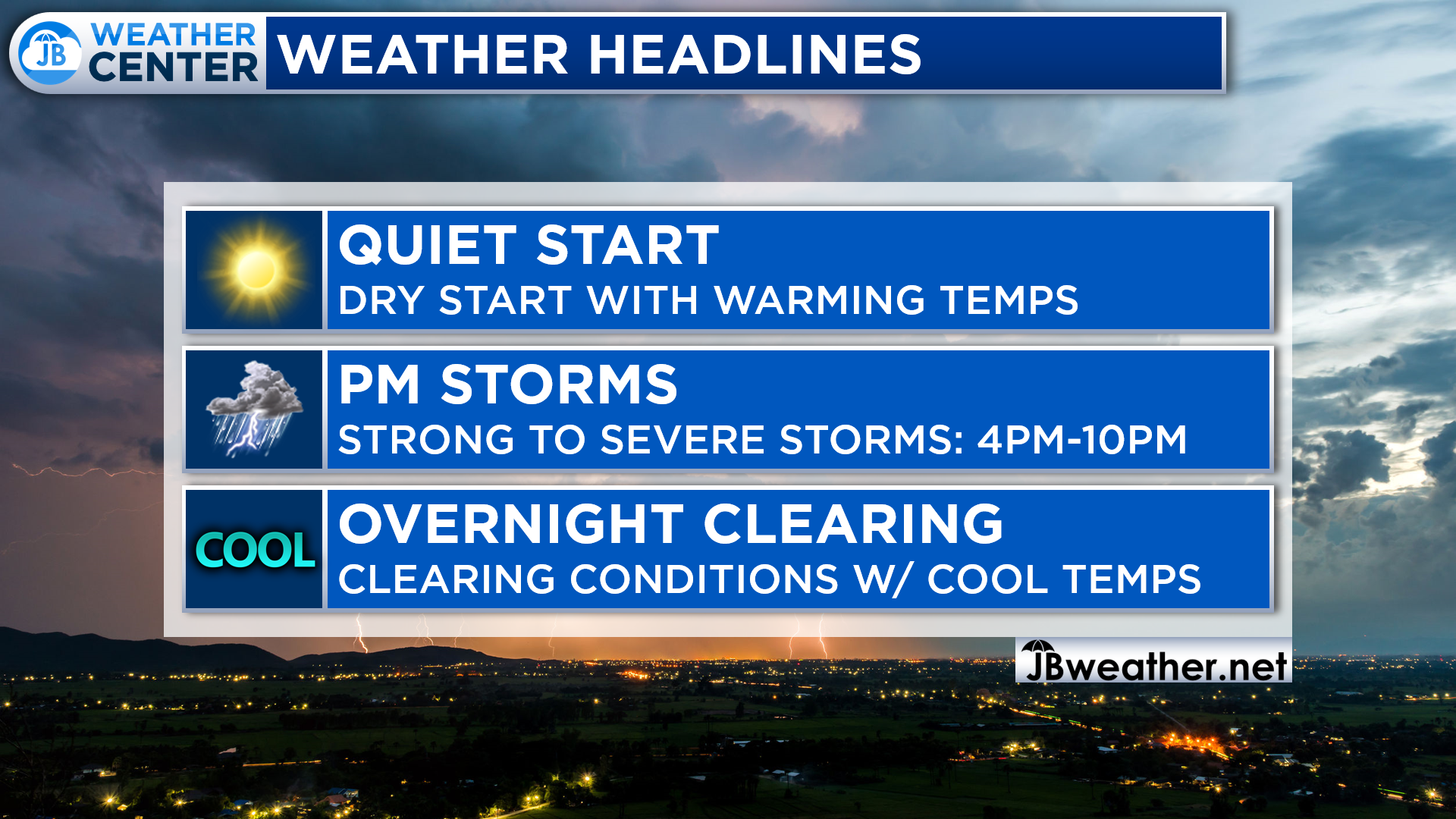
All in all, today definitely has the potential to be an active weather day across the region. Quiet conditions this morning will give way to warming temps that should peak in the 80s. Strong to severe storms are possible this afternoon and evening thanks to a cold front. The passage of this front will set up a cool start to the work week!
Stay with JB Weather for the latest information on Southern Maryland weather. You can always access my forecasts and updates here on the website, on Facebook, on Twitter, on Instagram, and on YouTube.
-JB

Real Estate now! Not sure where to start? View our Southern Maryland inventory of homes, land, farms and commercial properties on penfedrealty.com. Engage with our planning tools to determine your next real estate lifestyle decision, choose your realtor as a trusted advisor. Experience the difference with service and support from real estate’s forever brand!
John Bordash
View More PostsJB Weather forecaster John Bordash is working around the clock to provide Southern Maryland, and neighboring communities, with accurate and reliable weather information.