Brought to you by Calvert Title Company
After a warm and humid day yesterday that featured some afternoon storms, another active weather day looks likely for the Mid-Atlantic.
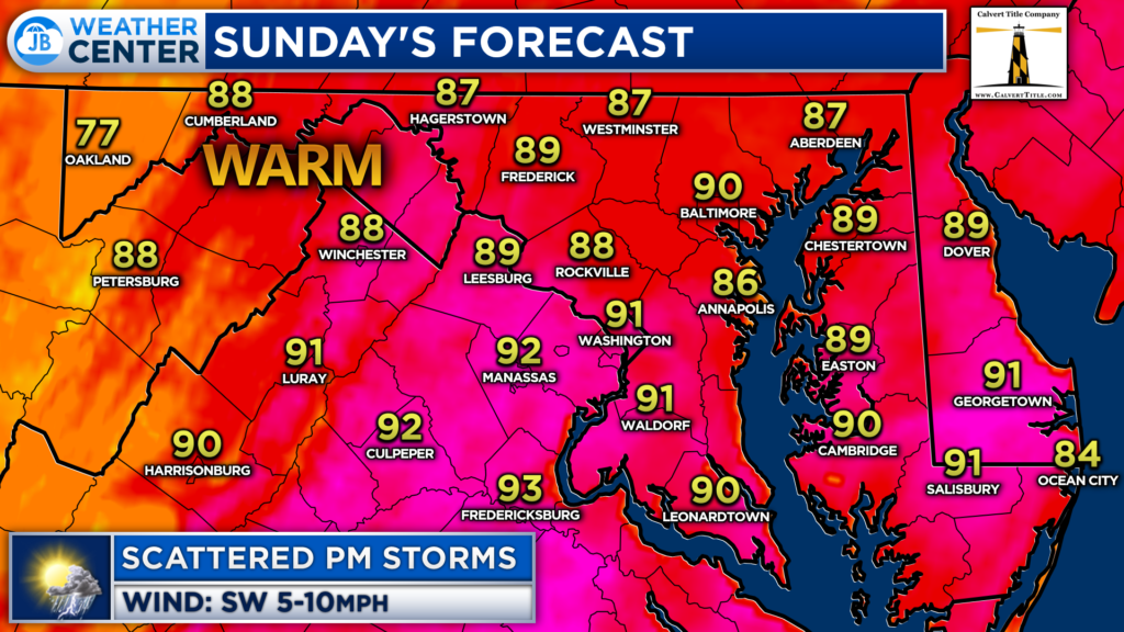
Firstly, today will be one of the hottest day so far this summer (which isn’t saying much given our relatively cool June). Temperatures will look to max out in the lower 90s this afternoon with dewpoints in the 70s. These hot and humid conditions will lay the building blocks for atmospheric storm energy to develop this afternoon.
Futurecast shows that scattered storms will likely develop after lunchtime this afternoon as a frontal boundary moves through the area. These storms will likely impact areas west of I-95 first before moving through the DC metro area and Southern MD during the mid-afternoon to early-evening hours.
Futurecast also suggests the potential for another round of showers/storms that could move through during the overnight hours. With that said, those storms would not likely be as severe.
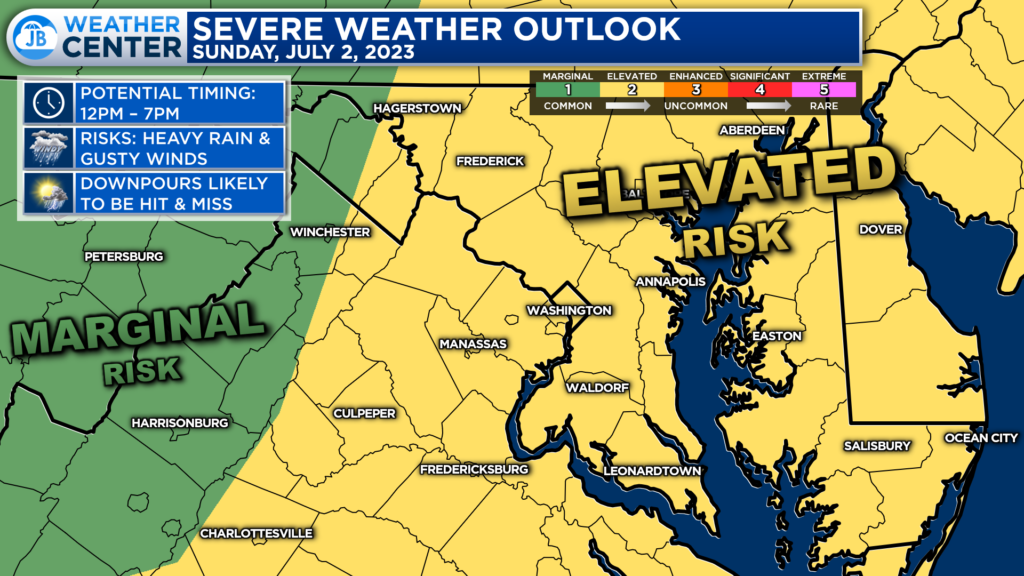
The Storm Prediction Center has placed much of our region under a Level 2 “Elevated Risk” of severe weather. This Elevated Risk is focused east of the Blue Ridge where the storm energy will likely be the highest this afternoon. Not everyone will see storms this afternoon, but the storms that do develop could be impactful.
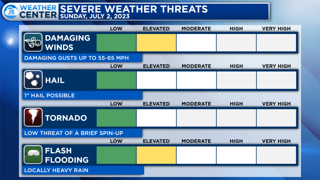
The primary risks from any storms that do develop are damaging winds in excess of 60mph and locally heavy rain. Some localized spots could see half an inch to an inch of rain this afternoon. This afternoon, the hail threat is somewhat limited, and the tornado risk appears to be low.
Remember that severe weather forecasting is far from a guarantee of anything. The goal of these forecasts is to alert you to the potential of storms, not a promise of storms.
The threat of these storms could impact any outdoor plans you may have, including fireworks. While I would not necessarily cancel any outdoor plans right now, do stay aware of the storm potential and have a back plan ready to go!
Stay with JB Weather for the latest information on Southern Maryland weather. You can always access my forecasts and updates here on the website, on Facebook, on Twitter, on Instagram, and on YouTube.
-JB

Calvert Title Company is guiding you HOME one closing at a time! Check out https://calverttitle.com/ today!
