Brought to you by Chesapeake Orthodontics
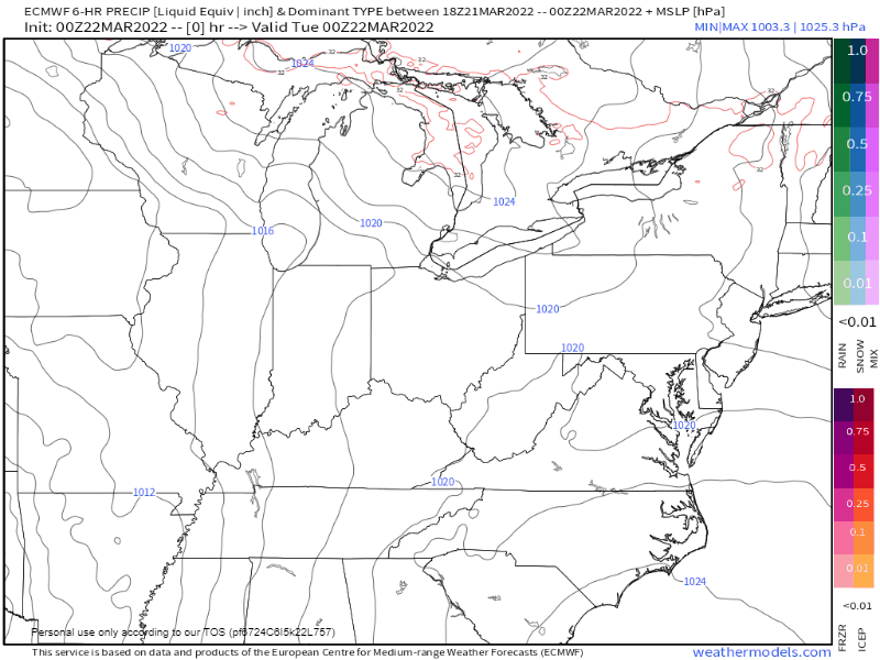
A potent system is currently moving across the southern Plains US. It is pretty easy to see where this system is on the radar this afternoon. We have plenty of rain and quite a bit of severe weather moving through the central section of the country.
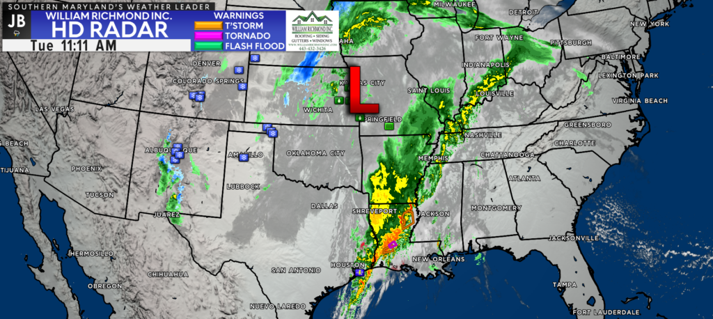
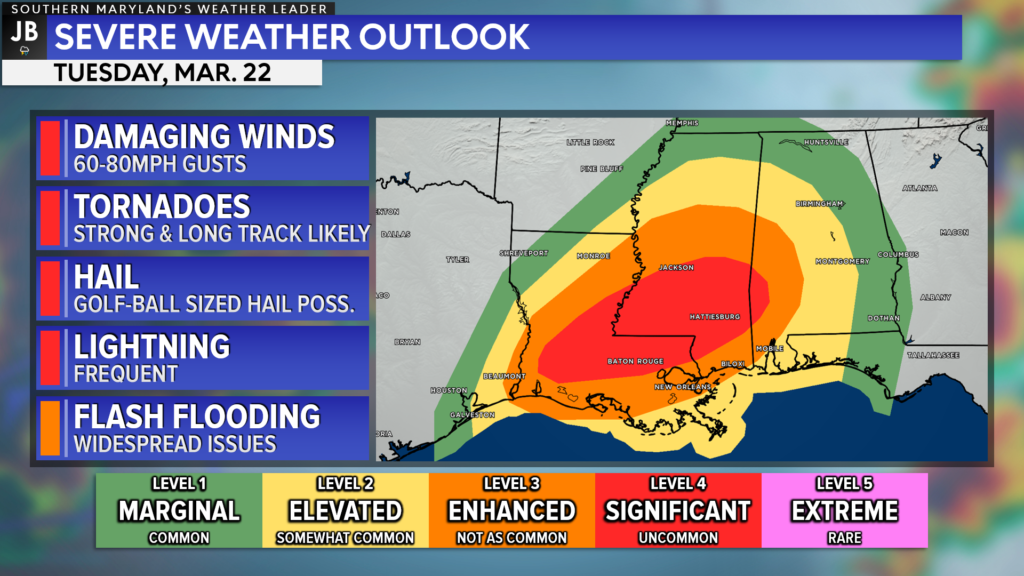
This is the same system that is responsible for the multiple tornadoes that moved through southern and eastern Texas yesterday. Today, that severe weather shifts to the Deep South. There are current concerns that today’s severe weather across Alabama, Louisana, and Mississippi will be more extreme and intense than yesterday’s outbreak in Texas. For that fact, a Level 4 “Significant Risk” has been issued across much of this region.
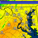
This system will continue moving eastward and will bring its slug of active weather to the Mid-Atlantic for Wednesday and Thursday. We will see the core of the low-pressure track to our north, which should allow for warmer to work into our region for Wednesday and Thursday, along with rain, before a cold front moves through on Thursday.
Shown above is the output from the European model, depicting how moisture is likely to spread over our area Wednesday and Thursday. We are likely to see rain arrive between sunrise and lunchtime on Wednesday, and continue throughout the day. We may see some brief periods of moderate-to-heavy rain by Wednesday afternoon.
We may see a break in the activity Wednesday evening before another slug of moisture works northward for Thursday. Once again, the rain could be heavy at times on Thursday as the moisture works through. We will eventually clear out as a cold front works through Thursday afternoon, ushering in cooler & drier air.
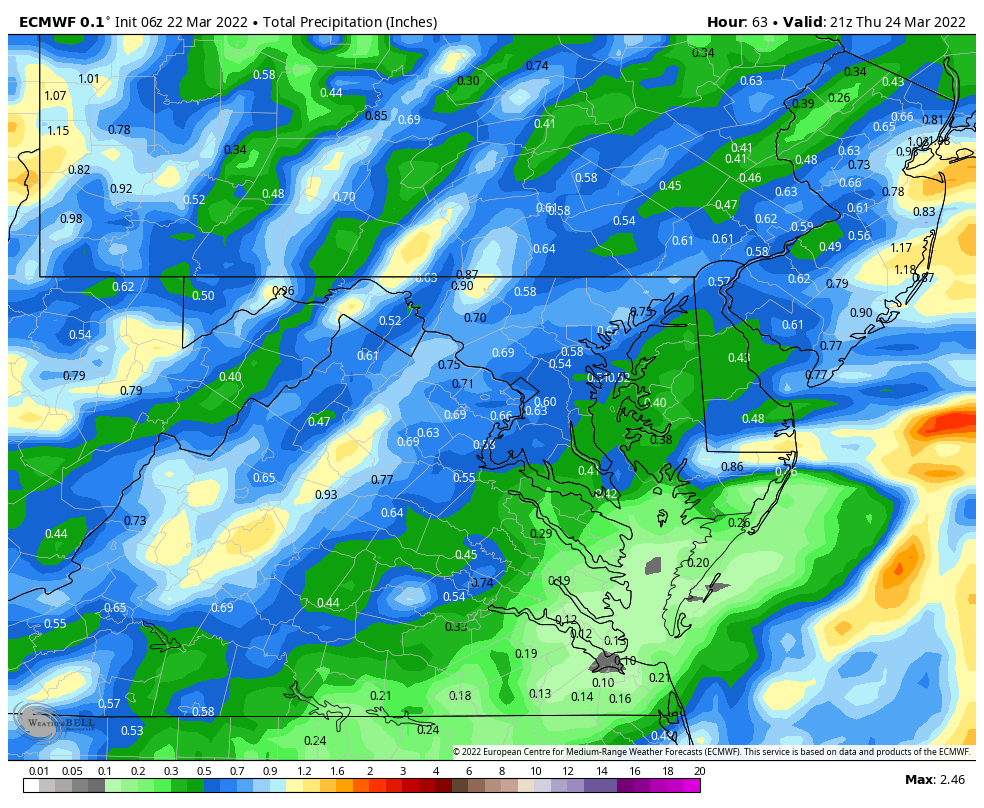
The European model suggests that our region could see between a half-inch to an inch of rain between both Wednesday and Thursday. Some of our other modeling, though, is more aggressive, giving some areas over an inch of rain. It will all come down to where the heavier pockets of rain set up. In the very least, I would have the umbrella handy both days and be prepared for intermittent rain showers.
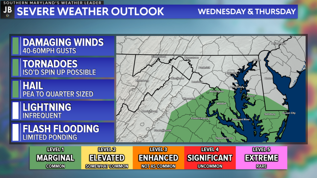
The focal point of the severe weather threat with this system will stay to our south. After focusing on the Mississippi delta today, the threat tomorrow will turn to the Carolinas. While the bigger severe weather concerns are to our south, we may see one or two embedded thunderstorms develop within the slug of moisture that will move through.
The Storm Prediction Center has placed our region on the cusp of a severe weather threat, placing areas south of DC under a Level 1 “Marginial Risk.” This risk is much lower than what the southern US is dealing with, and rightfully so. I do not foresee a huge severe weather threat for our region. With that said though, one or two of those embedded thunderstorms may contain locally damaging winds and could try to rotate. This will just be something to keep an eye on both Wednesday and Thursday. I think the bigger story here will be the soaking rain.
Stay with JB Weather for the latest information on Southern Maryland weather. You can always access my forecasts and updates here on the website, on Facebook, on Twitter, on Instagram, and on YouTube.
-JB
Dr. Thomas Hao and Dr. Dylan Schneider offer comprehensive orthodontic services for all ages. Schedule your free consultation today. Visit www.SOMDBraces.com today for more information!
John Bordash
View More PostsJB Weather forecaster John Bordash is working around the clock to provide Southern Maryland, and neighboring communities, with accurate and reliable weather information.