Brought to you by Calvert Title Company
Yesterday turned out to be a decent day with a few additional breaks in the cloud cover. Unfortunately, we may not be as lucky today. A stiff onshore flow will lock areas east of the Blue Ridge mountains in with cloud cover and scattered light showers.
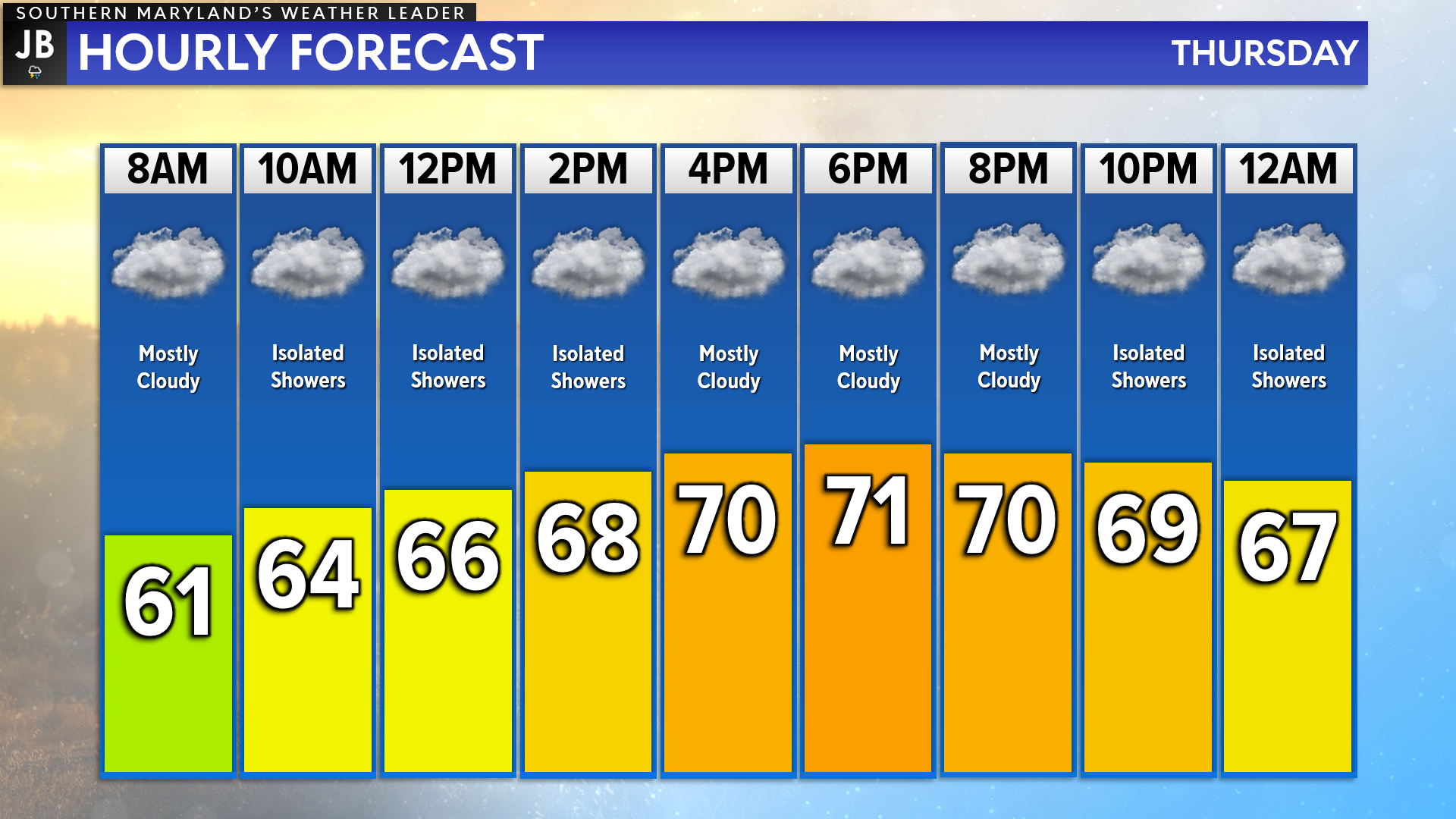
We are off to a somewhat mild start this morning with temperatures in the 60s with a touch of moisture in the air. While temperatures should rise through the day, we will still look to stay below our seasonal average of 79*. Clouds will be locked in with scattered shower chances.
Futurecast shows today’s weather set up pretty well. Thanks to the onshore flow, you can see how today’s cloud cover and shower chances stay focused east of the Blue Ridge. The mountains help to break up that flow and allow areas west of there to see clear skies and warmer temps! Today’s rain will not be widespread or heavy. Largely, I think we are just talking about an annoying drizzle throughout the day.
Looking ahead, Memorial Day Weekend will look to get off to a wet and potentially stormy start before clearing out and warming up late in the weekend. Tomorrow especially may offer the most impactful weather with severe weather looking possible. I will have an update on that threat this afternoon. In the meantime, I urge you to check out yesterday’s forecast post on this weekend’s outlook!
Stay with JB Weather for the latest information on Southern Maryland weather. You can always access my forecasts and updates here on the website, on Facebook, on Twitter, on Instagram, and on YouTube.
-JB
Calvert Title Company is guiding you HOME one closing at a time! Check out https://calverttitle.com/ today!
John Bordash
View More PostsJB Weather forecaster John Bordash is working around the clock to provide Southern Maryland, and neighboring communities, with accurate and reliable weather information.