Brought to you by Calvert Title Company
The first week of June sure has gotten off to quite a warm start! Tuesday saw a high of 94 at Pax River NAS, and we made up to 95 yesterday, the warmest temperature of the year yet! We will look to get back into the 90s again this afternoon, officially making this a heat wave. Thankfully, a cold front works through tonight to deliver some relief!

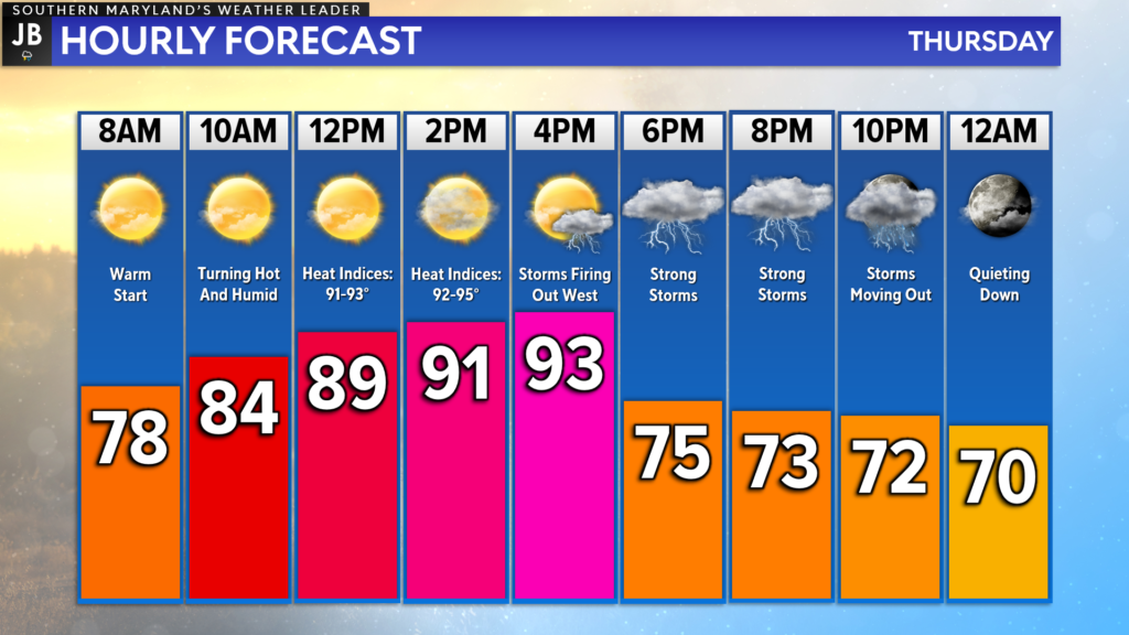
We are off to quite the warm and muggy start this morning. We will see temperatures quickly make their way through the 80s this morning and into the lower 90s this afternoon. This heat will be joined by humid conditions with dewpoints near 70! This will set the stage for storms to form this afternoon as cooler works into the region.
Our Futuecast model shows that showers and storms will begin to develop back to west around lunchtime. We will see the showers and storms gradually make their way eastward throughout the afternoon. The heat and humidity today will allow storm energy to develop overhead. This will lead to these storms strengthening as they push eastward this afternoon and evening.

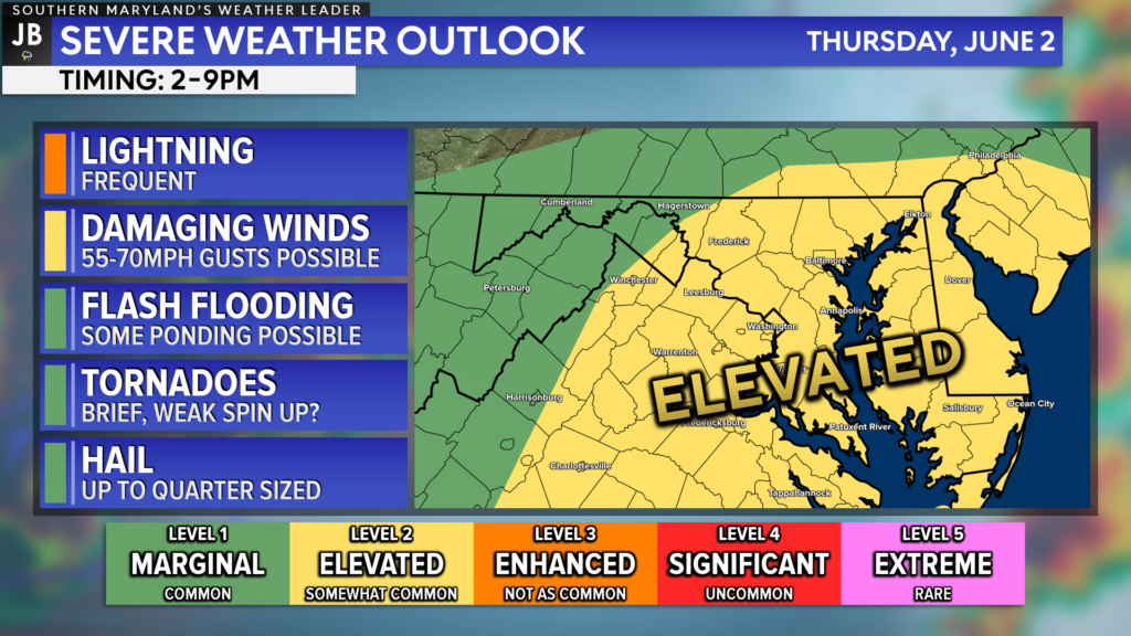
The Storm Prediction Center has placed our entire region under a Level 2 “Elvated Risk” of seeing severe weather today. The primary risks will come from damaging wind gusts up to 70mph. Flash flooding is also possible from these storms. There is a non-zero tornado threat as well, but that will not likely be the primary focus of today’s storms. The timing for potential severe weather looks to be from 2-9PM.
Keep in mind that severe weather forecasting is far from a guarantee of anything. The goal of these forecasts is to alert you to the potential of storms, not a promise of storms.
Stay with JB Weather for the latest information on Southern Maryland weather. You can always access my forecasts and updates here on the website, on Facebook, on Twitter, on Instagram, and on YouTube.
-JB

Calvert Title Company is guiding you HOME one closing at a time! Check out https://calverttitle.com/ today!

