Brought to you by Chesapeake’s Bounty
Monday offered the region a nice break from the heat that had been plaguing the region. Yesterday, we saw that warmth come back with Pax River NAS topping out at 90*! We will look to follow that up with a repeat performance as highs look to max out in the lower 90s today!
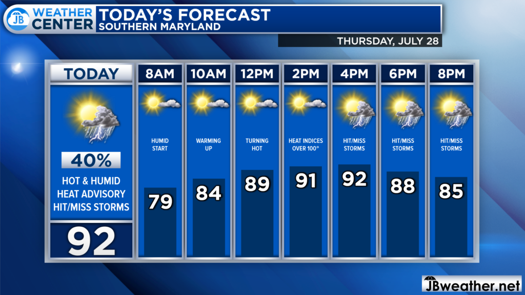
We are off to a warm and humid start this morning after some spotty overnight showers. This humidity will stick around throughout the day as the heat begins to ramp up. We are likely to be in the upper 80s by lunchtime and in the 90s by this afternoon!
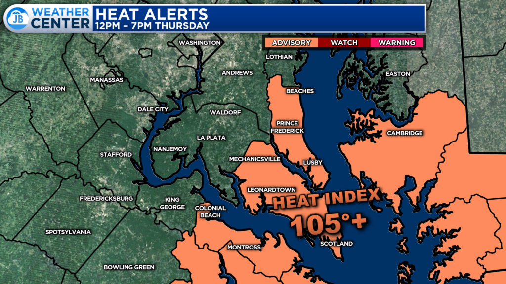
The combination of highs in the 90s and dewpoints in the 70s has led the National Weather Service to issue a Heat Advisory for Calvert & St. Mary’s Counties, as well as the Northern Neck and lower Eastern Shore, for this afternoon. In this region, we may see heat indices max out between 100-105*+!
Take this heat seriously! You want to ensure that you are drinking plenty of water and trying to stay cool. Be mindful of your activity outside as well as the activity of vulnerable groups and your pets. Take breaks as needed and try to wear light-colored and loose-fitting clothing.
The heat and humidity may also allow for some spotty showers and thunderstorms to, once again, bubble up this afternoon and evening. Futurecast shows some hit-and-miss activity becoming possible by mid-to-late afternoon as a wave of atmospheric energy passes through the Mid-Atlantic.
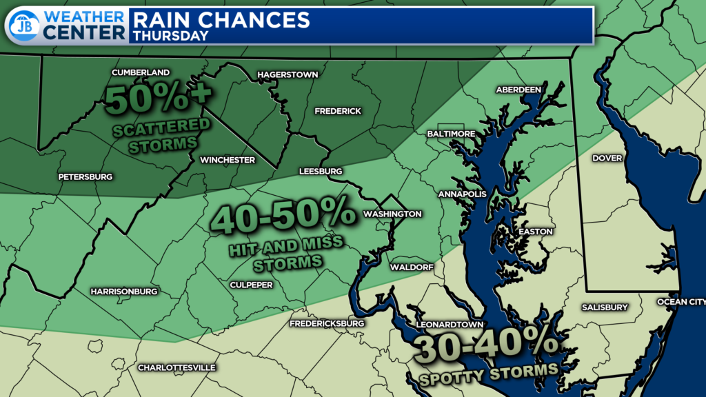
The highest rain chances are likely to be found northwest of DC where there is a 40-50% chance of seeing these showers and thunderstorms. Most of Southern MD only has a 30-40% of seeing a spotty shower or storm after 3pm. However, any storm that does develop could become strong and produce gusty winds and locally heavy rain!

Some weather impacts do look possible today. First, you will notice the heat and humidity today as they will work to push the heat index near 105! There may also be some hit-and-miss storms this afternoon. Not everyone will see storms today, but those that do could see some gusty winds and heavy rain.
If you have outdoor plans this afternoon and evening, I would not cancel them. However, I would have an extra bottle of water with you. And, I would recommend stay weather aware as hit-and-miss storms may try to develop after 3pm. Have a Plan B ready to go, and be ready to act if quickly-changing weather conditions move overhead.
Stay with JB Weather for the latest information on Southern Maryland weather. You can always access my forecasts and updates here on the website, on Facebook, on Twitter, on Instagram, and on YouTube.
-JB

Chesapeake’s Bounty is providing our community farm-fresh foods from the Chesapeake Bay region. Local seafood, produce, meats, dairy and more! Locations in Saint Leonard and North Beach. Make sure to stop by and also check out www.chesapeakesbounty.com
