Brought to you by Dugan, McKissick, Longmore LLC
With the remnants of Tropical Storm Fred racing off of the New England coast this morning, we should get today started on a quiet note. Temperatures will look to max out in the lower 90s this afternoon with only a few passing clouds. The humidity will be elevated though, which could make it feel like we’re in the middle to upper 90s.
We do have the threat of late-day showers and storms. While a pop-up afternoon shower is possible, we likely do not see rain chances really begin to increase until sunset. As a frontal boundary crosses through the region this evening we may see a corridor of showers and storms develop south of Washington.
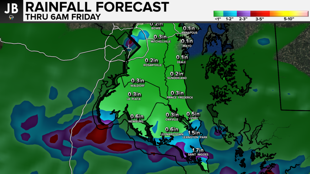
With rain chances coming after sunset, we will lack the daytime heating needed to make these storms severe. While gusty winds and lightning/thunder will be possible tonight, the primary threat will likely be heavy rain. Shown below is the model output rainfall forecast. We may see a corridor of 1-3″ fall across the Northern Neck in southern parts of SoMD overnight. If these storms are slow movers, we could see localized amounts to 4″+.

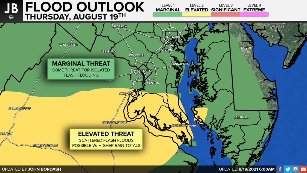
With this in mind, our region has been placed under an Elevated Risk of Flash Flooding. This means that scattered flooding will be possible, especially in low-lying areas and areas with poor drainage. The peak of this flooding threat may be from 8pm tonight through 6am Friday morning. This could lead to an impacted morning commute tomorrow.

Stay with JB Weather for the latest information on Southern Maryland weather. You can always access my forecasts and updates here on the website, on Facebook, on Twitter, and on YouTube.
-JB

Dugan, McKissick & Longmore, LLC has served our Southern Maryland community for over 25 years. Our trusted attorneys are here to handle your unique case from beginning to end. To schedule an appointment, call us today at 301-862-3764 or visit our website at www.paxlawyers.com.

