Brought to you by Berkshire Hathaway HomeServices PenFed Realty
We have a warm and humid day on tap across the region, which may set the stage for a potentially active day in the weather department. There are two potential windows for storminess today, one in the morning and again in the afternoon/evening. This means that today will be a day that you need to stay weather aware.
Our first potential round of showers and storms comes this morning before 11am. A weak frontal boundary has been set up along the Bay, and a storm complex from New York State will attempt to ride southward, along it. This morning’s rain chance is very dependent on whether that storm complex can survive the trip southward into our region.
The areas that have the highest of seeing this move through will be eastern areas, especially on the Delmarva. Futurecast shows this well with spotty areas of rain and locally heavy downpours dotting the map around/after sunrise. Futurecast shows that the further east you head, the higher the chance of rain. The threat of severe weather this morning is rather low, with the primary concern with any areas of rain being localized flooding. I will be providing updates on this threat throughout the morning on my socials.
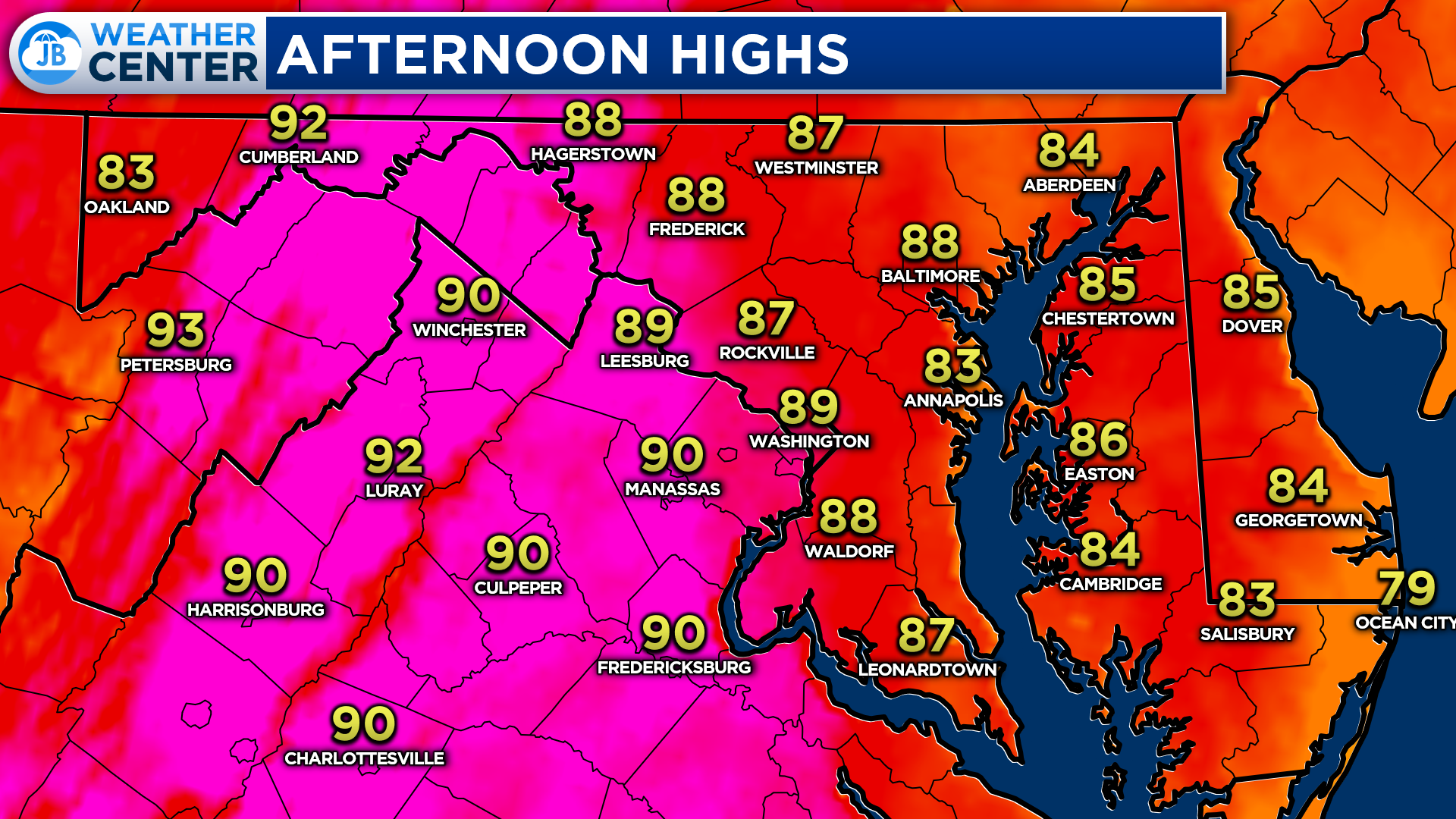
After this morning’s rain threat, we will look to clear out. How quickly we clear out will impact how warm we get today. Quick clearing, or limited AM storm coverage, would mean a warmer day, and the inverse is true if clouds and rain stick around. The warmest temperatures are likely to be found inland, away from this morning’s storm threat.
With that said, many areas should be able to make it into the upper 80s to lower 90s this afternoon. Dewpoints in the upper 60s will help to make it feel like we’re in the middle 90s. This warmth and humidity combo, if we do see midday clearing, will look to set the stage for a stormy afternoon/evening.
This afternoon will offer another chance of thunderstorms as a weak boundary works overhead. This boundary will attempt to kick off showers and storms between 4-8pm as it moves through. This is dependent on the amount of midday heating and clearing we see. If we see enough, then we could see a broken line of storms develop out west and push through with locally heavy rain, gusty winds, small hail, and even a non-zero tornado potential.
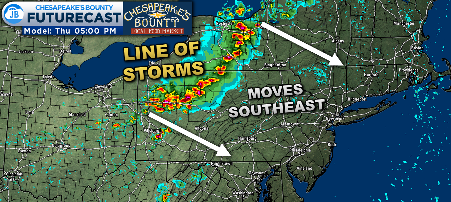
Additionally, there will be a strong line of thunderstorms that develops back across western New York and western Pennsylvania. This line will likely move southeast through those regions bringing a notable threat of severe weather. This line will attempt to move southward, across the state line into Maryland, after sunset.
I tend to believe that this line will be weakening as it does so thanks to the absence of peak heating and the afternoon line potentially using up a lot of the storm energy. With that said, if that line could survive the trip south, then we could see another brief round of locally heavy rain and gusty winds late this evening, between 8pm-1am. But, again, I am questionable whether that line will make it south of the state line.
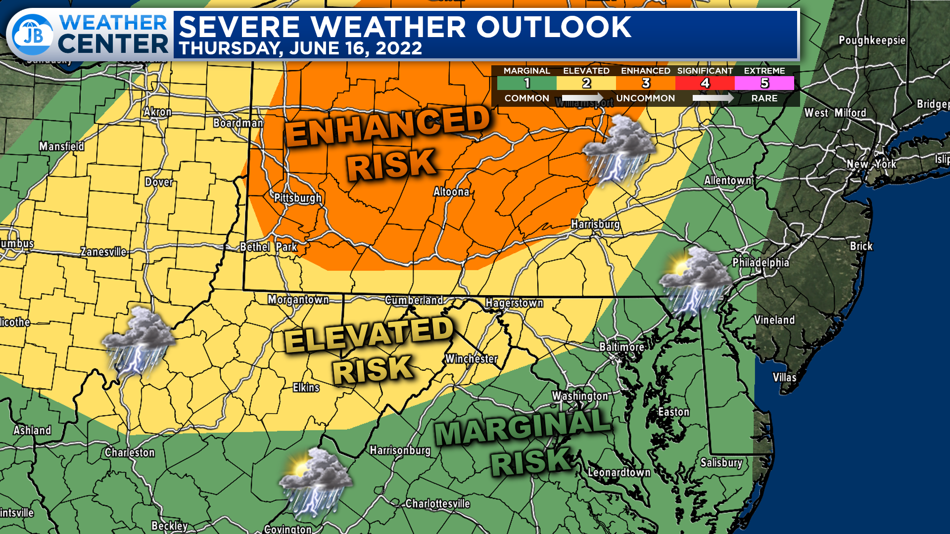
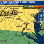
The greatest severe weather risks today will be across western New York and Pennsylvania where that line of storms is likely to push through. Therefore, an “Enhanced Risk” has been issued for those regions. The severe risk categories drop off as you head south and east thanks to greater uncertainty.
If we are able to see midday clearing today, then I could see that “Elevated Risk” being expanded southward, into our region, for that afternoon threat of storms. I think that afternoon threat will be our region’s highest chance to see severe weather out the potential windows I highlighted. We will need to monitor this potential.
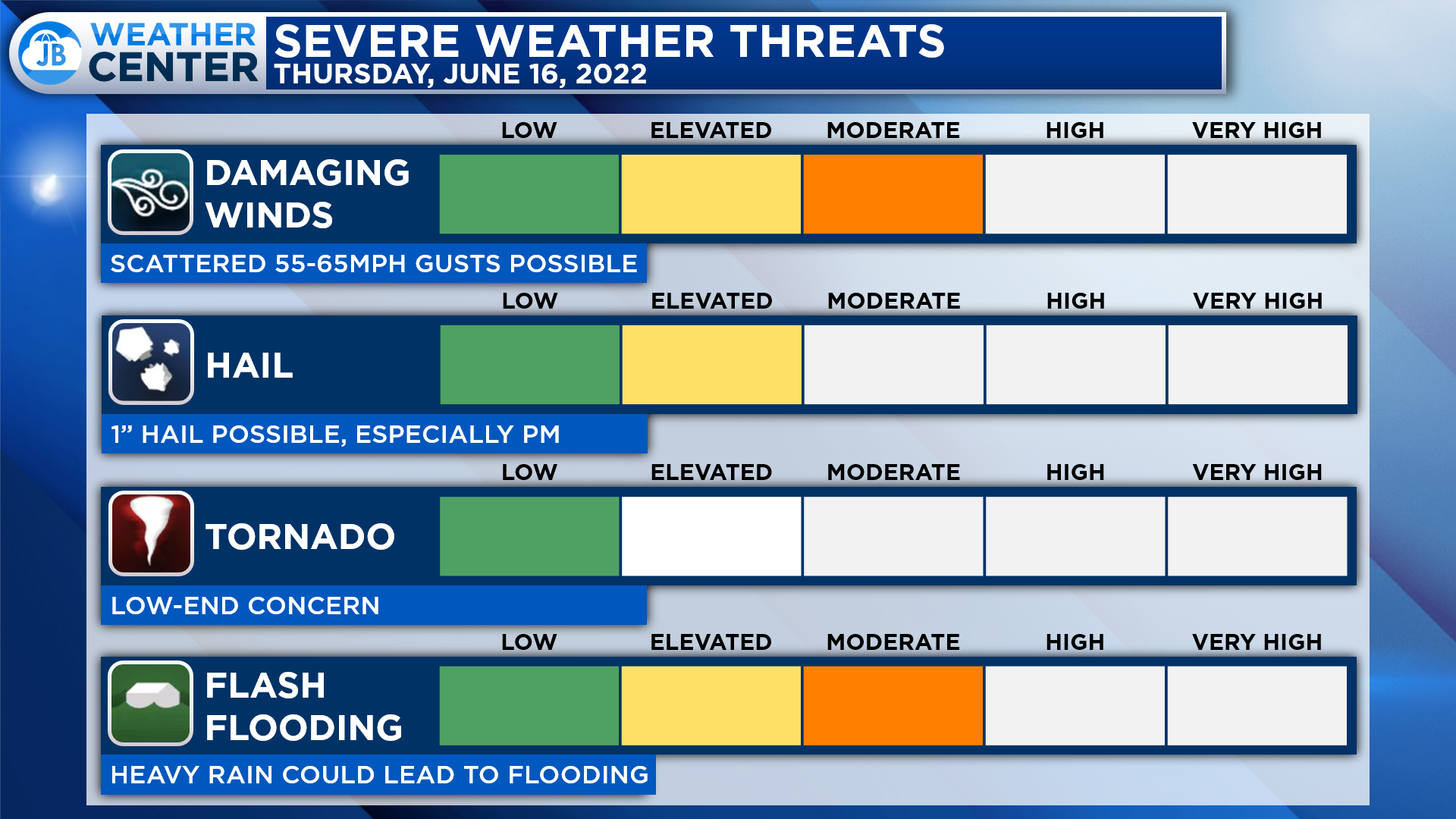
Locally, I believe that the main risks today will come from the threat of damaging winds and heavy rain. These threats will be the highest between 4-8pm. If severe thunderstorms do fire this afternoon, then hail could be possible as well with a non-zero tornado threat.
Again, it will be important to stay weather aware today. The main windows for potential rain will be before 11am and then between 4-8pm with a potential additional window between 8pm-1am. The late morning and early afternoon hours should be dry. How clear & warm we get this afternoon will play a big role in our afternoon storm chances.
Stay with JB Weather for the latest information on Southern Maryland weather. You can always access my forecasts and updates here on the website, on Facebook, on Twitter, on Instagram, and on YouTube.
-JB

Real Estate now! Not sure where to start? View our Southern Maryland inventory of homes, land, farms and commercial properties on penfedrealty.com. Engage with our planning tools to determine your next real estate lifestyle decision, choose your realtor as a trusted advisor. Experience the difference with service and support from real estate’s forever brand!
John Bordash
View More PostsJB Weather forecaster John Bordash is working around the clock to provide Southern Maryland, and neighboring communities, with accurate and reliable weather information.