Brought to you by Chesapeake Orthodontics
We’re starting the day on a cold and somewhat murky note, but a big change is on the way as warmer air surges in ahead of an approaching cold front.
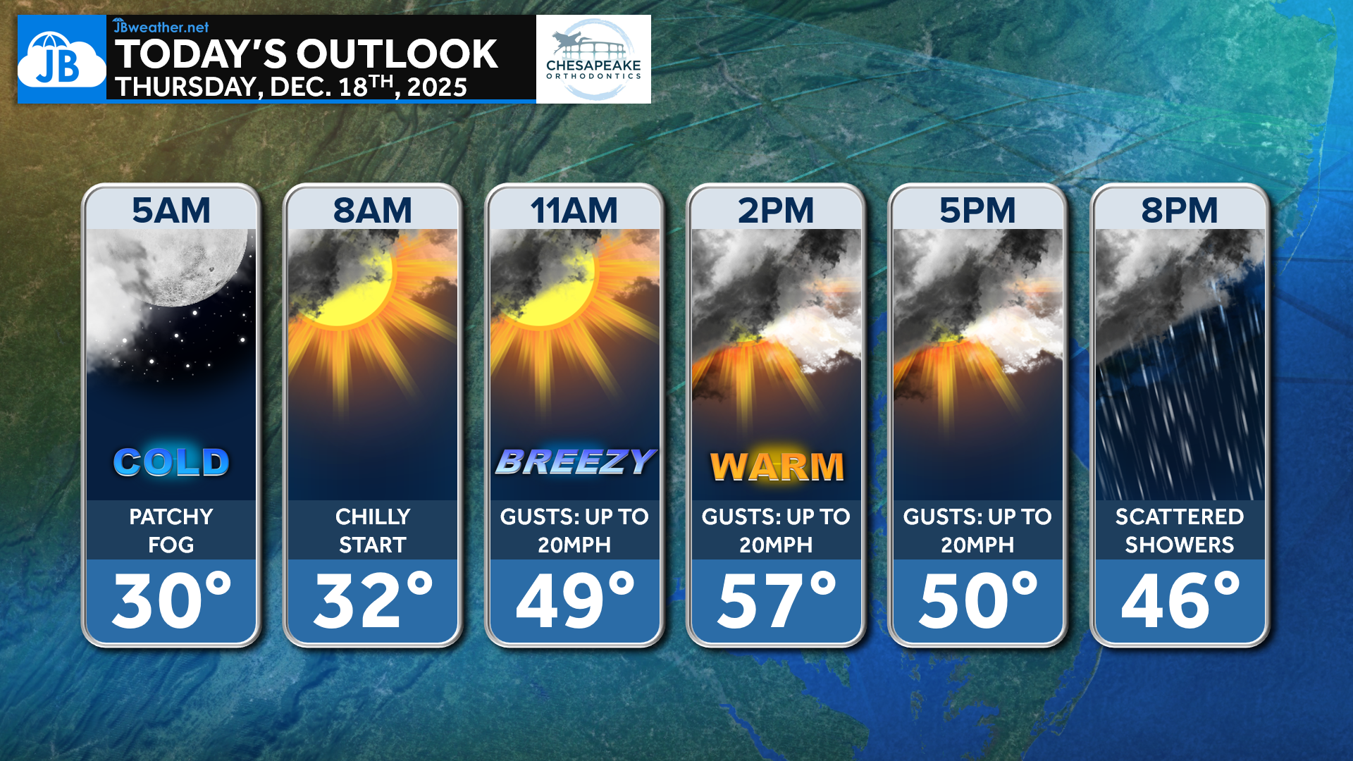
Patchy fog is possible early this morning, especially in low-lying areas, along with another cold start across the region. As the day goes on, southerly flow strengthens, allowing temperatures to rebound nicely into the 50s this afternoon despite increasing cloud cover. Winds will gradually pick up through the day, signaling the incoming pattern change.
A cold front pushing in from the west will bring the next round of active weather tonight. Rain showers may begin as early as 8 PM, with a more widespread and heavier batch of rain overnight into early Friday morning. There is even the potential for embedded thunderstorms, with a stronger line of rain possibly moving through between 5–8 AM Friday, as shown in the latest FutureView guidance. Winds will also become increasingly gusty overnight, with gusts of 35–40 mph possible, especially as the front passes.
Stay with JB Weather for the latest information on impacts here in Southern Maryland and across the Mid-Atlantic. You can always access my forecasts and updates here on the website, on Facebook, on Twitter, on Instagram, and on YouTube. JB Weather is the Mid-Atlantic’s Weather Leader, and I am working around the clock to keep you ahead of any storm!
Dr. Thomas Hao and Dr. Dylan Schneider offer comprehensive orthodontic services for all ages. Schedule your free consultation today. Visit www.SOMDBraces.com today for more information!
John Bordash
View More PostsJB Weather forecaster John Bordash is working around the clock to provide Southern Maryland, and neighboring communities, with accurate and reliable weather information.