Brought to you by Berkshire Hathaway HomeServices PenFed Realty
We are off to a mild start this morning, with temperatures in the 50s regionwide! This is a precursor of things to come this afternoon, as highs look to get well into the 60s, and potentially near 70°. I think several spots will be able to hit 70° with enough sunshine this afternoon. Too much cloud cover would limit that chance.
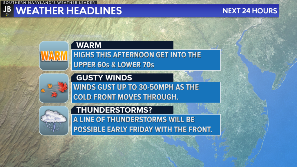
The next 24 hours will have a lot to offer weather-wise. In addition to the warm temps this afternoon, we will also have gusty winds throughout the day. These winds increase tonight ahead of a cold front that will move through with the potential for some overnight thunder!
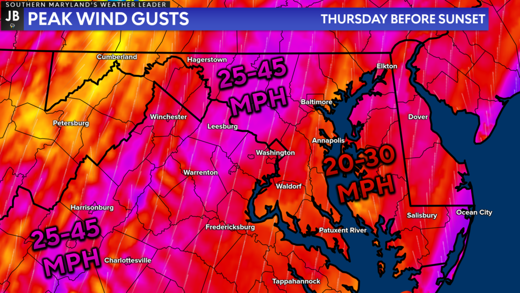
The warm temperatures today will be courtesy of strong southerly winds! Southerly wind gusts throughout the day will look to get upwards of 20-30mph at times, with gusts upwards up 35-40mph across the higher terrain of western Maryland and West Virginia.
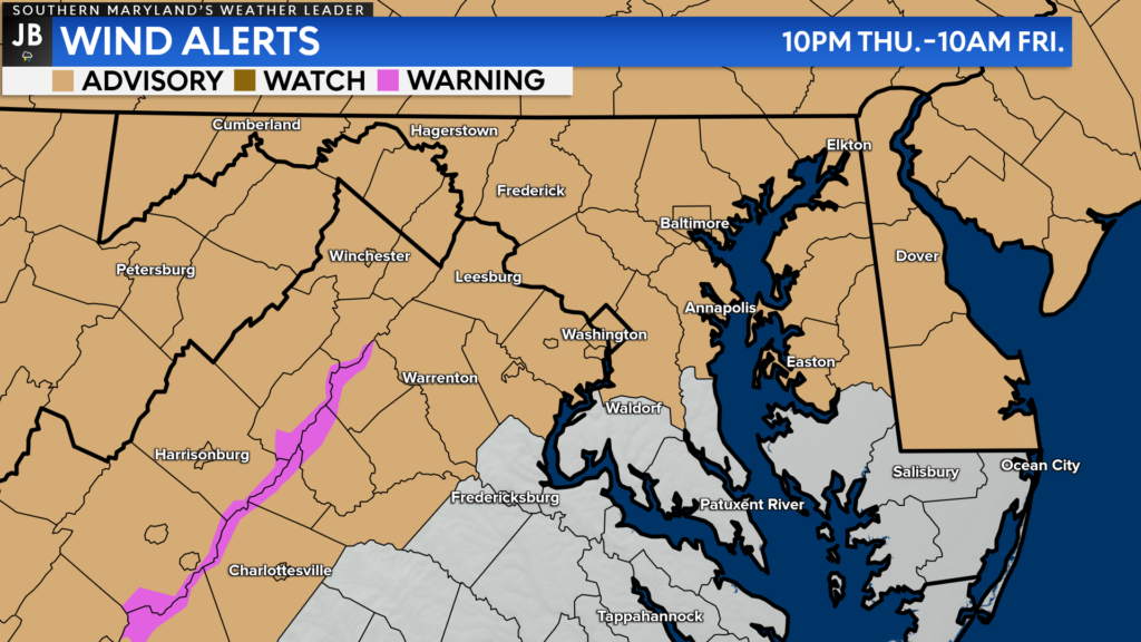
The winds will pick up tonight as the cold front moves closer. This has prompted the National Weather Service to issue a Wind Advisory, shaded in the tan, for many areas north and west of our region. This is where the winds will be the highest, potentially gusting upwards of 50mph, after the cold front moves through tonight.
Locally, this includes Anne Arundel and Prince George’s Counties from 10pm tonight until 10am Friday morning. Winds will also be gusty across the rest of Southern MD and the Northern Neck, but likely just below advisory criteria, which are gusts of at least 45mph.
Our Chesapeake’s Bounty Futurecast does a great job of depicting the potential setup as the cold front moves through. Heavier, consistent rains are likely to our northwest before rain starts moving through after 10pm-12am. We could see a narrow band of low-end thunderstorms move through overnight with the cold front. The most likely time frame for this looks to be between 2am-6am.
These thunderstorms would not likely be severe, as we would be missing a few key severe weather ingredients thanks to the unusual, early morning timing. However, we could see locally heavy rain and a few gusts up to 60mph within this line as it presses through.
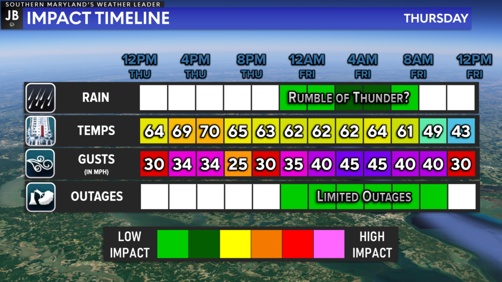
In Summary… The next 24 hours look rather active in the weather department! Warm temperatures this afternoon will be welcomed after our cold start this week. However, we will have gusty southerly winds throughout the day, which will only increase tonight. Low-end thunderstorms are possible late tonight as the cold front works through.
Stay with JB Weather for the latest information on Southern Maryland weather. You can always access my forecasts and updates here on the website, on Facebook, on Twitter, and on YouTube.
-JB

Real Estate now! Not sure where to start? View our Southern Maryland inventory of homes, land, farms and commercial properties on penfedrealty.com. Engage with our planning tools to determine your next real estate lifestyle decision, choose your realtor as a trusted advisor. Experience the difference with service and support from real estate’s forever brand!
