Brought to you by Bill Oosterink, Realtor
After Tuesday’s winter storm, yesterday was a day to dig out and recoup. We saw another system move in yesterday evening as warmer air surged northward. This has allowed for widespread rain across the region overnight with some wintry mix northwest of I-95.
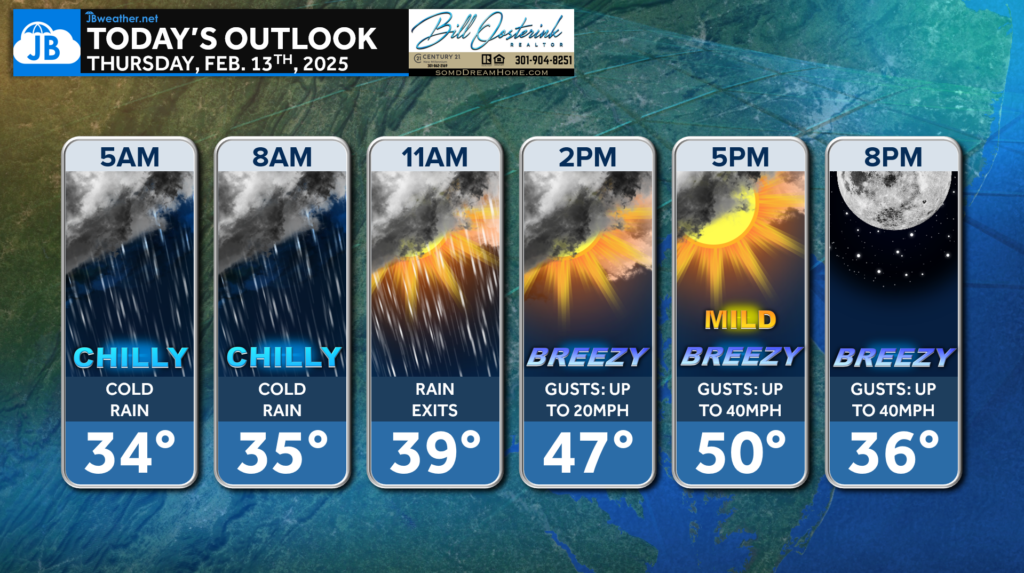
The rain will be with us throughout the morning and could be heavy at times. We should see the rain come to an end this afternoon, which will allow temperatures to spike into the upper 40s and lower 50s for a brief time! However, an incoming cold front will cool us and make things windy!
Our Futureview model shows that rain becoming heavy at times for some! Some may end up seeing up to an inch of rain before the rain moves out later this morning. Clearing skies then take hold.
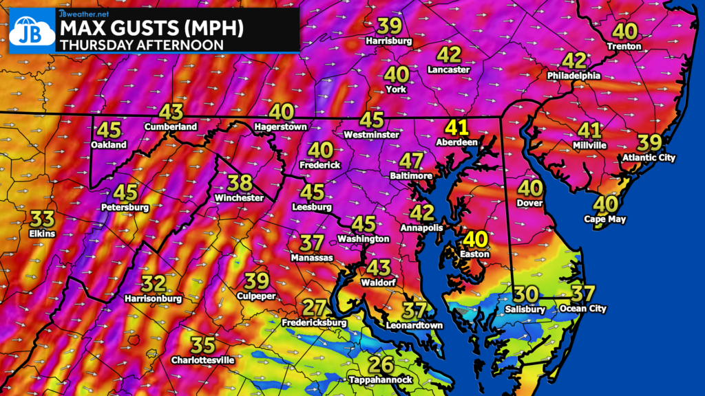
As the cold front passes through, we will likely see winds pick up. Our modeling suggests that we could see northwesterly gusts up to 30-40mph this afternoon! While we have no wind alerts yet, be prepared for this during the commute home!
Many local school districts in Maryland have opted to open today thanks to the rain melting the snow from yesterday. However, some districts in Virginia have opted for delays or closures. You can stay up to date on the latest school alerts at the link below.
Stay with JB Weather for the latest information on impacts here in Southern Maryland and across the Mid-Atlantic. You can always access my forecasts and updates here on the website, on Facebook, on Twitter, on Instagram, and on YouTube. JB Weather is the Mid-Atlantic’s Weather Leader, and I am working around the clock to keep you ahead of any storm!
Buying. Selling. Investing. Ready when you’re ready! Check out www.somdDreamHome.com today!
John Bordash
View More PostsJB Weather forecaster John Bordash is working around the clock to provide Southern Maryland, and neighboring communities, with accurate and reliable weather information.