Brought to you by Sonder Studios
Our winter storm is moving out, but the impacts will continue well into tomorrow as cold air rushes into the region tonight!
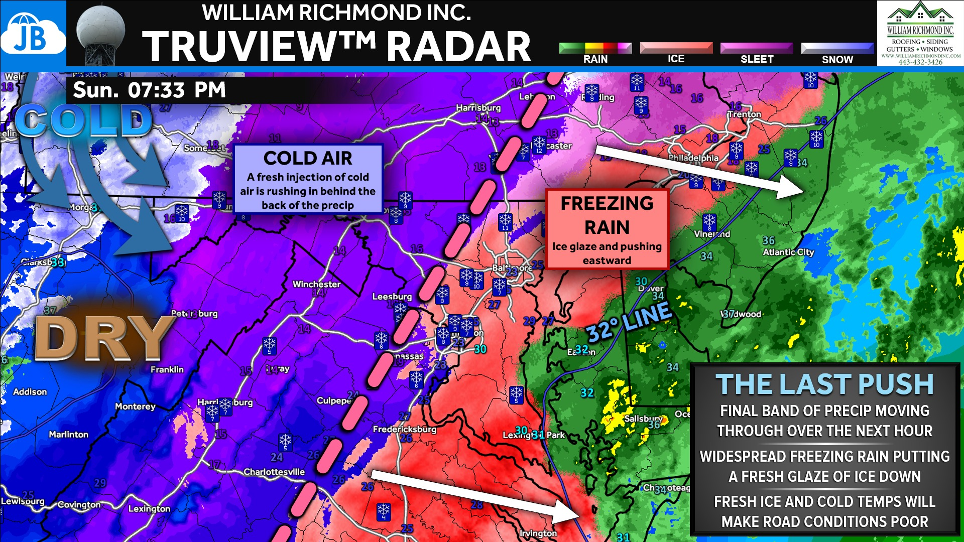
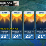
❄️ The storm is winding down, but the impacts are far from over. Freezing rain is ending and precipitation is pushing out of the region, but what’s left behind is a dangerous setup overnight. The 4–8” of snow and sleet, combined with ice accretion, will quickly freeze up as temperatures fall into the teens. Areas that saw the most snow will see their temps drop into the single digits!
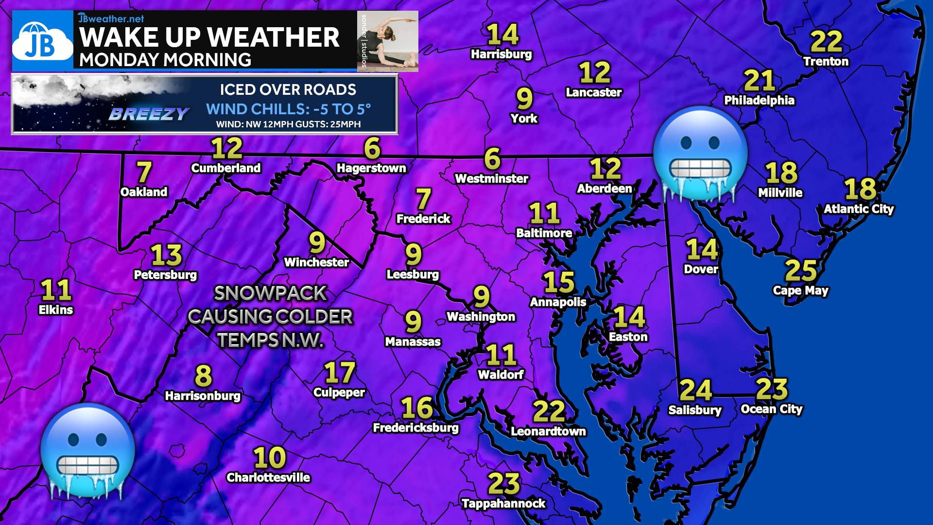
🌬️ Northwest winds will increase overnight and into Monday, driving wind chills below zero in spots and preventing any meaningful improvement on roads. Expect widespread icy conditions by morning, including untreated roads, sidewalks, and parking lots. Travel Monday morning will be hazardous — even where precipitation has already ended.
Stay with JB Weather for the latest information on impacts here in Southern Maryland and across the Mid-Atlantic. You can always access my forecasts and updates here on the website, on Facebook, on Twitter, on Instagram, and on YouTube. JB Weather is the Mid-Atlantic’s Weather Leader, and I am working around the clock to keep you ahead of any storm!

SONDER STUDIOS® is home to Yoga, Pilates, Barre, and Strength classes in Calvert County. Wellness is our business, and belonging is at the heart of our culture. We are grateful for your trust for 6+ years. Sign up for an intro week at www.sonderstudios.us
John Bordash
View More PostsJB Weather forecaster John Bordash is working around the clock to provide Southern Maryland, and neighboring communities, with accurate and reliable weather information.