Brought to you by Sonder Studios
Over the last several days, we have been monitoring the threat of winter weather for Wednesday and Thursday of this week. There has been plenty of hype and misguided expectations online, as you would expect. We are starting to get a better picture of the system, and this may not be the blizzard that others have proclaimed.
A storm system will move out of the Mid-South on Tuesday as cold air from the north settles into the region. As has been the case all winter, the forecast relies on how strong that cold air to the north is. If it is too strong, it will suppress this system, along with its snow chances, and guide it out to sea. If it’s not too strong, it will allow the storm to come further north, allowing for a more widespread winter storm.
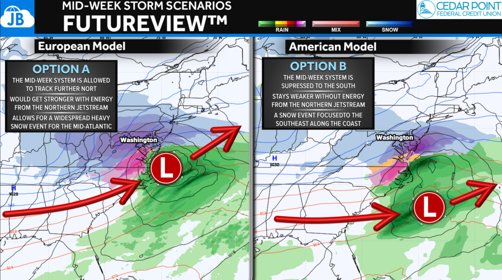
Right now, our models are two camps, and we can see this on today’s models runs.
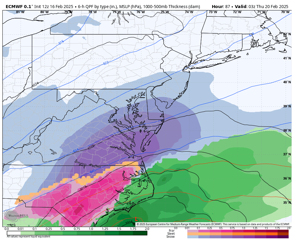
The European Model has been consistent in showing a suppressed, southern solution. Without the interaction of the northern Jet Stream, the storm is focused to the south. This would put most of the winter weather impacts across Virginia and North Carolina. Southern MD would be on the northern edge, with little falling north of the Mason-Dixon Line. The trend with our storms this winter is for them to verify to the south, so this is important to note.
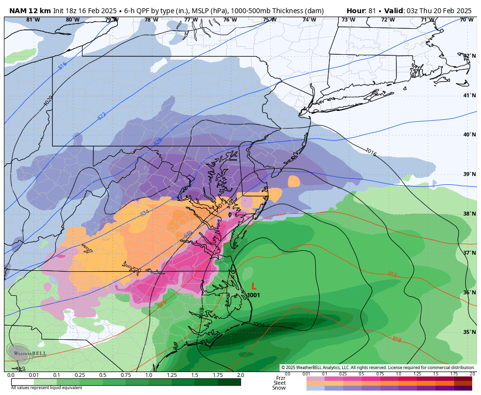
The North American Model is one of our only models showing what a northern solution would look like. If the system is able to interact with the northern Jet Stream enough, it would help pull it closer to the coast. This would spread winter weather impacts further north and would allow for a stronger storm.
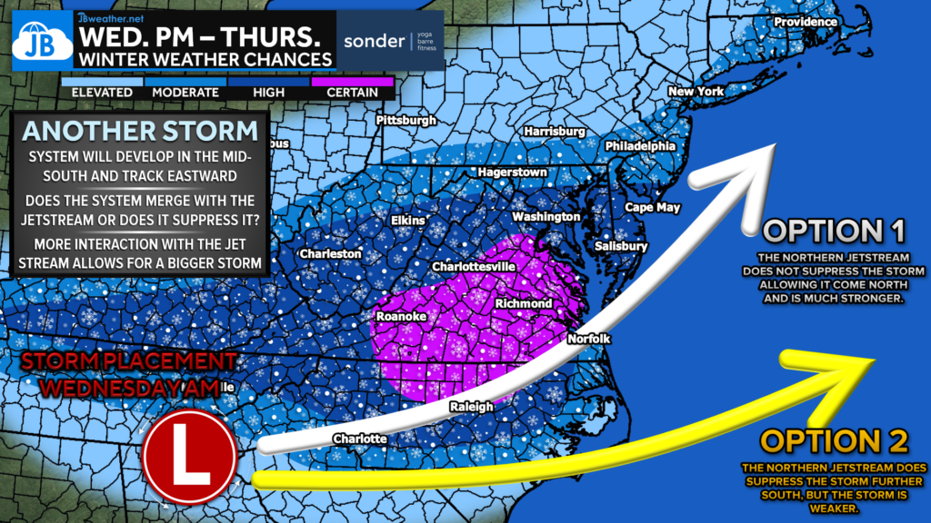
It is a bit too early to say which scenario option will verify. The trend this winter has been for storms to stay to the south, but there is some reason to believe that this can come further north. With that said, the highest chances of winter weather Wednesday PM into Thursday are across central Virginia into southern MD. With that said, small changes with the northern Jet Stream interaction will play a big role. However, the calls of a massive blizzard seem to be fading. There are sure to be changes to this forecast over the next 24 hours! Stay tuned.
Stay with JB Weather for the latest information on impacts here in Southern Maryland and across the Mid-Atlantic. You can always access my forecasts and updates here on the website, on Facebook, on Twitter, on Instagram, and on YouTube. JB Weather is the Mid-Atlantic’s Weather Leader, and I am working around the clock to keep you ahead of any storm!

SONDER℠ Yoga studio. Barre studio. Fitness Studio. Classes, events & education for being well. Sonder is a mindful community, and you are invited. 5+ years in Calvert County, MD. We are grateful for your trust. Check out sonderstudios.us!
John Bordash
View More PostsJB Weather forecaster John Bordash is working around the clock to provide Southern Maryland, and neighboring communities, with accurate and reliable weather information.