Tropical Storm Erin officially formed this afternoon over the eastern Atlantic, well off the African coast. With warm water and generally favorable atmospheric conditions ahead, Erin is expected to gradually intensify over the next several days, likely reaching hurricane status by mid-to-late week. For now, the storm will continue its steady westward trek across the open Atlantic.
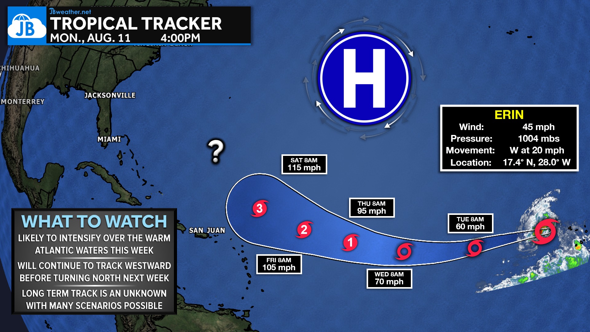
The biggest wildcard in Erin’s long-term track is the large area of high pressure positioned north of the system. That high will act as Erin’s steering wheel in the coming days. If the high weakens or shifts east sooner, Erin will be able to turn north earlier, increasing the chances of a curve out to sea. If the high hangs on longer, Erin may travel farther west before eventually curving, which would change downstream impacts and timing considerably.
At this point, early signals suggest Erin is unlikely to pose a direct threat to the U.S. East Coast, but it remains far too early to make any sweeping claims. As always with long-range tropical tracking, small shifts in the steering pattern can lead to big differences several days down the line. Erin is absolutely one to keep an eye on as we move through the week, and I’ll continue updating you as the guidance becomes clearer.
John Bordash
View More PostsJB Weather forecaster John Bordash is working around the clock to provide Southern Maryland, and neighboring communities, with accurate and reliable weather information.