Brought to you by Cedar Point Federal Credit Union
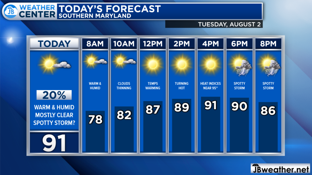
The mid-Summer will be back in full force today! A southwesterly wind will help to pump up heat and humidity into the region, sending many communities back into the lower 90s! Heat indices for some may get between 95-100* as humidity levels remain high.

As has been the case most mornings, we are already off to a warm and humid start with temps in the 70s. Some patchy morning clouds will give way to mostly clear skies this afternoon. This will allow temps to warm into the 90s. The heat and humidity may also provide enough support for a spotty storm or two.
Futurecast shows today’s rain threat quite well. With a lack of a forcing mechanism (like an incoming front), any storms today will be isolated. However, the heat and humidity will help to build up some atmospheric storm energy. This may allow one or two low-end, non-severe storms to bubble up between 3-9pm.
Not everyone will see storms today, and it’s actually more likely that you won’t. But you will want to stay aware as any small pop-up could bring locally heavy rain and gusts to 30mph.

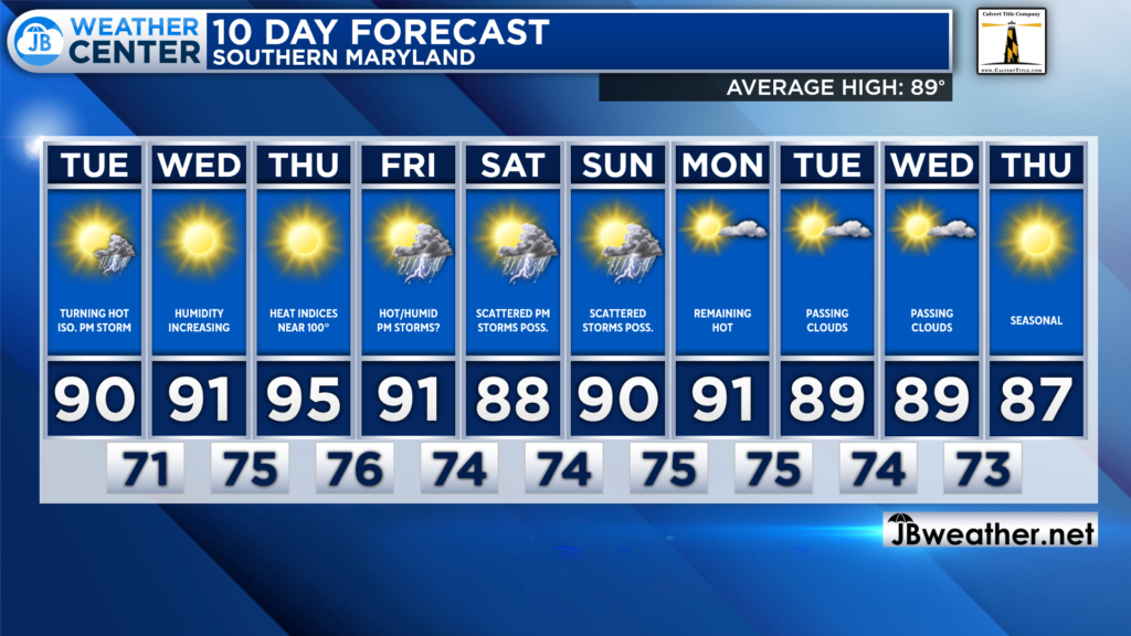
Looking ahead, the heat and humidity will likely stick around throughout the week! Temperatures will remain in the 90s through the weekend, with Thursday looking to be the hottest day of the week. We will see a 30-40% chance of PM storms each day this weekend, as well!
Stay with JB Weather for the latest information on Southern Maryland weather. You can always access my forecasts and updates here on the website, on Facebook, on Twitter, on Instagram, and on YouTube.
-JB

Cedar Point has been providing trusted banking, lending and personal finance solutions to the Southern Maryland Community since 1945. Visit the credit union at any of its 6 locations in St. Mary’s, Charles and Calvert counties or online at www.cpfcu.com.

