Brought to you by Berkshire Hathaway HomeServices PenFed Realty
There is the potential for an active start to our Tuesday in the weather department. Our region is under a Level 2 “Elevated Risk” of severe weather this morning as a storm complex situated in the Great Lakes will attempt to swing through the Mid-Atlantic during the mid to late morning hours.
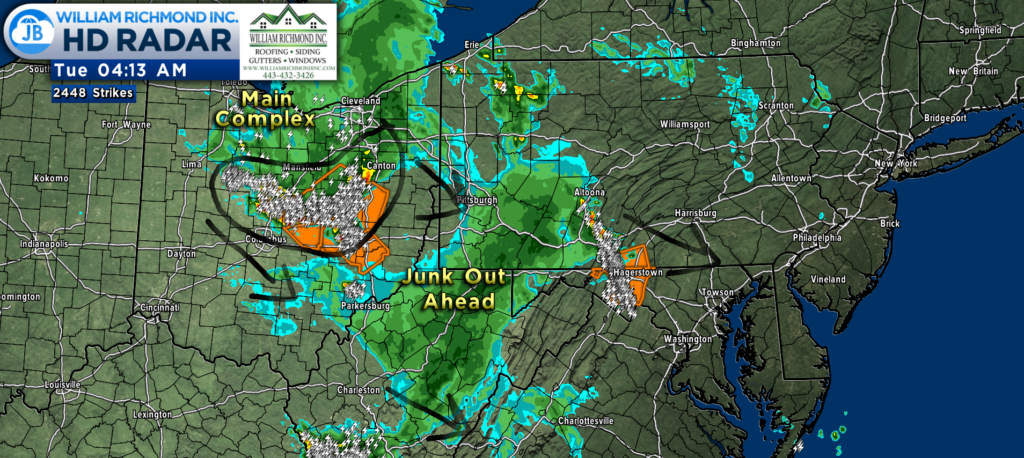
Our main storm complex is moving through central Ohio & diving southeast. However, we have junk out ahead of it that is moving through southeast PA and entering western MD…
Why is this important? The junk (non-severe rain showers) can act as a “stabilizer” in the atmosphere, limiting the amount of storm energy that the developing complex behind it has. It remains to be seen if the junk can use the energy for itself & become the primary concern. Therefore, it is entirely possible that the main system is not nearly as severe as it moves through. However, how far southeast does that junk make it? Does it stabilize our atmosphere, too? And at what degree does all of this move southeast?
I see some evidence that the worst of this *may* focus west of I-95 between 8-11am, and that our main system may be weakening as it pushes through the Mid-Atlantic. But who knows for sure? I could still see all sides of the coin happening with this forecast. We will need to see if that junk out ahead of the main system is able to materialize into a more substantial threat or if it dies out as it tracks southeast.
Our Chesapeake’s Bounty Futurecast offers up a mixed bag with this forecast. Our early run of the model takes the shower activity southeastward, bringing showers to much of the region. Again, this may act to stabilize the atmosphere if this does happen. However, our model does track that area of storminess from Ohio towards the mountains and then into our region later on this morning.
As I mentioned, it looks like the highest severe weather threat may be west of I-95 if this does hold together. That would be because the initial round of showers may use up our storm energy for itself (granted, not doing much with it). This will be a fluid situation to watch. Nevertheless, Futurecast has us clearing out by the early to mid-afternoon hours.

Our main weather concerns with any potential storms would be damaging wind gusts upwards of 55-70mph. There would also be a notable flash flooding risk.
It is important to note, again, that this is dependent on that storminess over Ohio holding together and moving through. If it fails to hold together and breaks up, then our severe threat would be markedly lower with limited action in our region. Conversely, if it does hold together, then we could see some moderate to high impacts by mid to late morning.

Behind the storm potential this morning, we will see skies gradually clear and temperatures rise. It is humid out there this morning, and that humidity will likely stick around throughout the day. The time frame to watch for this storm’s potential is 6am-2pm.
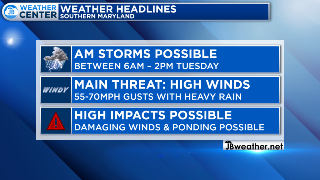
It will be important to stay weather aware throughout the morning as we continue to track this potenital storm threat. The main timeframe to watch will be between 6am-2pm for these storms to potentially bring damaging winds and heavy rain. How much storm energy we have around will be critical to this forecast. I will be in the weather center all morning tracking this threat.
Remember that severe weather forecasting is far from a guarantee of anything. The goal of these forecasts is to alert you to the potential of storms, not a promise of storms.
Stay with JB Weather for the latest information on Southern Maryland weather. I will be with you all throughout the day to cover this potentially impactful system. You can always access my forecasts and updates here on the website, on Facebook, on Twitter, on Instagram, and on YouTube.
-JB

Real Estate now! Not sure where to start? View our Southern Maryland inventory of homes, land, farms and commercial properties on penfedrealty.com. Engage with our planning tools to determine your next real estate lifestyle decision, choose your realtor as a trusted advisor. Experience the difference with service and support from real estate’s forever brand!
