Brought to you by Chesapeake Orthodontics
After days of tracking this threat, it does indeed look like we have high-impacts on tap across the region for our Tuesday. A powerful system will be moving through the Great Lakes today. And while the Midwest will get snow from it, much of the Mid-Atlantic is on tap to see heavy rain and damaging winds.
Futurecast shows rain showers moving into the region this morning and generally picking up through the morning hours. More steady rains are likely by lunchtime. Some of the heaviest rains with localized downpours look like this by this evening’s commute. We should see drying conditions overnight.
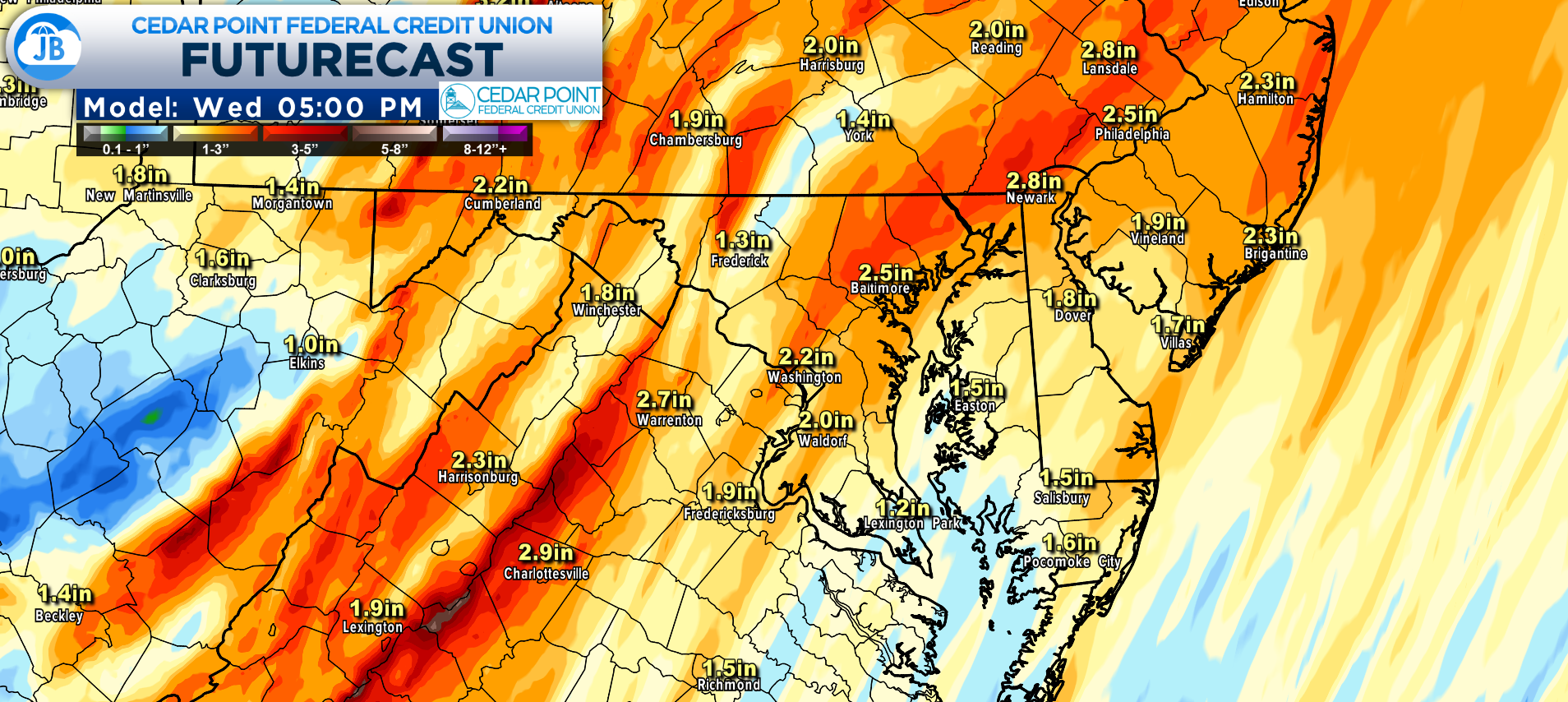
Our Futurecast model suggests that many areas are likely to see widespread 1-2″ of rain. However, we could see some communities locally see higher amounts of 2-3″ where downpours train. This is why a Flood Watch is up for much of the region. Flash flooding will be a real concern, especially this evening.
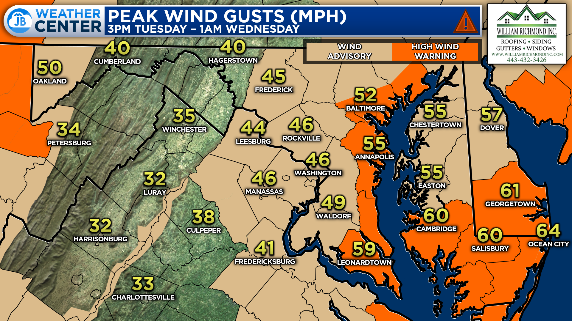
In addition to the heavy rain, we will see strong wind gusts from the southeast. These wind gusts will likely get between 40-50mph at times. Locally higher gusts up to 60mph are possible for our Bayside locations, where a High Wind Warning is in place. The worst of the winds are likely this evening. This could lead to scattered power outages!
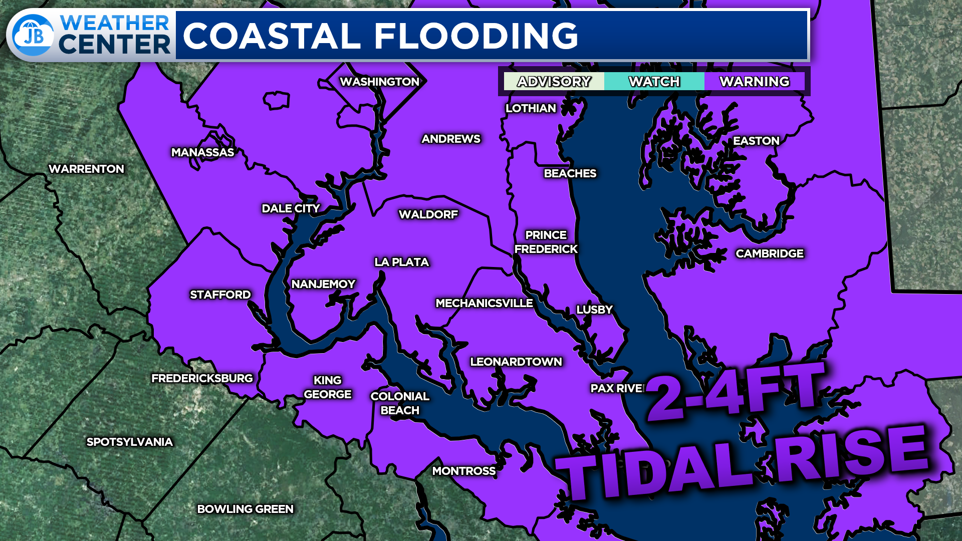
The strong wind gusts from the south will also help to pile water from the Bay and our back rivers/creeks. This will cause between 2-4 feet of tidal water rise. As a result, our entire region is under a Coastal Flood Warning. Sensitive locations along the immediate coastlines can expect moderate to high coastal flooding impacts.
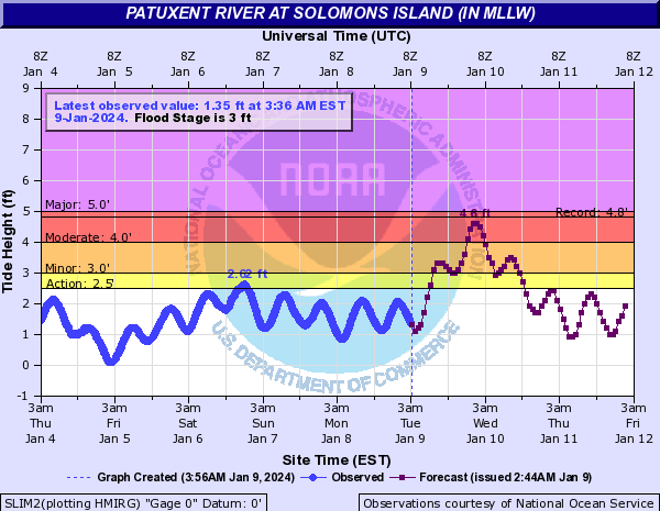
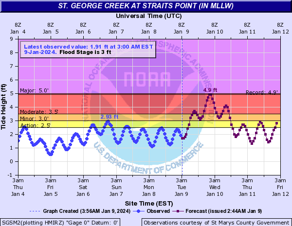
The flood gauges at Solomons Island, and Piney Point are forecast to get near record levels tonight. Water levels near 4-5 feet will create issues for these communities. The National Weather Service outlines some of these expected impacts, here:
- St. George Island: At 3.5 feet, water covers roads on Saint George Island, is in yards, and is approaching structures. To the east, inundation is occurring at multiple marinas off St. Mary`s River, Smith Creek, and Jutland Creek.
- Solomons Island: At 4.0 feet, flooding of structures near Charles Street in Solomons is possible. Yards, parking lots, and portions of both Charles and Williams Street are covered by more than a foot of water.
- North Beach: At 4.0 feet, portions of 7th, 8th, and 9th Streets will flood in North Beach, with homes affected near 9th Street.
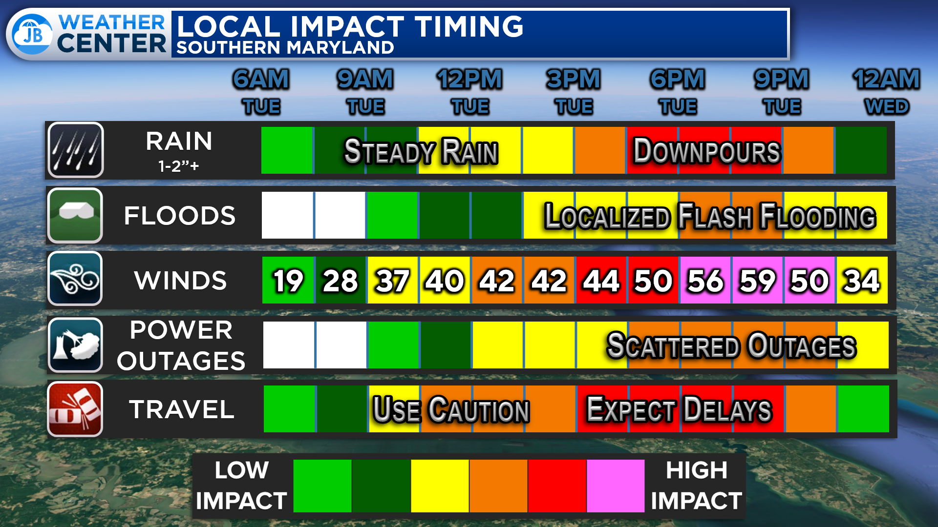
All in all, we have a high-impact weather day on tap. These impacts will come from heavy rain/flooding, tidal water rise, and damaging winds. Expect impacts on the evening commute when the worst of these conditions are likely. Scattered outages will also be possible. Several school districts (such as Calvert, St. Mary’s, and Anne Arundel) have gone ahead and announced that they are closing early today to get out ahead of this weather. Stay weather-aware throughout the day. While I will be at school teaching today, you can get updates here on the website, and my live coverage kicks off this afternoon.
Dr. Thomas Hao and Dr. Dylan Schneider offer comprehensive orthodontic services for all ages. Schedule your free consultation today. Visit www.SOMDBraces.com today for more information!
John Bordash
View More PostsJB Weather forecaster John Bordash is working around the clock to provide Southern Maryland, and neighboring communities, with accurate and reliable weather information.