Brought to you by Calvert Title Company
Yesterday turned out to be quite a hot and humid day! Pax River NAS saw a high of 93° with a maximum heat index of 106° for a few hours. We even saw some storms move through some communities. Unfortunately, we look to have a repeat performance on tap today across the region!
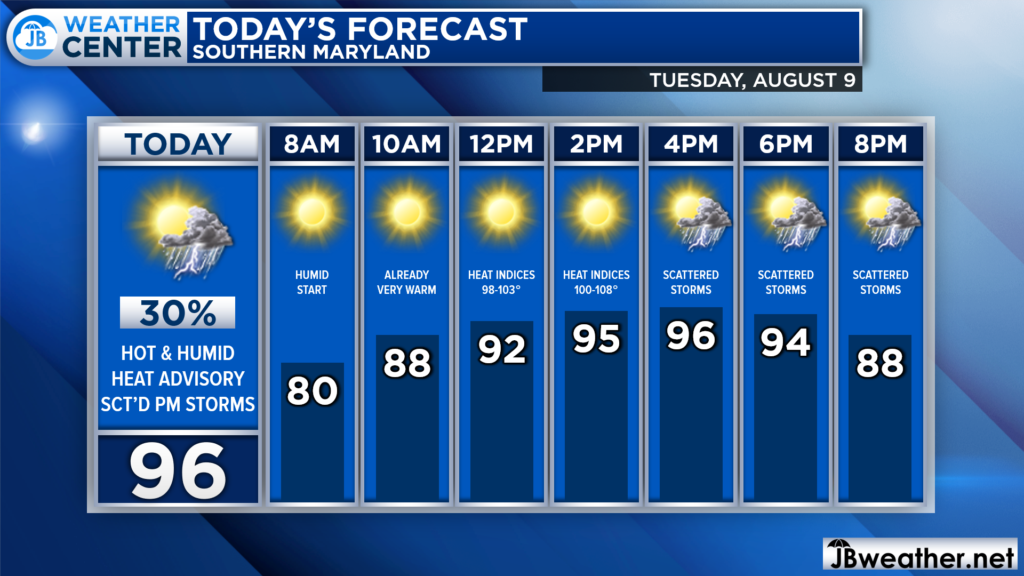
Temperatures this morning are already quite warm. This will set the stage for a rapid warm-up this morning with temperatures likely getting near 90° by lunchtime. High humidity and clear skies will make it feel much warmer and may allow for scattered storms to fire up this evening.
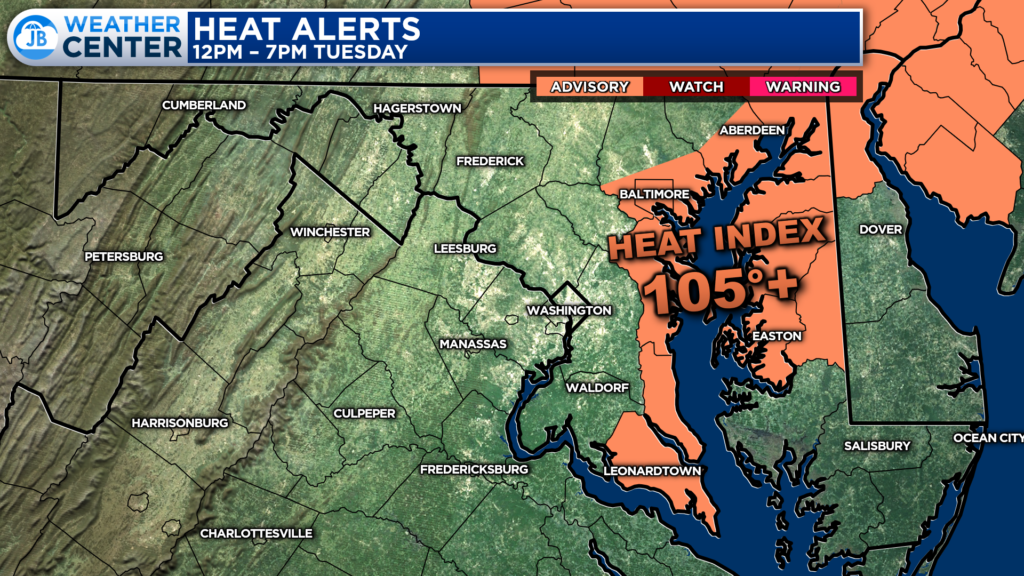
The Bayside counties of St. Mary’s, Calvert, and Anne Arundel are under a Heat Advisory for this afternoon, from 12-7PM. These coastal communities are likely to see higher levels of humidity than other spots, which will allow the heat index to stay above 105° for 3 or more hours.
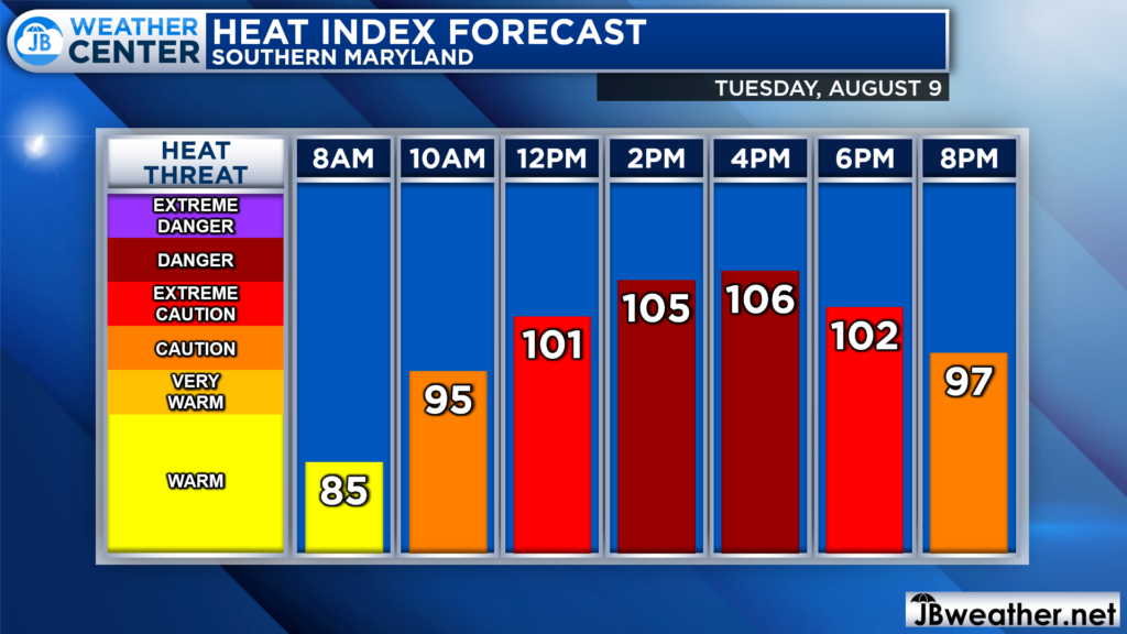
The heat today will be something to take seriously! Heat indices will likely already be over 100° by lunchtime. This afternoon will feature some of the highest numbers with heat indices likely getting between 102-108°.
You will want to ensure that you are drinking plenty of water and trying to stay cool. Be mindful of your activity outside as well as the activity of vulnerable groups and your pets. Take breaks as needed and try to wear light-colored and loose-fitting clothing.
Futurecast also suggests that the heat and humidity will set the stage for scattered storms to develop this afternoon and evening as a weak pulse of atmospheric energy moves overhead. These storms are likely to be more widespread than yesterday, but still, not everyone will see them.
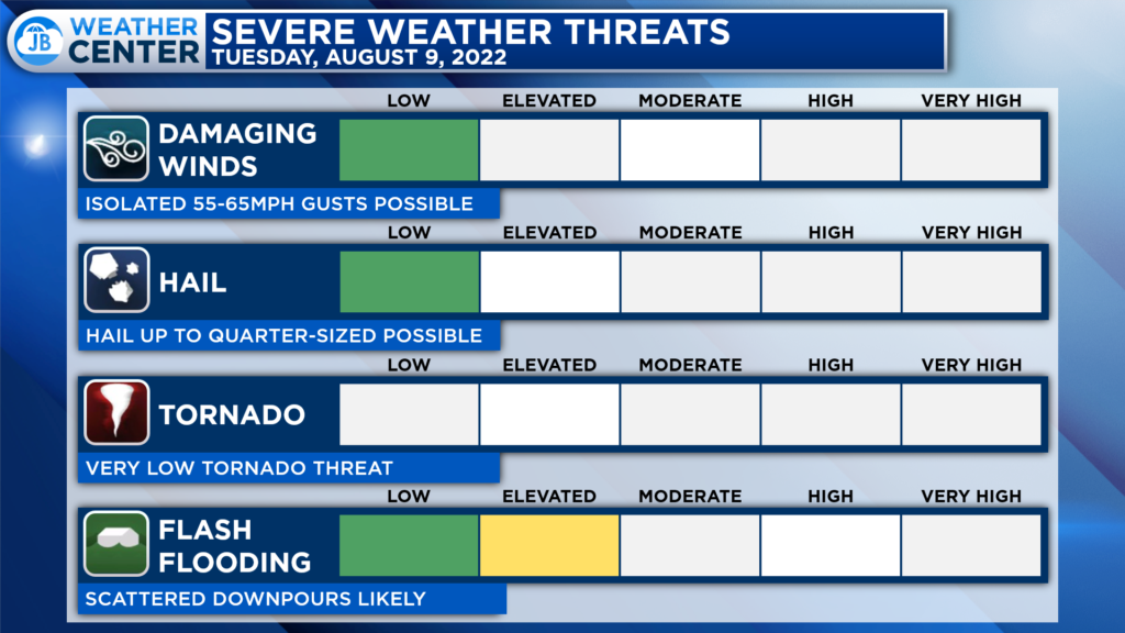
The overall severe risk for our region today is rather low. Some storms may contain some locally gusty winds up to 55-60mph, but the tornado and hail threats are low today. The primary risk with any storms that fire up will be locally heavy rain, which could lead to flooding, and frequent lightning. Storms will be possible between 3-11pm. Again, not everyone will see storms this evening, but those that do could see them become strong.
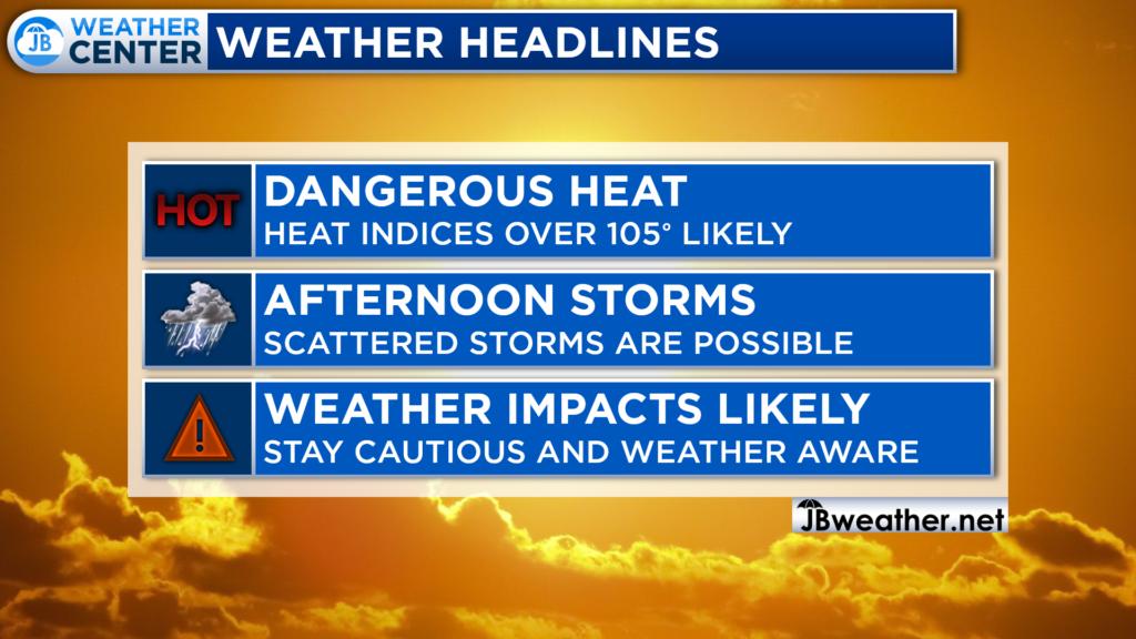
All-in-all, today is likely to be another high-impact weather day. We are likely to see more heat and humidity settle over the area. Heat indices are likely to get over 105° this afternoon, so you will want to take it easy. The heat and humidity will also prime the region for potential storms. This means that you will want to stay weather aware throughout the day.
If you have outdoor plans this afternoon and evening, I would not cancel them. However, I would have water with you. And, I would recommend stay weather aware as hot and miss storms try to fire during the afternoon and evening hours. Have a Plan B ready to go, and be ready to act if quickly-changing weather conditions move overhead.
Stay with JB Weather for the latest information on Southern Maryland weather. You can always access my forecasts and updates here on the website, on Facebook, on Twitter, on Instagram, and on YouTube.
-JB

Calvert Title Company is guiding you HOME one closing at a time! Check out https://calverttitle.com/ today!
