Brought to you by OakPoint Insurance
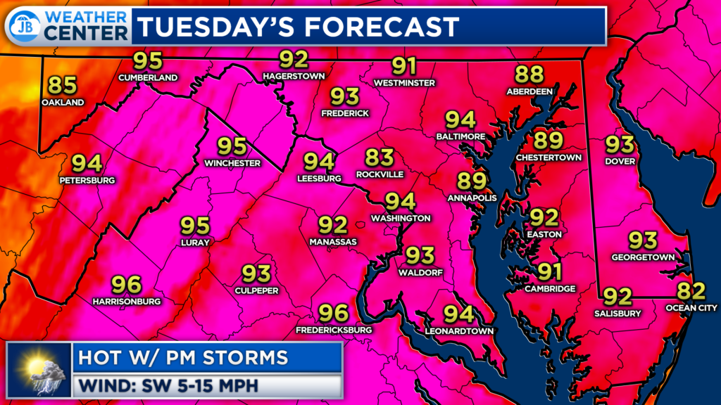
Yesterday was a pretty nice day by mid-July standards with low humidity and seasonally cool temps in the lower 80s. Unfortunately, we will see things revert back to our summer-time norms today. Hot and humid conditions are likely today ahead of the chance of some evening storms.
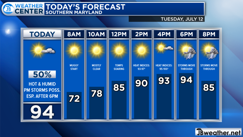
We are to a muggy start already this morning with dewpoints in the 70s. Temperatures will quickly rise into the 80s later on this morning before maxing out in the lower to middle 90s this afternoon! The heat and humidity combination will send heat indices in the upper 90s to near 100°. Then, we likely see storms erupt to our west during the late-afternoon hours.
Our Futurecast model shows that most of the afternoon will be mainly dry, with just a few passing clouds. It is not until later in the afternoon, close to 4-6pm, that we see storms develop to our northwest, near the Mason Dixon line. Atmospheric storm energy will be the greatest before sunset, so storms have a better likelihood of impacting the NW DC suburbs today.
With that said, Futurecast shows those storms propagating eastward, and potentially moving across I-95 around sunset. The questions here are how far south can the storms come and is there enough storm energy after sunset to support these storms? Futurecast seems to think so, bringing that storm chance through Southern MD between 8pm-1am.
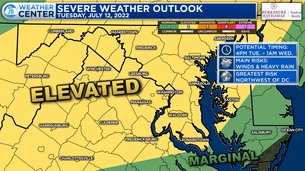
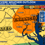
The Storm Prediction Center has placed much of the region under a Level 2 “Elevated Risk” of severe weather for this afternoon and evening. This risk level indicates the increased chance of seeing several strong to severe thunderstorms. Again, to me, the highest storm chance looks to exist northwest of I-95 today. However, we will need to be on guard later on this evening and through the early overnight hours.
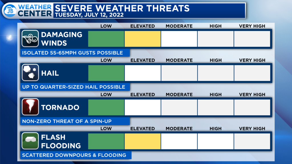
The primary threat from any storms that do fire up would be damaging wind gusts up to 60mph and the threat of flash flooding, especially after this weekend’s deluge. There is the chance that we could see storms containing up to 1″ hail. There is a non-zero tornado threat today, but that risk does look pretty limited, and focused northwest of us. But we will monitor all of this.
Remember that severe weather forecasting is far from a guarantee of anything. The goal of these forecasts is to alert you to the potential of storms, not a promise of storms.
All-in-all, today looks like a typical summer day for Southern Maryland. Expect hot and humid conditions this afternoon with heat indices peaking out in the upper 90s! There will be the threat of storms this evening as well which will need to monitor. While I would not cancel any afternoon or evening plans do stay weather aware and have some water ready!
I will be out of the weather office and in my first student-teacher professional development today from 8am-3pm. While I do note expect storms during those times, this means that there will not be any weather updates then. So, stay wether aware!
Stay with JB Weather for the latest information on Southern Maryland weather. You can always access my forecasts and updates here on the website, on Facebook, on Twitter, on Instagram, and on YouTube.
-JB

The premier insurance agency in Southern Maryland with three locations. We provide insurance for Home, Auto, Business, Farm, and Life. In partnership with many top insurers, we provide solutions to fit our client’s needs. Get in touch with us at 301-863-8100 to experience the difference, mention JB Weather to claim your free gift!
