Brought to you by Chesapeake’s Bounty
Yesterday’s storms stayed primarily to our north and west. While we stayed dry, parts of the Baltimore metro area were under flash flood warnings as heavy rain moved through. Thankfully, we look to have mostly clear conditions on tap for today, which will help dry things up a bit!
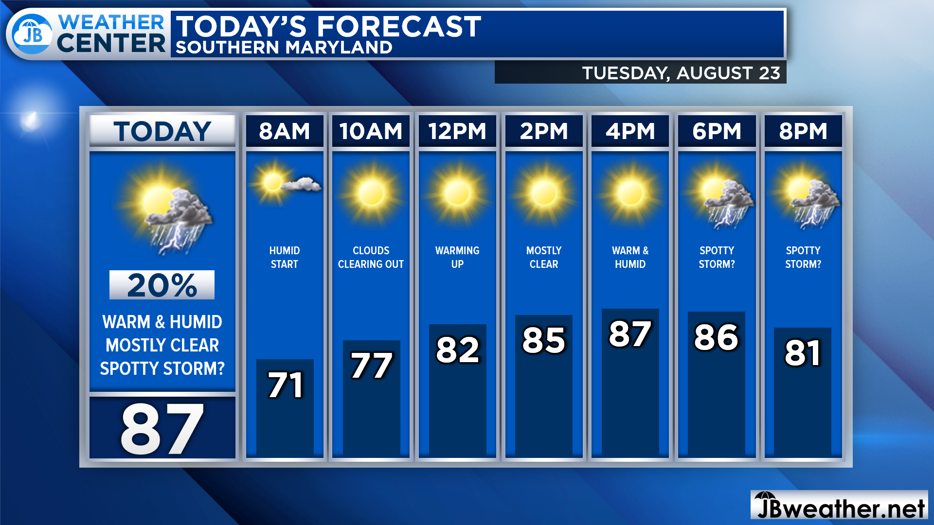
We are off to a bit of a humid start with some patchy fog outside this morning. Any fog or cloud cover should burn off by mid-morning as temperatures begin to rise. We’ll likely be in the 80s by lunchtime and in the upper 80s this afternoon. Today, we only have a 20% chance of a spotty shower or storm.
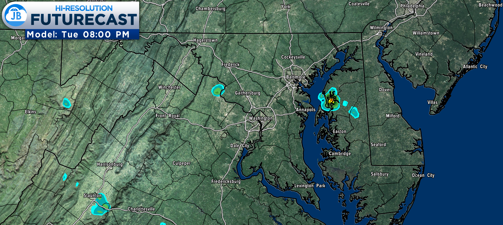
Our Futurecast model is not really all that enthusiastic about today’s rain chances. Our model shows just two random cells popping up this evening. While the model has to the north of Southern MD, we could see these pop anywhere. While I’m not expecting anything too severe or heavy, I would not rule out stay shower moving overhead after 5/6pm.
Stay with JB Weather for the latest information on Southern Maryland weather. You can always access my forecasts and updates here on the website, on Facebook, on Twitter, on Instagram, and on YouTube.
-JB

Chesapeake’s Bounty is providing our community farm-fresh foods from the Chesapeake Bay region. Local seafood, produce, meats, dairy and more! Locations in Saint Leonard and North Beach. Make sure to stop by and also check out www.chesapeakesbounty.com
John Bordash
View More PostsJB Weather forecaster John Bordash is working around the clock to provide Southern Maryland, and neighboring communities, with accurate and reliable weather information.