Brought to you by Calvert Title Company
We have a warm and humid day on tap with the chance of afternoon and evening thunderstorms. The joys of Summertime in Maryland! We are off to a humid start this morning with temperatures in the 70s, allowing some morning fog to develop. We should see temperatures quickly warm into the 80s by lunchtime and near 90° this afternoon. This warm and humid combination will set the stage for potential storm development this afternoon and evening.

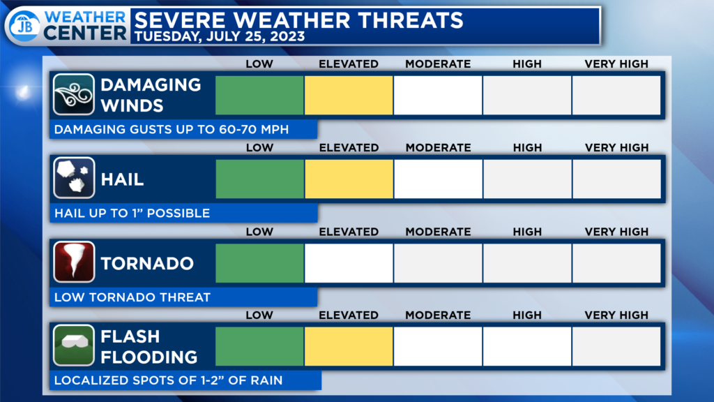
The Storm Prediction Center has placed much of our region under a Level 2 “Elevated Risk” of severe weather for this afternoon. The greatest threat for severe storms looks to be focused along the Bay. Storms will not be widespread, though! This activity is expected to be more scattered in nature.
Our Futurecast model plays this threat out quite nicely. We should see some activity bubble up to our northwest just after lunch. Today’s heat and humidity will allow a decent amount of atmospheric storm energy to develop over our region. As these developing storms move eastward, they will try to tap into those favorable conditions. The highest storm chance looks to be focused between 3-8pm.

The primary threat from any storms that develop will be the elevated risk of damaging winds that could gust up to 60-70mph. These storms will also have the potential to produce hail and a decent amount of lightning. Flash flooding will also need to be watched today as localized 1-2″ amounts are possible under the strongest storms.
Stay with JB Weather for the latest information on Southern Maryland weather. You can always access my forecasts and updates here on the website, on Facebook, on Twitter, on Instagram, and on YouTube.
-JB

Calvert Title Company is guiding you HOME one closing at a time! Check out https://calverttitle.com/ today!

