Brought to you by OakPoint Insurance
After a warm and humid start to the day, we have only seen conditions become even more oppressive! This typical mid-summer heat wave is just beginning and could bring the threat of hit-and-miss storms to the region this afternoon and evening.
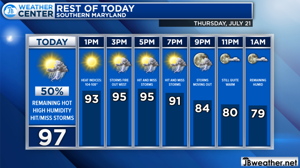
Through the rest of the afternoon, we will see hot and humid conditions continue. As of noon, Pax River NAS has already warmed to 91° with a heat index of 102°. We will likely see temperatures max out in the middle to upper 90s, with heat indices over 105°. Then, we could see storms develop.
Our Futurecast seems to have a good handle on the PM storm threat. The primary focal point of storms today will be to our south, across central and southern Virginia. However, we will still likely see these hit-and-miss storms try to move through Southern MD. Any storms that do fire up will have the potential to turn strong to severe.
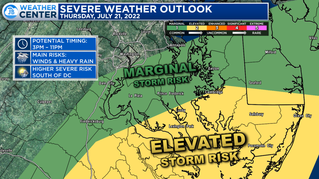
Parts of our region have been upgraded to a “Level 2” Elevated Risk of severe weather for this afternoon. This highlights the rather scattered nature of the potential storms, suggesting that they will not be widespread. However, there are sufficient atmospheric ingredients to allow whatever storms form to become quite strong to severe.
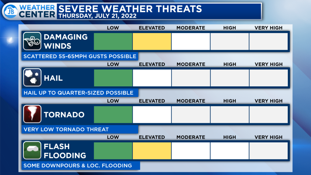
The primary threats from any storms this afternoon and evening will be damaging winds, potentially up to 55-65mph, and localized flash flooding. We could see 1 or 2 storms become strong, and they could bring some locally high impacts in both of the aforementioned categories. Thankfully, the tornado threat is quite low today.
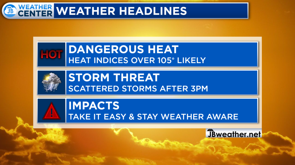
If you have outdoor plans at any point this afternoon, you will experience high heat impacts. You will want to take it easy out there today in regards to the heat. Take frequent breaks, stay hydrated, and stay cool. You will also want to stay weather aware for that PM storm threat.
While I would not necessarily cancel any outdoor plans, I would seriously consider moving any plans indoors to escape the heat, humidity, and storm threat. Sports practices are likely to face some difficulties getting complete practice sessions in with no impact.
Stay with JB Weather for the latest information on Southern Maryland weather. You can always access my forecasts and updates here on the website, on Facebook, on Twitter, on Instagram, and on YouTube.
-JB

The premier insurance agency in Southern Maryland with three locations. We provide insurance for Home, Auto, Business, Farm, and Life. In partnership with many top insurers, we provide solutions to fit our client’s needs. Get in touch with us at 301-863-8100 to experience the difference, mention JB Weather to claim your free gift!
