Brought to you by Cedar Point Federal Credit Union
The tropics continue to remain top of mind as Hurricane Ian poses a significant threat to Florida and the Southeast United States. The forecast with Ian continues to evolve and change as we learn more, and now some details are beginning to come into focus.
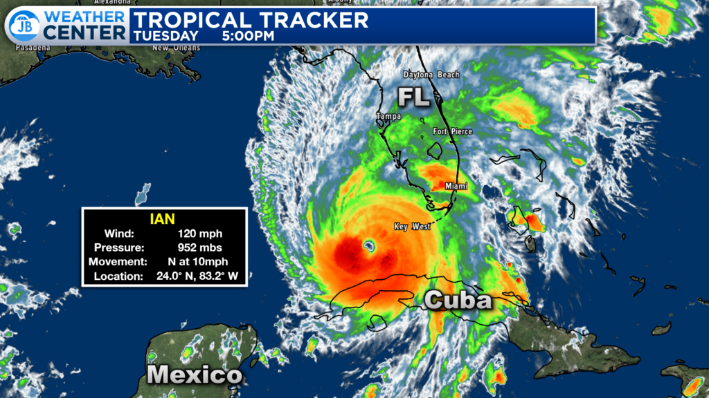
Overnight Ian began a period of rapid intensification and reached CAT 3 Major Hurricane status just before making landfall in Cuba around 5am. Ian has moved across the western tip of Cuba and has now reemerged back over water. Ian currently sits in the southern Gulf and is already bringing rain and wind to much of southern Florida.
With Ian reemerging over water, we have seen the storm resume its intensification. Ian is still a Category 3 Major Hurricane with maximum sustained winds of 120mph.
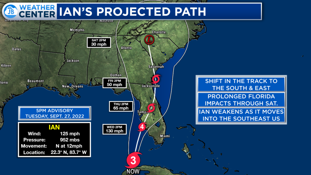
The projected path with Hurricane Ian has shifted to the south and east today. This new path does take the eye of Ian just south of Tampa (granted, they are not out of the woods). The storm will slow down on approach to Florida, and will not make landfall until early Thursday. Ian is expected to make landfall near Fort Myers, Florida.
After Ian comes ashore, the storm will begin to move northward, and may briefly reemerge over parts of the Atlantic Ocean. Ian will move into the Southeast US this weekend and weaken considerably.
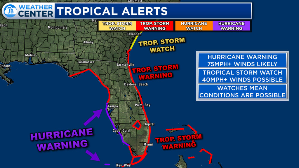
There are Hurricane Warnings in effect for much of Southern Florida, denoted by the purple lines that are on the coast. Tropical Storm Warnings are also in effect, shown in red. Hurricane Watches and Tropical Storm Watches are in effect for the areas where the forecast is more uncertain but could see direct impacts.
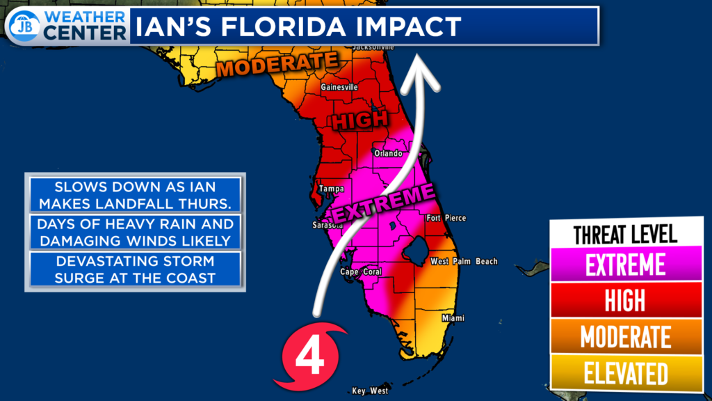
Ian will bring Extreme impacts to much of southern Florida. These impacts will be magnified because the storm will be slowing down considerably before it makes landfall. Parts of the western Florida coastline could see high to extreme impacts for 24-48 hours as the storm crawls across the peninsula.
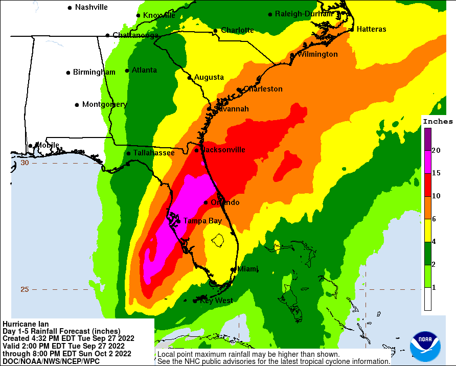
The National Hurricane Center expects upwards of 6-12″+ of rain to fall across much of the sunshine state through Friday. The heavy rain threat begins to shift northward, into the Southeast, this weekend as the storm moves further north. Some spots could see 2-5″+ of rain in the Carolinas!
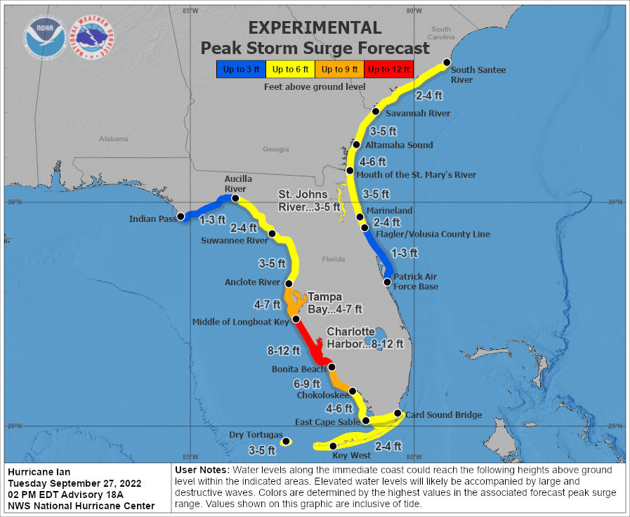
Storm surge will be a big threat for Florida. The National Hurricane Center expects upwards of 8-12 feet of coastal inundation just south of Tampa Bay! Up to 6-9 feet of surge is possible across much of Florida’s west coast. The storm surge threat will be exacurbated because of its slow crawl inland.
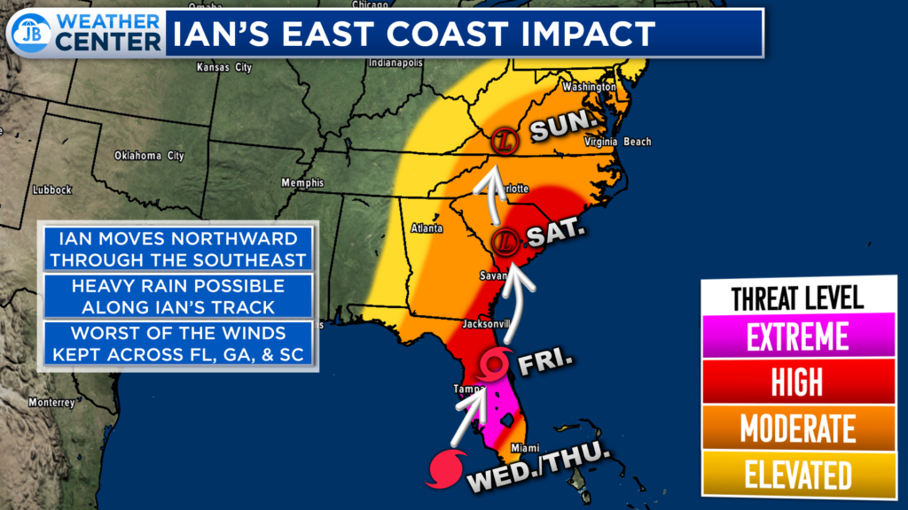
Many people locally want to know, “how will this affect me.” Well, that picture is just now beginning to come into focus, but it is still sketchy. Ian will decay quickly as it moves inland this weekend. This would likely lead to a diminished wind threat (outside of Florida). However, rainfall could be a concern, especially in the Carolinas and southern VA. This is where 2-5″ of rain may fall between Friday and Sunday.
The forecast in Southern MD is tough as we are right on the edge of potential impacts. Right now, it looks like Southern MD could see rain begin late Friday/early Saturday and linger through Monday. The rainfall amounts are still very sketchy, but there are some indications that we could see 1-3″ of rainfall from Ian. This could cause some flooding issues. With that said, that rainfall number is likely to change over the coming days–we are still 4 days out. And, it is too early to say whether we will see severe weather.
All interests in the path of Ian need to take this storm seriously, and stay up to date on the latest! The forecast will continue to evolve as we learn more. Southern MD people–our forecast will come into better focus as we approach Thursday.
Stay with JB Weather for the latest information on Southern Maryland weather. You can always access my forecasts and updates here on the website, on Facebook, on Twitter, on Instagram, and on YouTube.
-JB

Cedar Point has been providing trusted banking, lending and personal finance solutions to the Southern Maryland Community since 1945. Visit the credit union at any of its 6 locations in St. Mary’s, Charles and Calvert counties or online at www.cpfcu.com.
