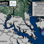
After an active stretch last week—featuring a wintry start for northwestern zones and a Friday snow event that clipped our southern areas—we’re not getting much of a break. Another weak system is lining up to slide off the Southeast coast Monday into early Tuesday, and it has just enough cold air to work with to bring another round of light snow to parts of the Mid-Atlantic.
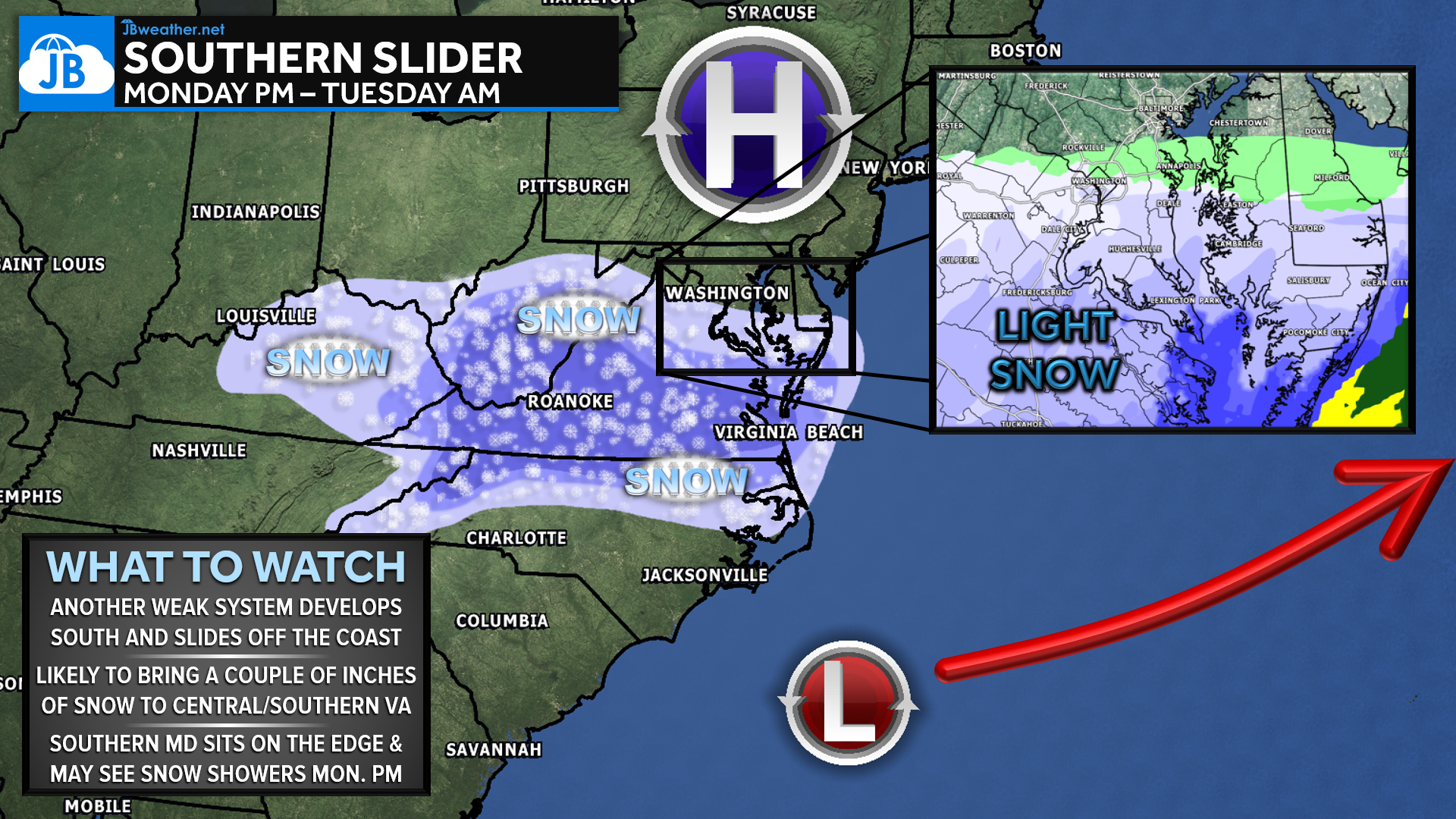
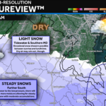
A new coastal disturbance will develop to our south on Monday and track east-northeast offshore. As this happens, an area of light snow is expected to break out across Virginia throughout the day. Central and southern Virginia currently stand the best chance of seeing 1–3″+ of accumulation, especially south of I-64 where moisture is deeper and temperatures stay cold enough. Earlier model cycles kept this system fully suppressed to the south under strong high pressure, but recent trends have nudged the track slightly north. That subtle shift now puts more of the Lower Mid-Atlantic in play for at least some impacts.
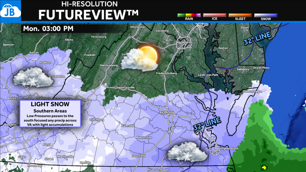
For Southern Maryland, this remains a very tight call. As of this morning, we sit just outside the primary snow shield, with most guidance keeping steady snow bands south of the Potomac. Areas closer to Richmond, however, have a much higher chance of seeing accumulating snowfall—potentially several inches. But as we learned with last week’s setups, small northward adjustments can matter a lot. If this system shifts even 30–50 miles further north, Southern Maryland could see light snow develop Monday afternoon and evening, though any accumulation would likely stay limited.
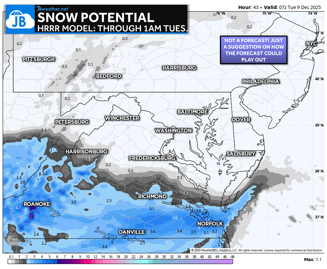
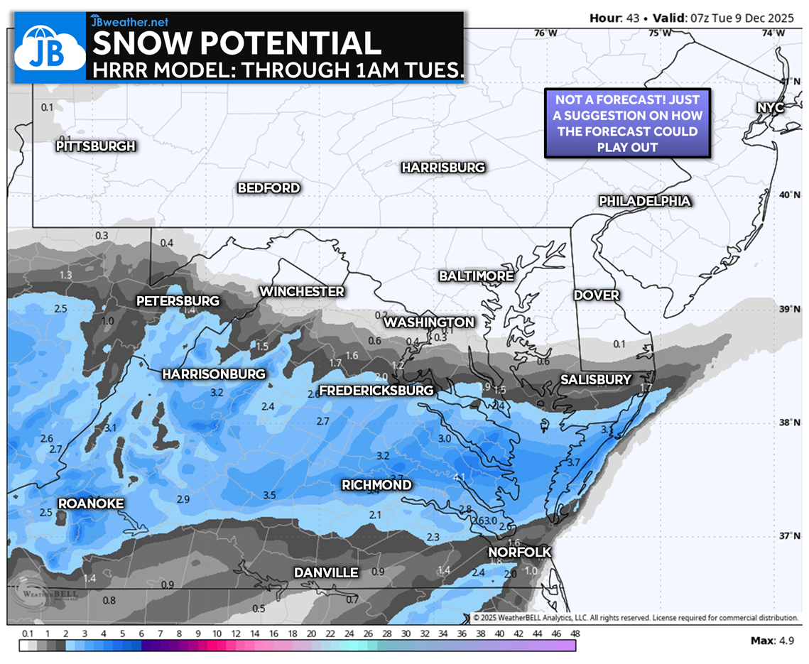
Modeling remains divided: the NAM—which handled the last two storms very well—keeps the core of the snow shield safely south, suggesting minimal to no accumulation locally. The HRRR, on the other hand, brings light snow farther north and would support up to around an inch in parts of Southern Maryland. Right now the HRRR is the clear outlier, but it does highlight why trends will need to be monitored closely through Monday morning. I’ll continue to watch the data and will provide updates as confidence increases.
Stay with JB Weather for the latest information on impacts here in Southern Maryland and across the Mid-Atlantic. You can always access my forecasts and updates here on the website, on Facebook, on Twitter, on Instagram, and on YouTube. JB Weather is the Mid-Atlantic’s Weather Leader, and I am working around the clock to keep you ahead of any storm!
John Bordash
View More PostsJB Weather forecaster John Bordash is working around the clock to provide Southern Maryland, and neighboring communities, with accurate and reliable weather information.