A quiet and seasonably mild Christmas Eve is in store across the Mid-Atlantic, but our next weather system is already coming into focus for late week. Enjoy today’s calm conditions while we continue to monitor a more impactful setup heading into Friday.
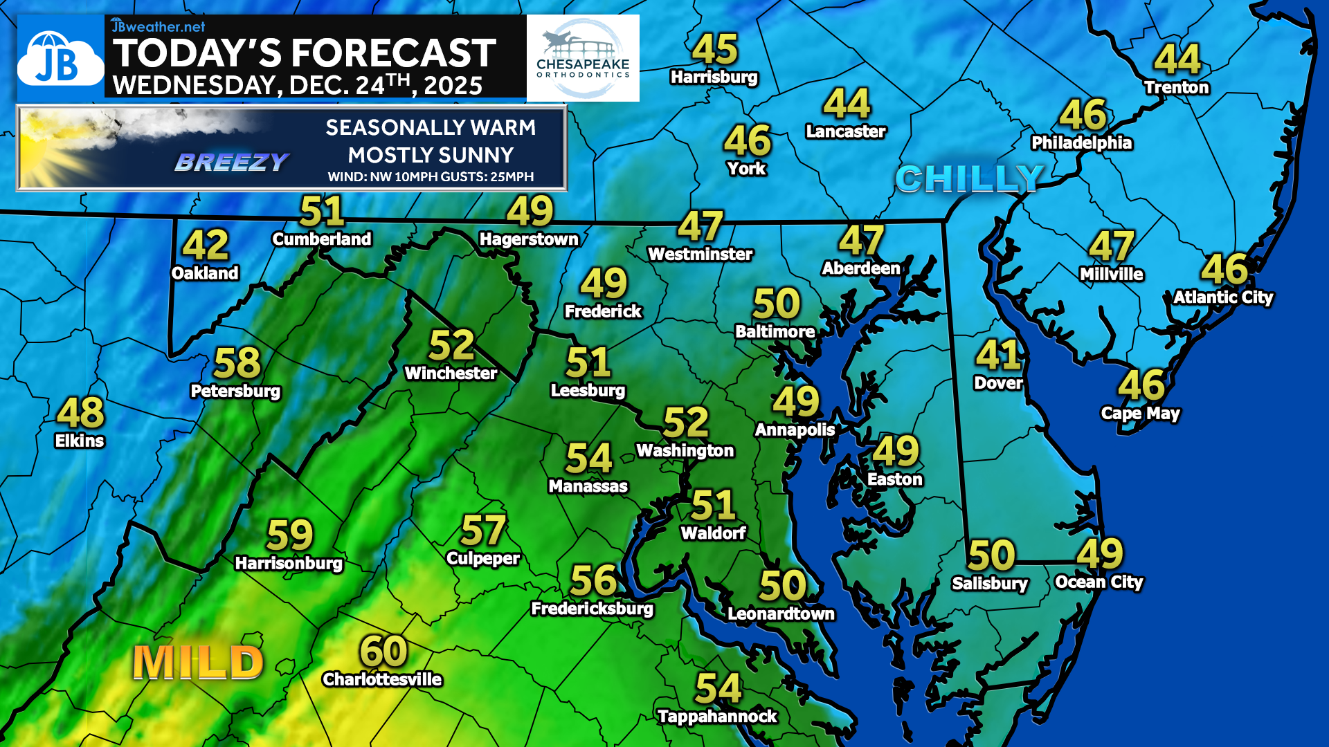
High pressure remains in control today, delivering a breezy but pleasant December day across the region. Expect mostly sunny skies with seasonably mild temperatures, especially across southern and western areas where highs will push into the low to mid-50s, with some upper-50s possible. Farther north and east, readings will stay cooler in the mid-40s. A northwest breeze will occasionally gust over 20 mph, adding a bit of a chill despite the sunshine, but overall conditions will be dry and favorable for holiday travel and last-minute errands.
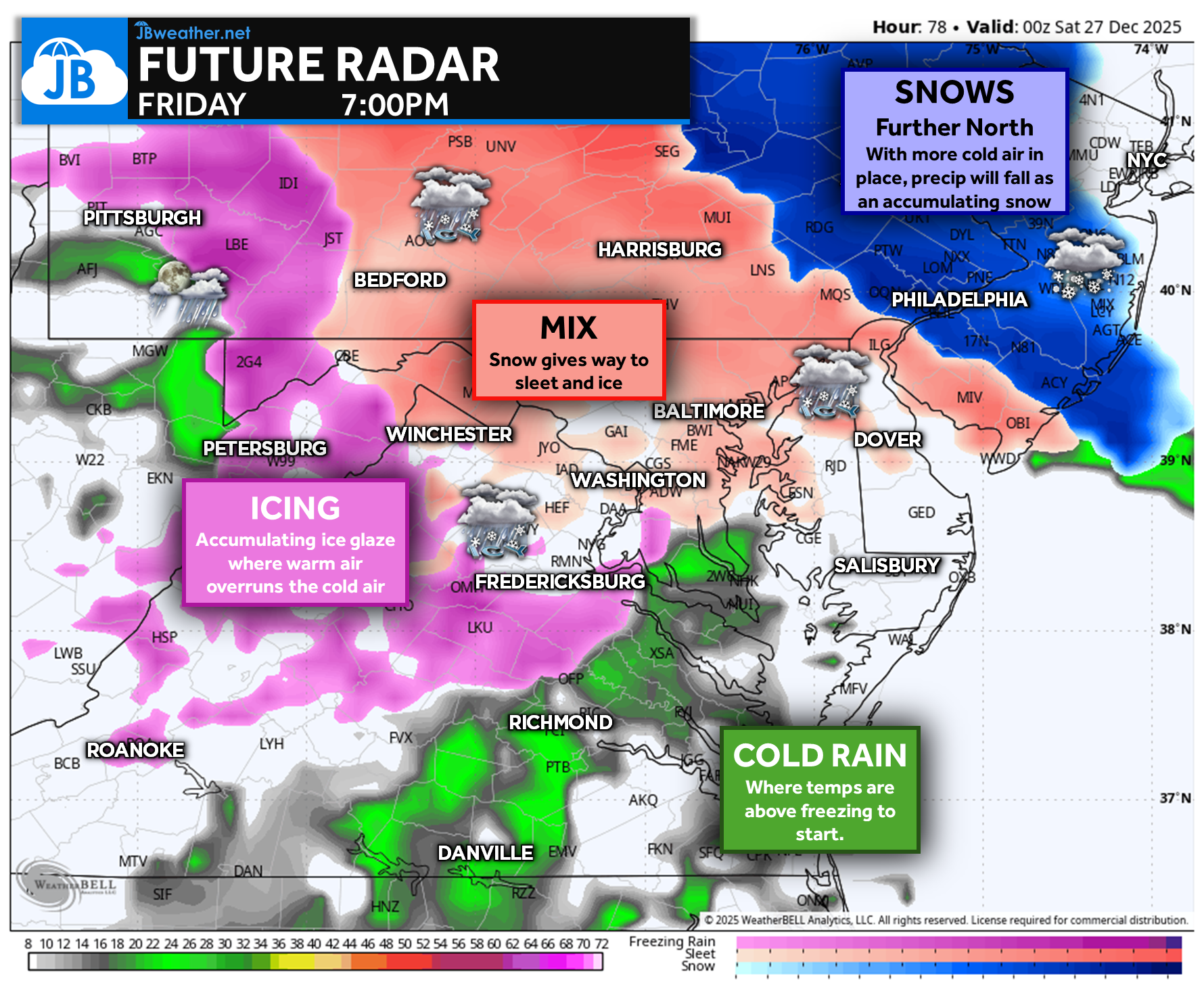
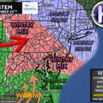
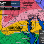
Attention then turns to Friday, as we continue to monitor a developing storm system that could bring a wintry mix to parts of the region. While details are still being refined, colder air already in place north of the Mason-Dixon Line raises concern for snow, sleet, and freezing rain, especially early in the event before warmer air moves in. A Winter Storm Watch has already been issued for areas north of the Mason-Dixon Line, and I’ll be closely watching trends throughout the day today. Travel impacts are possible, particularly in northern zones, and additional updates will be posted as confidence increases.
Stay with JB Weather for the latest information on impacts here in Southern Maryland and across the Mid-Atlantic. You can always access my forecasts and updates here on the website, on Facebook, on Twitter, on Instagram, and on YouTube. JB Weather is the Mid-Atlantic’s Weather Leader, and I am working around the clock to keep you ahead of any storm!
John Bordash
View More PostsJB Weather forecaster John Bordash is working around the clock to provide Southern Maryland, and neighboring communities, with accurate and reliable weather information.