Brought to you by Chesapeake’s Bounty
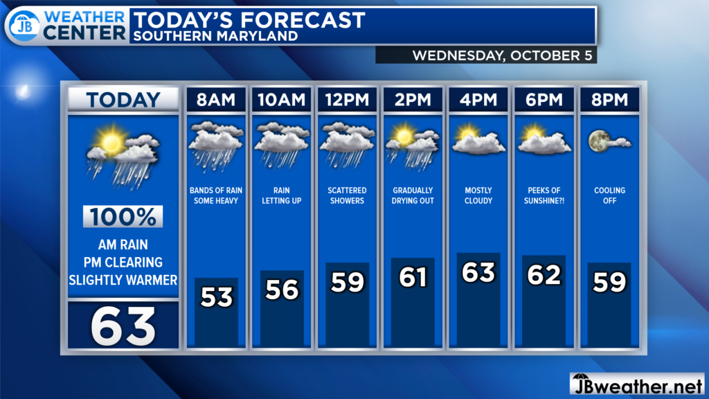
So far, October has been off to quite a wet start! Many spots have picked up between 3-6″ of rain over the last 5 days as the remnants of Ian slowly slide off the Mid-Atlantic coast. The bad news is that the rain will continue to start the day. However, we may finally see some clearing by late this afternoon!

We are off to another wet start as bands of light and heavy rain rotate through the region. You will definitely want an umbrella as you walk out of the door this morning! However, we should see the rain begin to ease up some as we approach lunchtime. We may even see some peeks of sunshine this evening as the remnants of Ian finally move out!
Futurecast shows that we are likely to see widespread showers continue across SOuthern MD through the morning. However, the rain should become more isolated later this morning. We finally see the last drops fall this afternoon! The clearing conditions late today should allow temps to warm up!
Stay with JB Weather for the latest information on Southern Maryland weather. You can always access my forecasts and updates here on the website, on Facebook, on Twitter, on Instagram, and on YouTube.
-JB

Chesapeake’s Bounty is providing our community farm-fresh foods from the Chesapeake Bay region. Local seafood, produce, meats, dairy and more! Locations in Saint Leonard and North Beach. Make sure to stop by and also check out www.chesapeakesbounty.com

